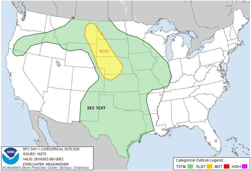
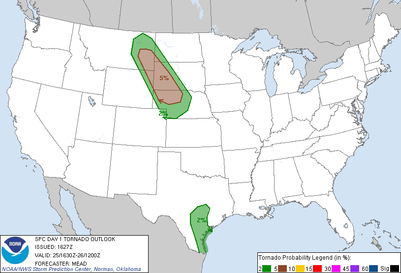
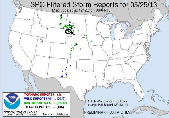
SPC Convective Outlook SPC Tornado Prob. NOAA Storm Report
May 25th, 2013, Sturgis, SD Hailstorms
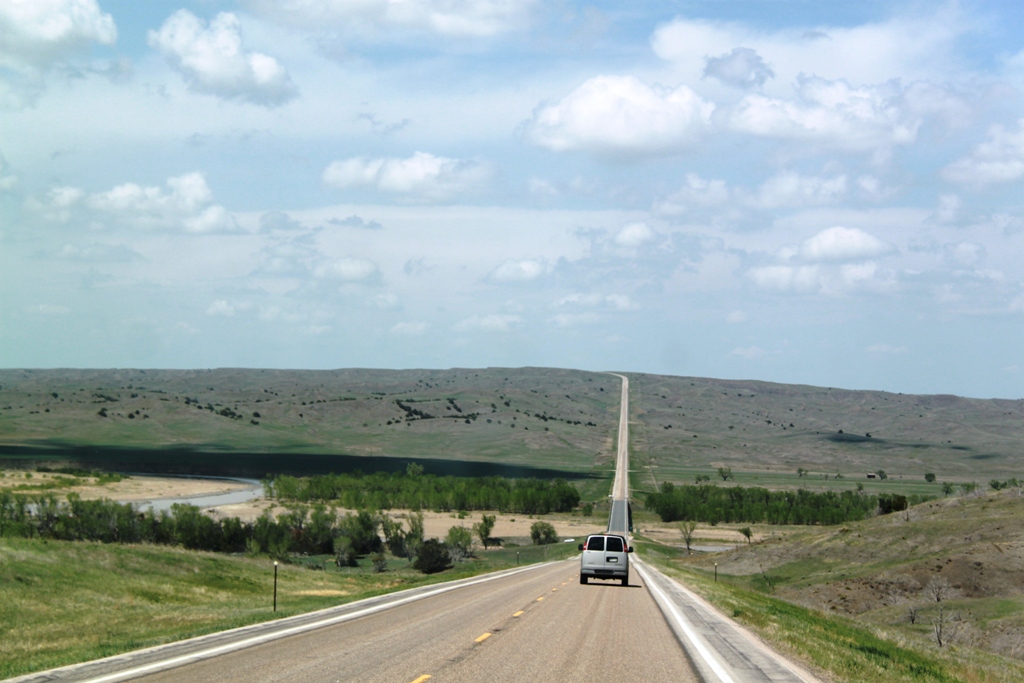
The best non-tornadic storms I’d seen to date (perhaps only until the next day, see May 26th)! Structure was the name of the game today as we left North Platte, NE with our target being northeast of Rapid City, SD. We headed up through Valentine and then into South Dakota. By the time we reached I-90, storms were already firing off the Black Hills, and we made the decision to head north, then west to get to our target storm. We stopped in Philip, SD for fuel and then the chase was on! At Howe’s we turned west as our storm, which was between Belle Fourche and Spearfish, had barely moved in the hour we’d approached, and then it began to right turn hard over Bear Butte.
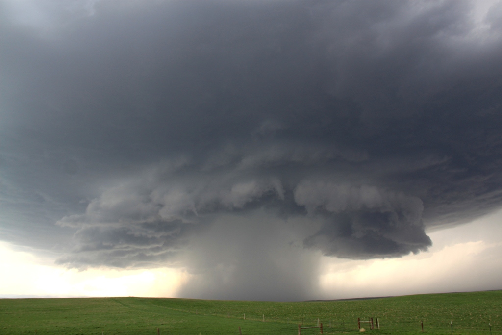
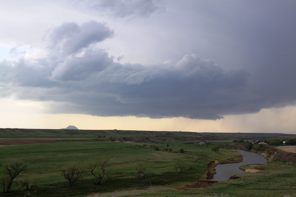
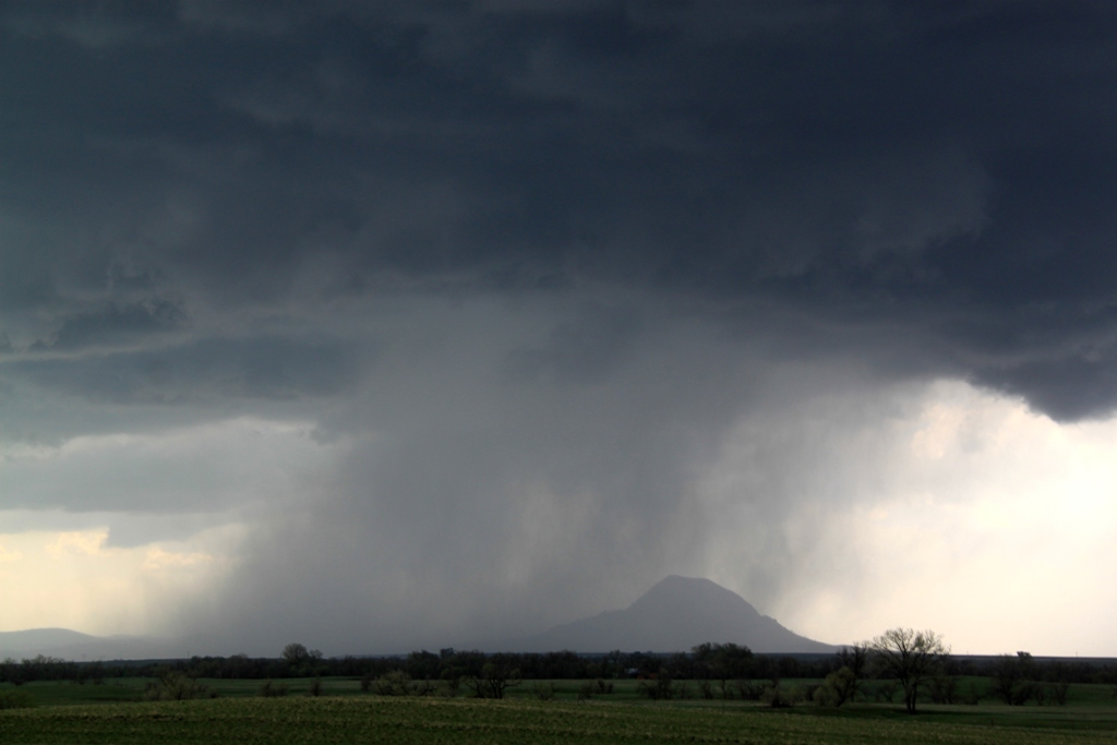
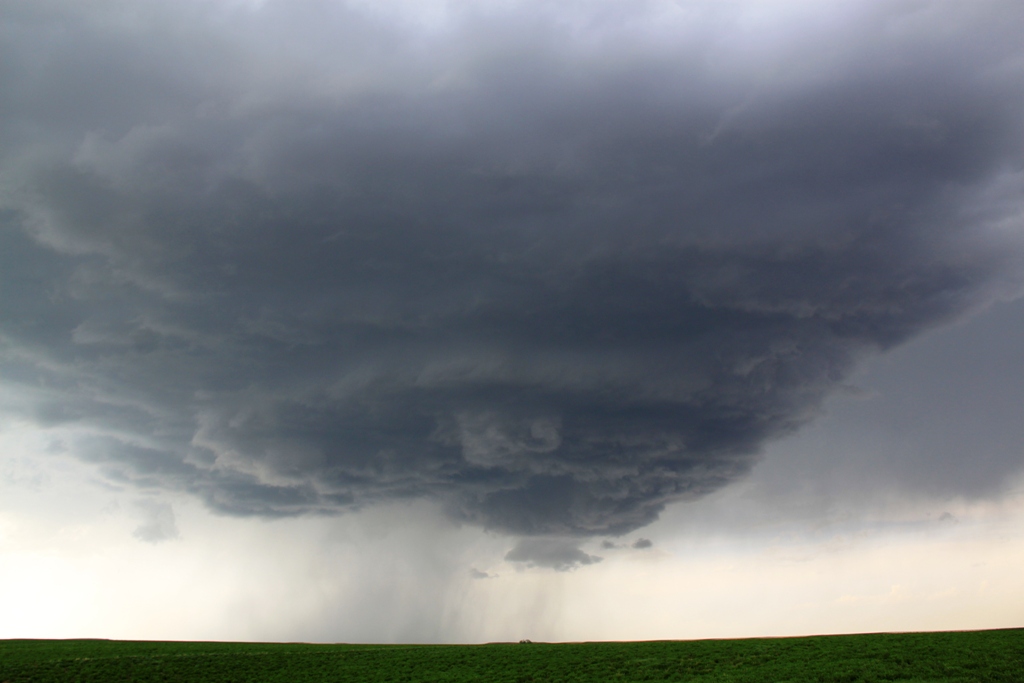
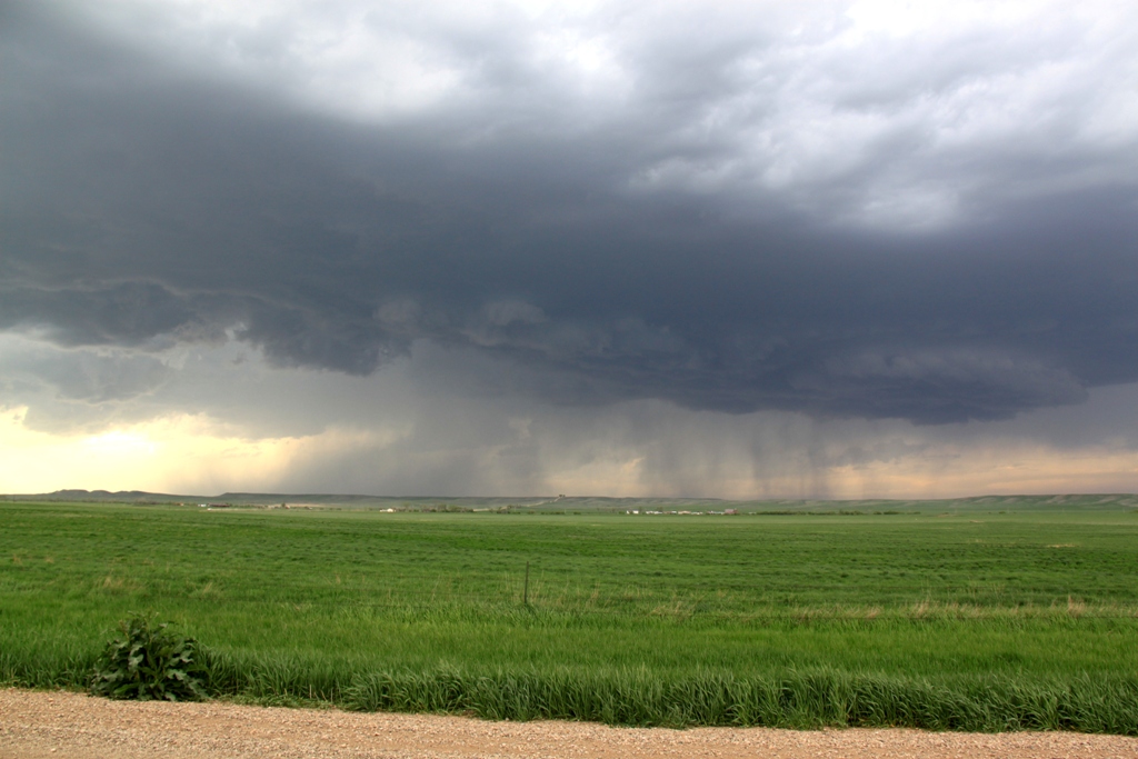
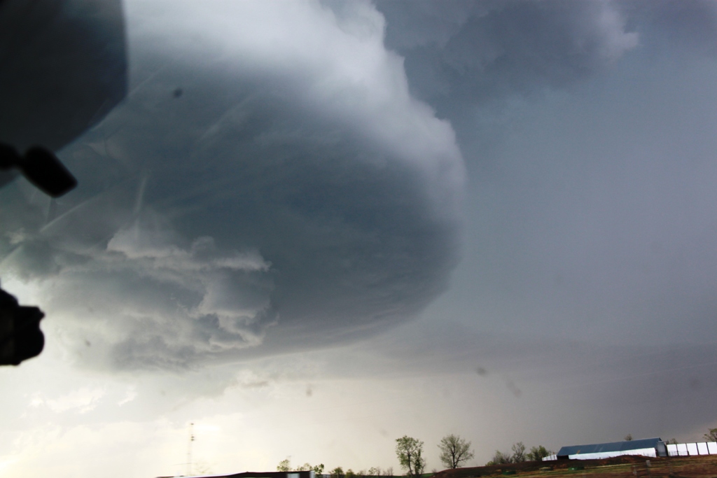
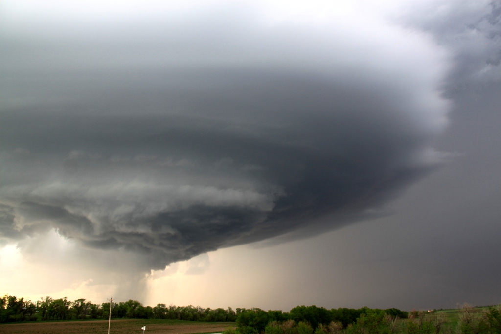
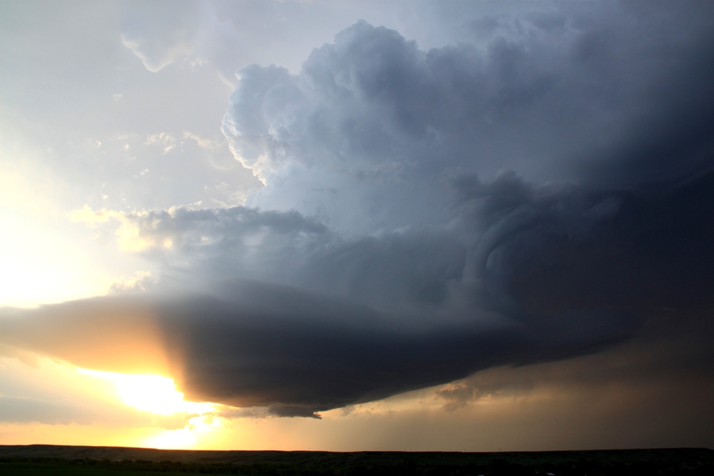
One thing about chasing in South Dakota is that the terrain is spectacular even without a storm over it, which makes for some very photogenic shots. As we drove west about half way between Union Center and Sturgis on Rt. 34 we stopped and watched the storm about 20 miles from us, framed over Bear Butte with a farm and a river in the foreground, and a long inflow band wrapping around over us into the storm. After about 15 minutes we headed west towards Sturgis, then dropped south onto dirt roads and drove right up to the hook area of the storm as it belched a big hail core right over the Butte. The storm still barely moved and we were able to maneuver to just about any position we wanted for a good view, and at every stop we weren’t disappointed at the structure of the storm. Behind us, the inflow winds were howling into the storms for hours.
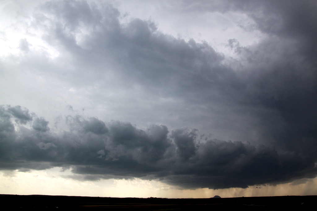
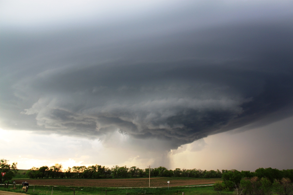
After the first cell started to cycle down after a weak attempt to spin up, the western updraft of the storm took over and again, we drove right into the notch and watched the incredibly structured supercell spinning away with a big, broad meso as it came right to us, which dirt entrained in the inflow blasting by us towards the updraft. Luckily the dirt roads were in good shape and we didn’t have much trouble getting around in the road hole. As the second cell got very close to us it dropped a HUGE hail core just to our northwest where you could almost watch the individual streams of hail falling. Again, there was solid rotation on radar but still, not even a decent attempt at a funnel.
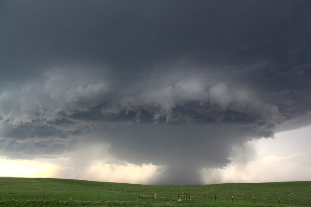
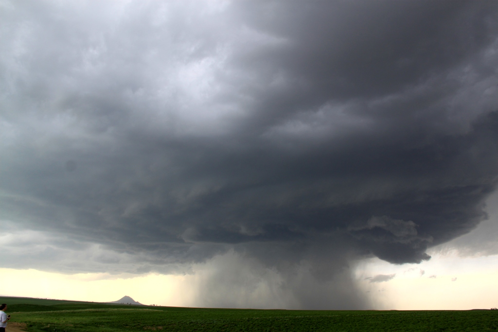
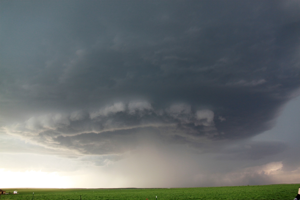
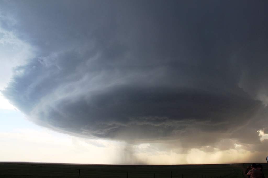
After the big hail core bombed out, the new western updraft took over and we did the same thing all over again as the new storm took on the classic “mothership” look with a big disk of a base and striated layers on top. We had to run east towards Elm Springs to beat the big hail, then headed south with the storm obediently following along. The structure somehow was even better than the previous two updrafts!
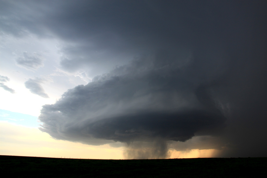
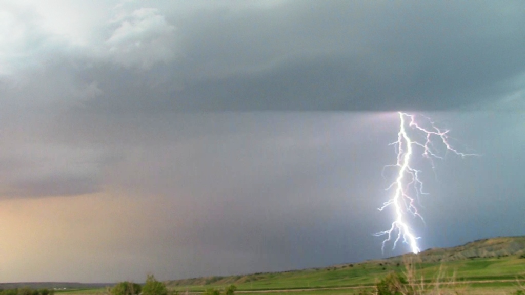
Finally we decided to get out ahead of the storm for a distant view of the structure, getting on I-90 again and heading a little east to a rest area near Wasta. As the Sun set behind the storm, the storm got even MORE photogenic! As it crossed the highway, a decent funnel formed (finally) but then the storm cycled down. We found another great vantage point and watched the storm, which was now becoming a skinny LP storm, twisting and turning with the Sun setting behind it and numerous cloud to ground and cloud to cloud bolts coming out of the vault area. We finally called it quits and headed to the hotel in Spearfish for the night. A great chase day! And, the mileage was not that bad at 562 for the day.
SPC
Convective Outlook SPC
Tornado Prob. NOAA Storm Report
 |
 |
 |
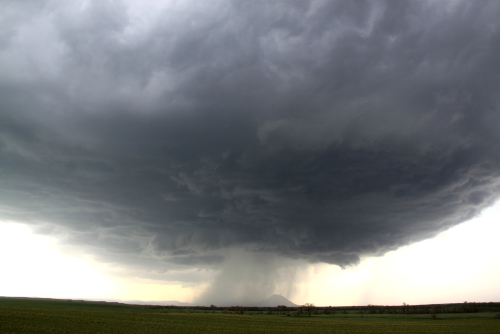 |
| Our target was Rapid City, SD. We drove up from North Platte, NE, stopping at Phillip, SD to fuel up, the chase was on through the beautiful SD grasslands... | Awesome landscape near Union Center, with the storm in the distance over Bear Butte. | As the storm winds up, a long inflow band forms to our south. | Now in the grasslands east of Sturgis, the storm starts to hail out right over the butte. |
 |
 |
 |
 |
| A closer look at the hail core. Over the next several hours we barely had to move to chase the storms. | Coming off the butte to the east, the storm shows signs of rotation and a large lowering forms under the updraft. | To our south from where we were watching the storm, the awesome South Dakota landscape with farms and long rolling hills. | The first storm died out, but the flanking line produced another storm just as picturesque as the first, and rotating like a top. |
|
|
|
 |
 |
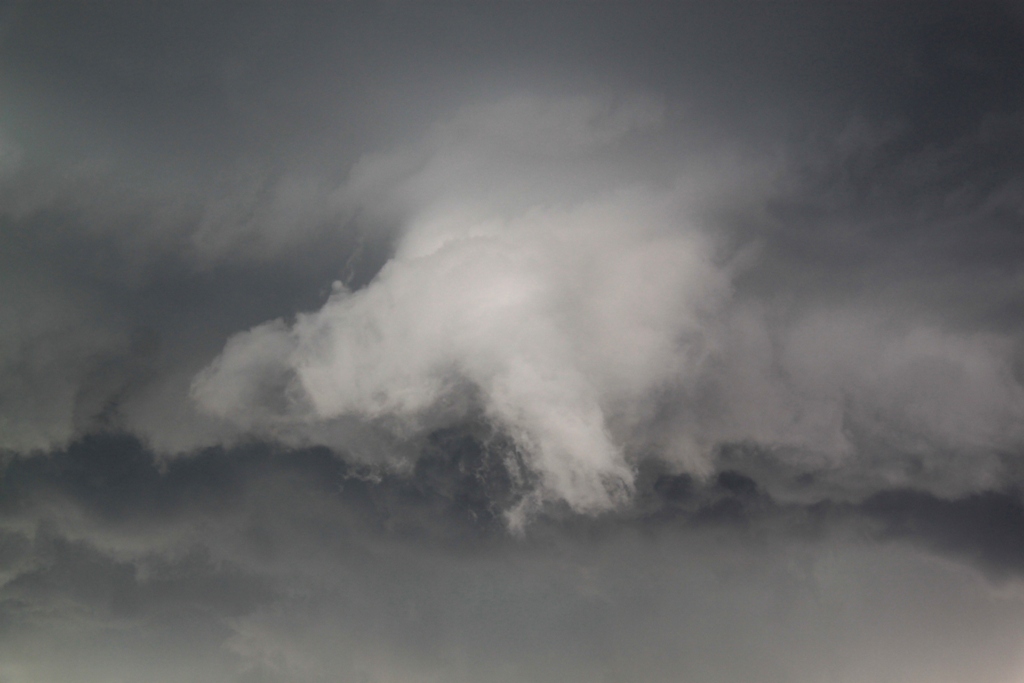
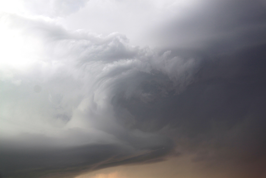
| The storm dumps a monster hail core just north of us. It almost looked like a waterfall. | Another block wall cloud forms, but the low level wind was not strong enough to focus the rotation to the ground. | A pretty strong mid-level funnel forms but never progressed much from that point. | Storm number two rains out and we think the day is over. |
 |
 |
 |
 |
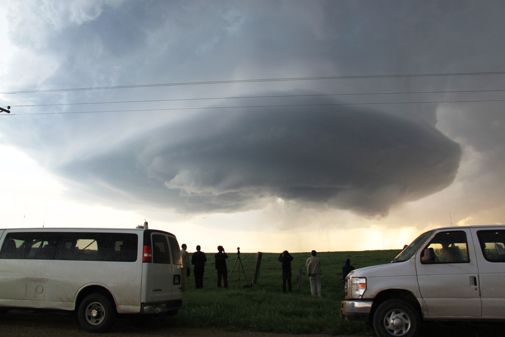
| But, the flanking line produces yet another storm with great structure, this one spinning HARD. | Mothership almost right over us! | Great structure as we stayed out in front of the storm on the dirt roads northwest of Wasta. | Nice barber pole updraft to our west. The front flank core is hailing out big time, and rain and hail is falling out of the updraft as well. |
 |
 |
 |
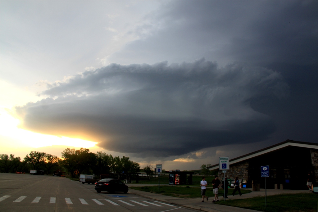 |
| The group watching as the updraft comes straight at us. | Reaching I-90, the structure keeps getting better and better! | Like a top! | Now at a rest area on I-90 near sunset. One of the best structured storms I've seen, with a corkscrew updraft, now getting highly electrified. |
 |
 |
 |
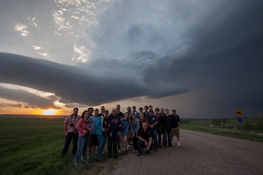 |
| Weird cloud feature in the anvil area, looks like a wolf's head! | The updraft at sunset. | Nice branched cloud to ground lightning bolt under the vault! | The whole gang. Photo taken by Roger Hill's Timer :) |
All pictures (C) Richard Hamel 2017.