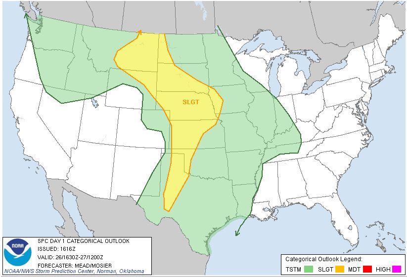
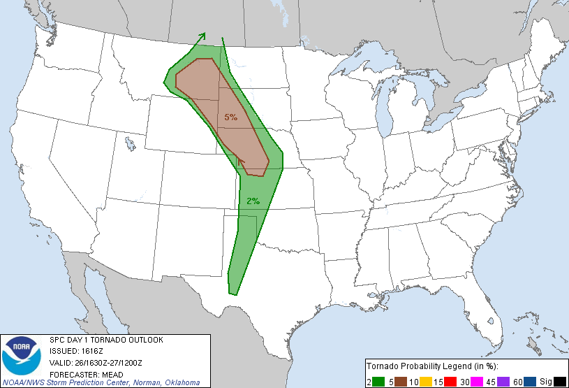
SPC Convective Outlook SPC Tornado Prob. NOAA Storm Report
May 26th, 2013, Arcadia, NE Photogenic Supercell
A day with multiple levels of frustration followed by great reward: We awoke in Spearfish, SD with the intention of chasing in Montana but a look at the morning models quickly changed our focus to a more southern target in central Nebraska. Both target areas had issues: The Montana target had better shear, but looked to lack the necessary instability to support anything other than high-based storms, even in the higher terrain up there. In Nebraska, the instability and moisture was there to support strong tornadic storms, but the question was whether the shear profile would get it done. The models thought it would, and we needed to be in Kansas the following day regardless, so we adjusted our target to Thedford, NE, but left very late as we’d expected only a 2 hour drive to our target and not the 4-5 hours it would take to get to Thedford.
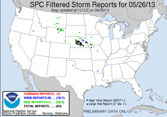
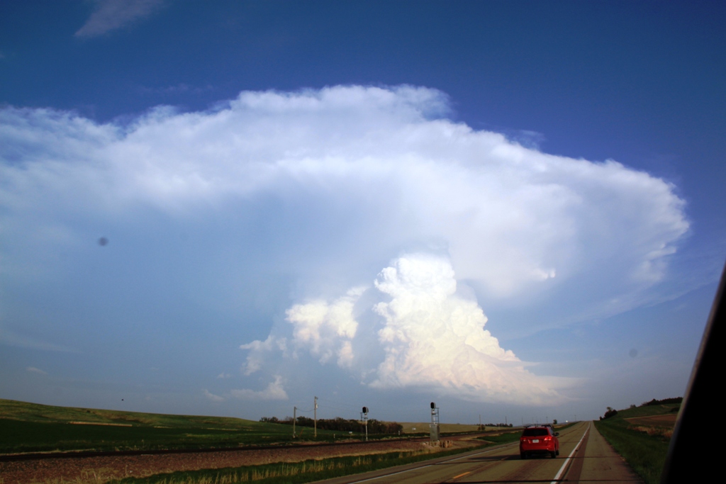
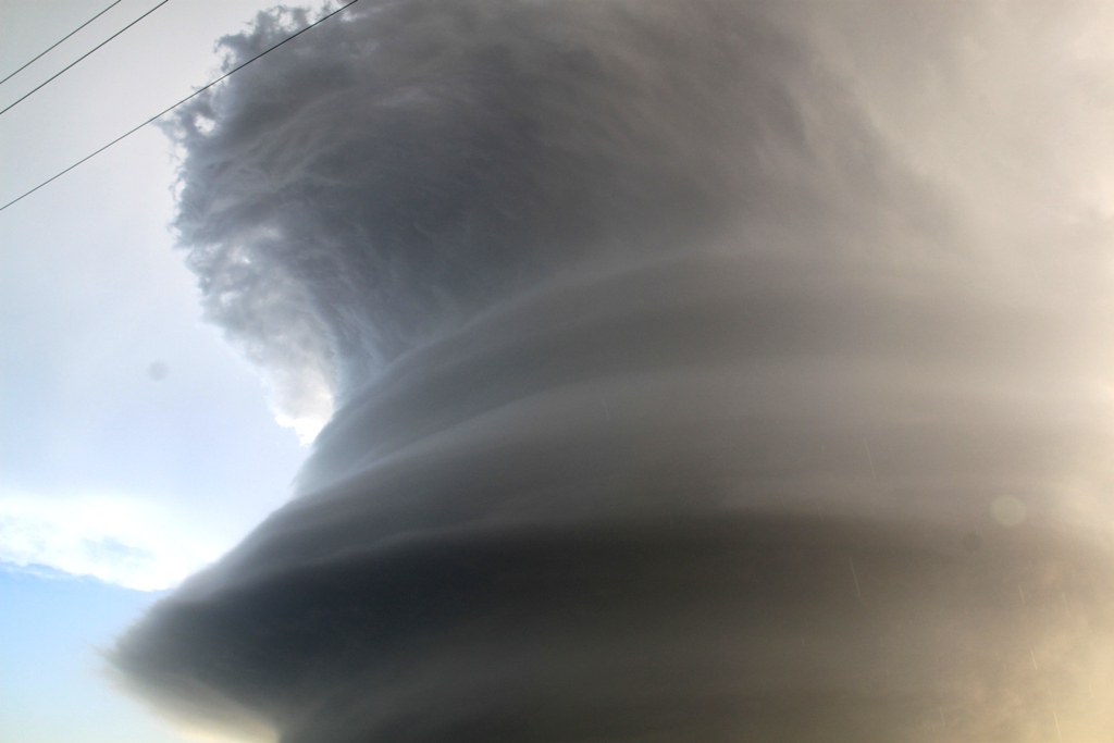
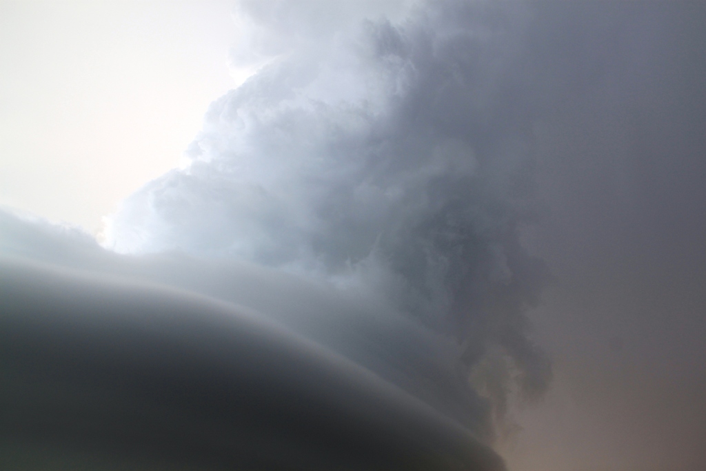
As we headed east on I-90 in the soup north of the warm front, it seemed like we’d never get south before initiation as there was already a developing cumulus field in west Cherry County and a mesoscale discussion was issued for that area. However, as we headed south begging for the cap to hold on until we got down there, the cumulus field more or less died and as we emerged into the Sun south of Valentine, NE when we crossed the frontal boundary, the whole area looked capped to the point where we wondered whether initiation would happen at all. We reached Thedford at about 5:30 with no sign of anything happening and waited for over an hour before finally towers exploded to our north and east and we were off and running. Between Dunning and Anselmo on Rt. 2 we were faced with a tough decision: The updraft we were targeting to our east was the oldest, but despite the strong convection and broad updraft, it didn’t seem to be doing much, while a younger updraft to the north quickly generated an overshooting top and cloud heights above 50 thousand feet. We continued past Broken Bow trying to decide whether to break off and head north up Rt. 183 to intercept the northern storm, but as we got near Westerville and up along the side of the updraft the structure on our storm was incredible! We could not possibly bail on the storm regardless of what was going on up north with this tank of an updraft just to our south, so we headed east through the north edge of the hail core and stopped to film the big barrel base with laminar striations on the bottom and a crisp spiraling updraft above. In fact, the structure was so good that we didn’t hesitate getting out in order to video the storm despite the golfball sized hailstones that were falling all around us!
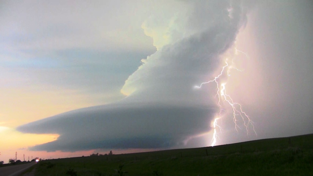
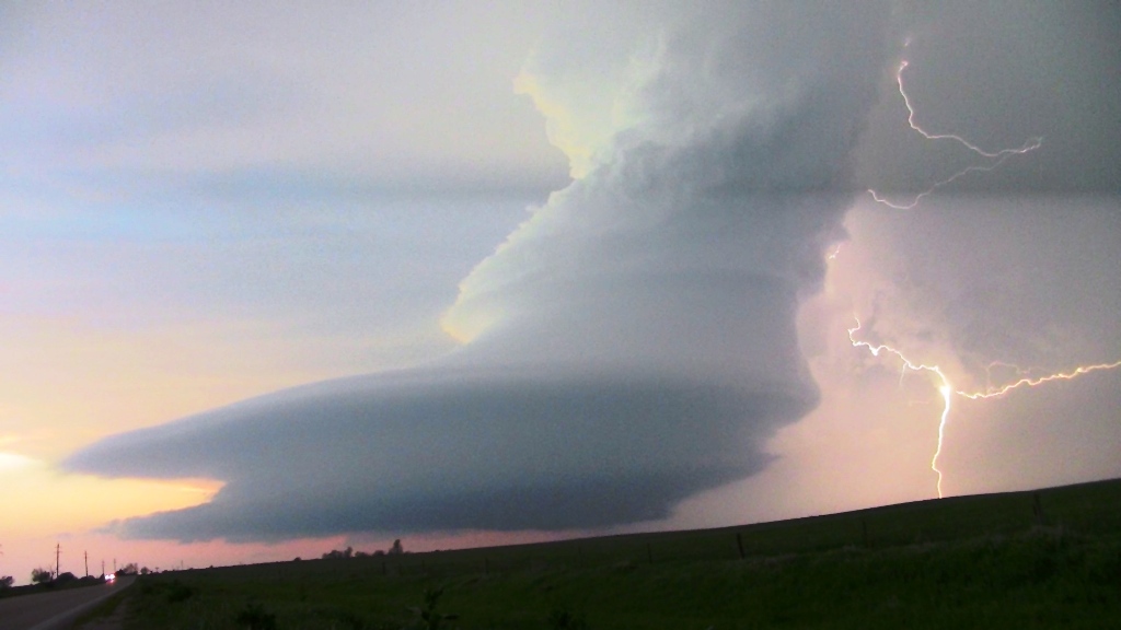
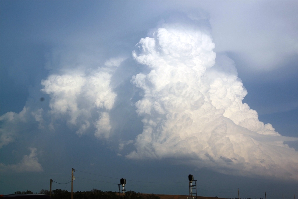
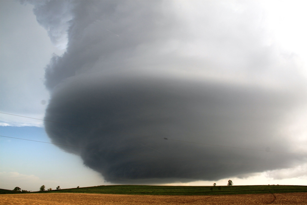
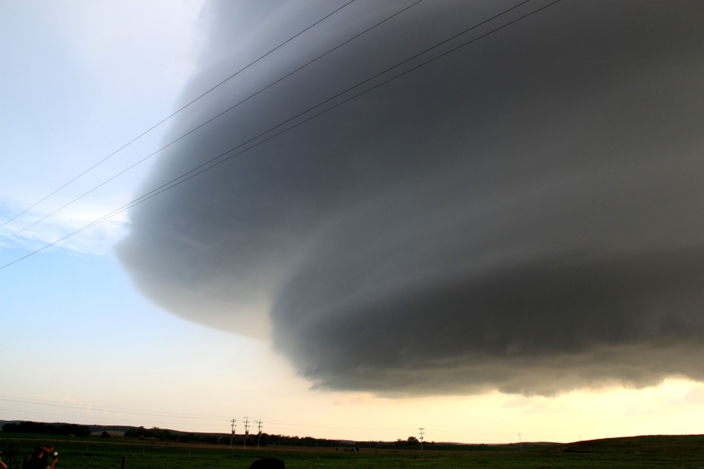
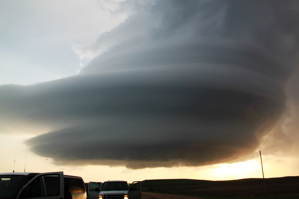
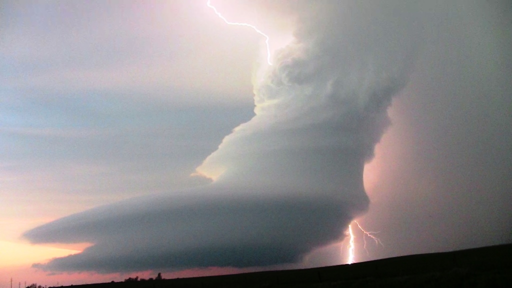
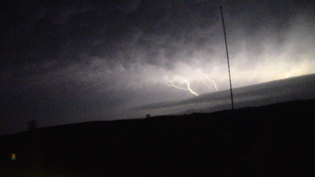
Soon the updraft was literally right on top of us and anvil lightning began striking behind us, so it was time to get out of Dodge and back in front to continue to watch the storm develop. We passed through Arcadia and stopped again with a more distant view of the magnificently structured supercell, then again moved on towards Ord, still keeping our options open for heading towards the north storm. Since initiation had been so late however, we decided that even if we did break off and head north we’d never get to the northern storm before dark. When our storm became tornado warned, we decided to focus on it and headed west on dirt roads trying to get a closer look at the base. The road network killed us though, passing through wooded areas and down into valleys that frustrated us over and over, so we popped back out on Rt. 70 and headed west back towards Arcadia, then stopped and watched the unbelievably structured storm, backlit against the setting Sun and throwing cloud to cloud and cloud to ground lightning prolifically. The storm by now had a rear inflow band that seemed to extend southwest all the way to the horizon and was just a textbook-diagram looking storm.
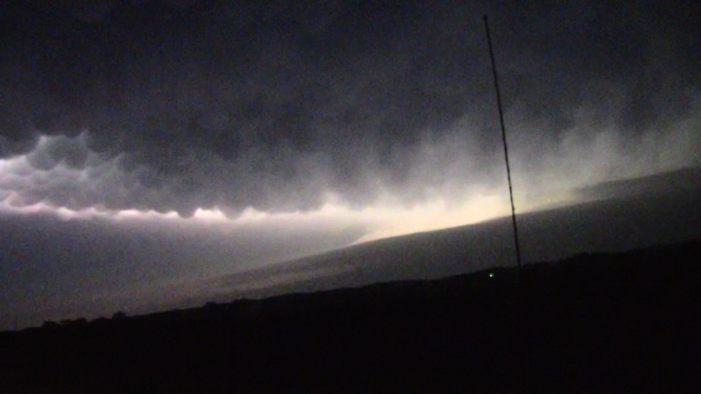
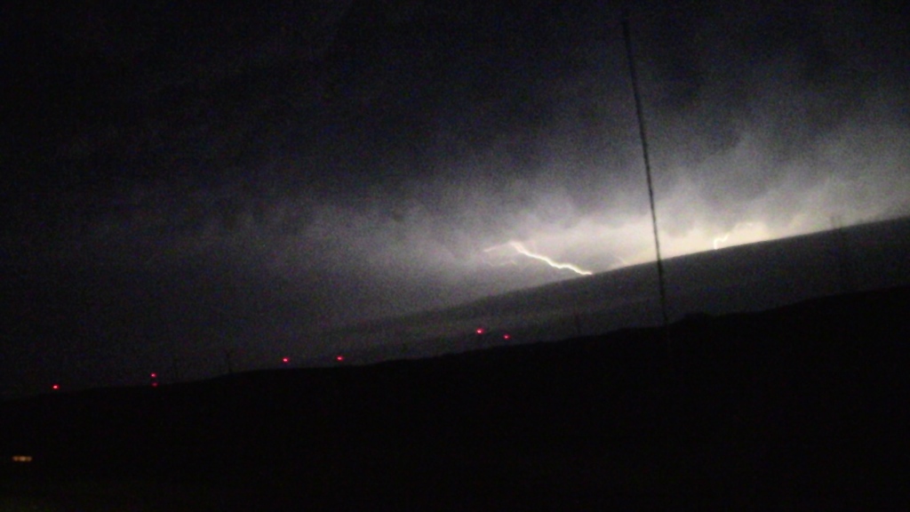
After spending 30 minutes or so filming the awesome lightning display, we again headed towards Ord to possibly get a look into the notch of our storm, or possibly take a look at the now massive HP storm the northern cell had become. Our cell died though, and as we got to Ord we gave up and headed for our hotel in North Platte. On the way back we were treated to an excellent lightning show from the northern cell that was rapidly plunging south and back building. I ended up taking a lot of video with the dash cam of the lightning that was illuminating the nice mammatus field just to our north.
What a great storm from a day that looked like it was going to be a failure several times! We finally made it to the hotel at about midnight after a 580 mile trek.
Click here for video of the Arcadia supercell lightning show!
SPC
Convective Outlook SPC
Tornado Prob.
NOAA Storm Report
 |
 |
 |
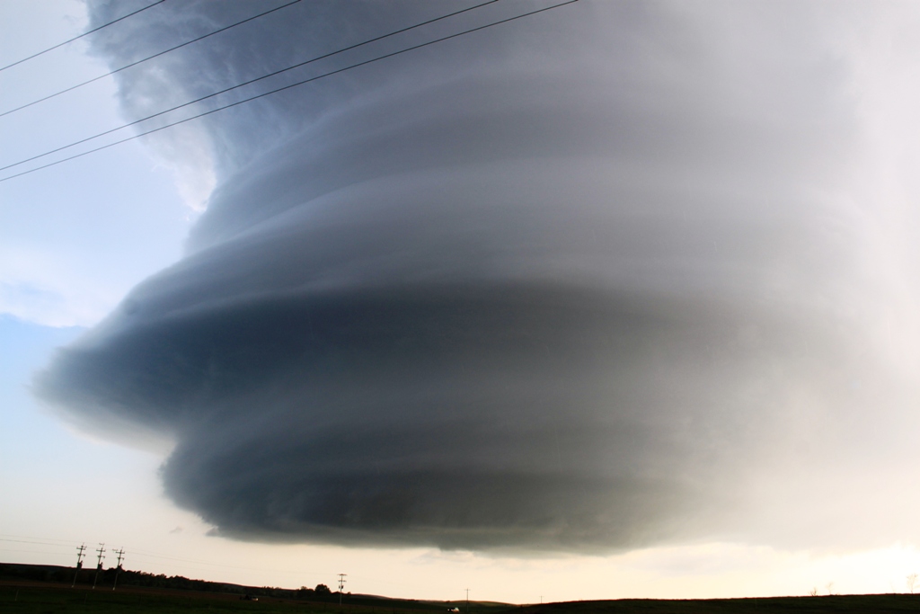 |
| After the morning model runs changed our targets from Montana to Nebraska, we blasted south from Spearfish, SD and arrived at Thedford, NE just before initiation. Soon enough storms fired and we headed east towards Broken Bow as a storm developed right in front of us. | Closer look at the cauliflower convection in the updraft. | We caught the storm near Westerville north of Broken Bow and as we got northeast of the storm were gifted with this fantastic rotating updraft! | We got out to take pictures even though we had golfball sized hail bombing around us. |
 |
 |
 |
 |
| Fantastic striations in the updraft. | Another look at the mothership. | We cleared out to the east to get away from the hail. | What a barber pole!! |
|
|
|
 |
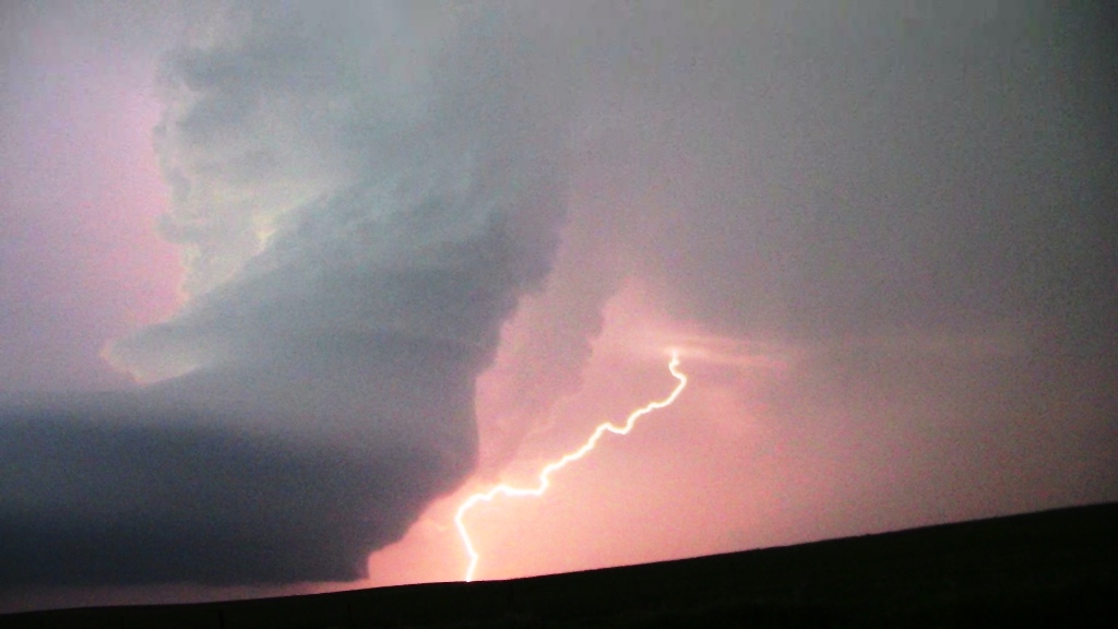 |
| We headed east but were unable to get in front of the storm because of the road network. We turned around and came back to the storm and watched the spectacularly electrified storm spinning like crazy at sunset. | You could visibly see the clouds curling around the updraft as the storm spin. | Cloud to ground bolt from the anvil. | As the sun finally went down the focus of the lightning was out of the vault region. |
 |
 |
 |
 |
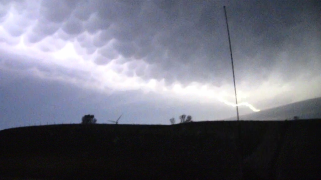
| Later heading back to the hotel in North Platte, another storm crashing down from the north provided a spectacular lightning show which illuminated a nice mamamatus field in the anvil. | Anvil lightning highlights the approaching shelf cloud. | Awesome mammatus as the storm closes in. Looks like we were passing through a windfarm at the time. | More anvil lightning. |
All pictures (C) Richard Hamel 2017.