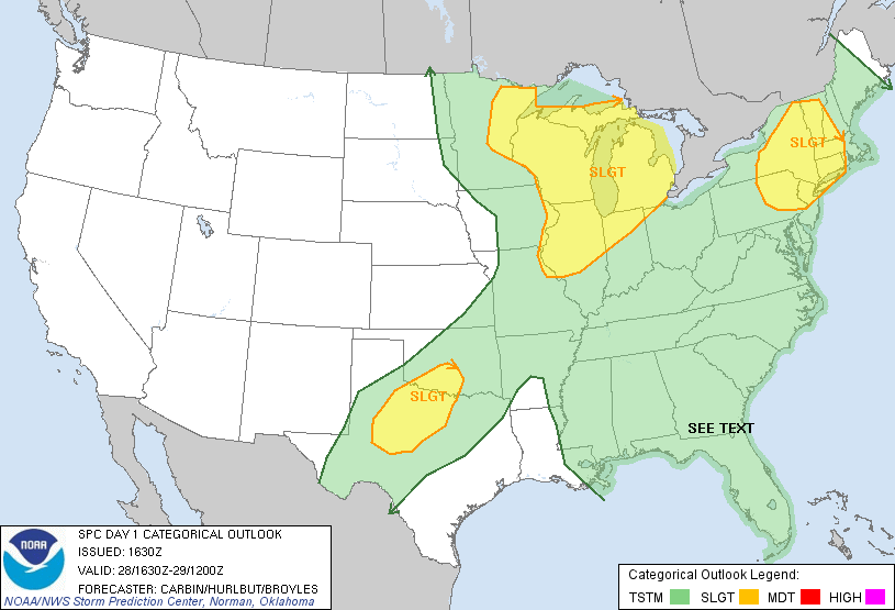
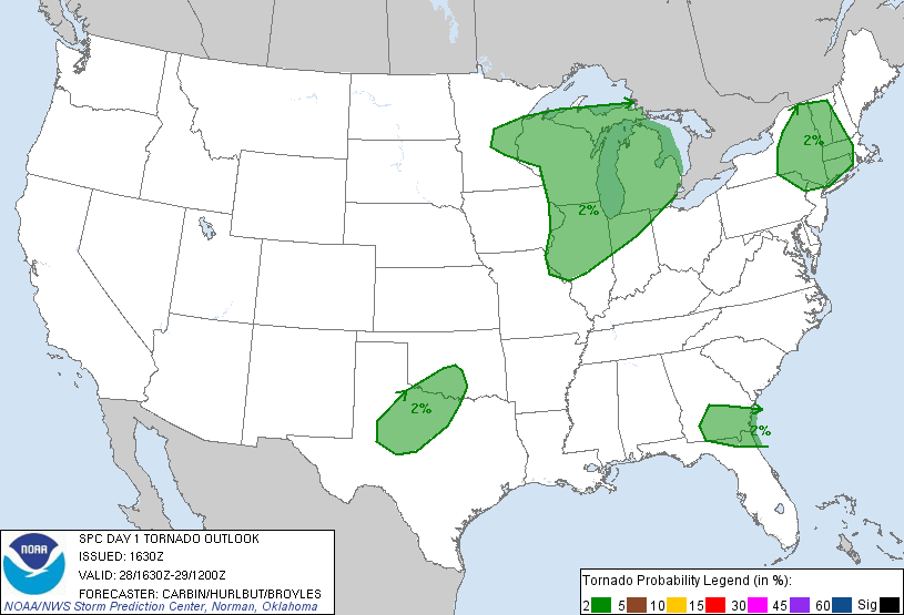
SPC Convective Outlook SPC Tornado Prob. NOAA Storm Report
May 28th, 2012, Seymour, TX Supercell
A really fun chase day! We started the day in Salina, KS, targeting the Wichita
Falls, TX area. We got down there in pretty good time and arrived in Seymour, TX
just as the boundary was lighting up all the way from the Childress, TX to
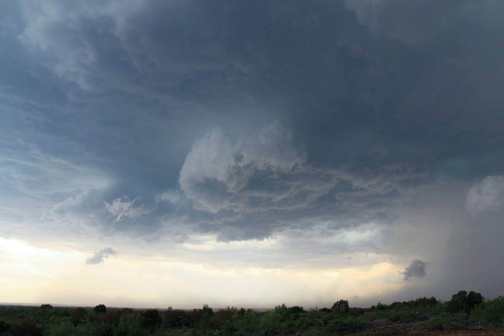
almost the Midland / Odessa area. Waiting in Seymour there were towers going up
all around us but they were all VERY high based. We ultimately decided to target
the one nearest us as it had the highest VIL in the area and headed northwest
out of Seymour on FTM 1919 towards Crowell, running into Tim Marshall, the
Southern Kentucky University team, and later a couple of the other tour groups.
Nonetheless once we were out of town it was one of those great storm chasing
kinds of moments when you are out on the scrublands and it feels like it's just
you and the storms. We watched the storm dump an enormous rain core, probably a
wet microburst, well off to our northwest and right turn directly towards us. We
sat and photographed the storm for a solid half hour before we started heading
back towards Seymour, stopping every few miles to watch until the big RFD plume
the storm was producing starting catching up to us. As we got close to Seymour,
the VIL's were maxed out and GRLevel3 was projecting 4" hail so we knew we
didn't want to mess with that core. Additionally, the storm to our east was
looking progressively better and we could see a distinct lowering in the
distance and wanted to keep an eye on that one as well, so we headed southeast
towards Olney, stopping briefly on the road to Archer City to check in on the
eastern storm, but by now our original storm was really the big dog. The only
probably was that the storm not only was now a huge HP hail machine, but all of
the storms were forming a bow echo complex a hundred miles wide and we didn't
really have a way around it. We charged west towards Throckmorton but decided
we'd never beat the hail core there about 1/2 way along the way (in hindsight we
probably could have made it but didn't want to risk it) so we headed south on
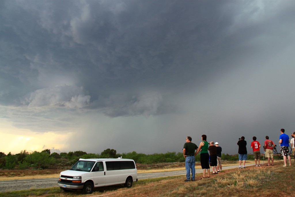
FTM 578 to try to buy a little more time. Down near Woodson, TX, the structure
to our north was awesome with the usual green glow of hail and an impressive
sharks teeth shelf cloud. We clearly weren't going to get around the monster
core so we drove into Woodson and put the vans up against the south side of a
school building and let it run us over. We expected to get bombarded with big
hail, but instead got none at all. We did however get torrential rain and
hurricane force winds along with VERY close CG strikes as the core rolled over
us. The church steeple just about 1/4 of a mile from us got hit twice by
lightning strikes.
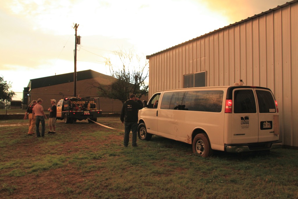
Once the core rolled over us, the next challenge ensued as there had been so
much rain that one of the vans got stuck in the mud! Luckily for us the town
brush fire unit just happened to drive by and they quickly attached a tow rope
and dragged us out. For all the talk of getting a hard time from police /
emergency services this year, this was the second day in a row we had a really
good experience with law enforcement.
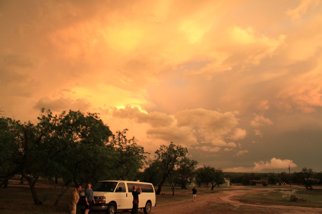
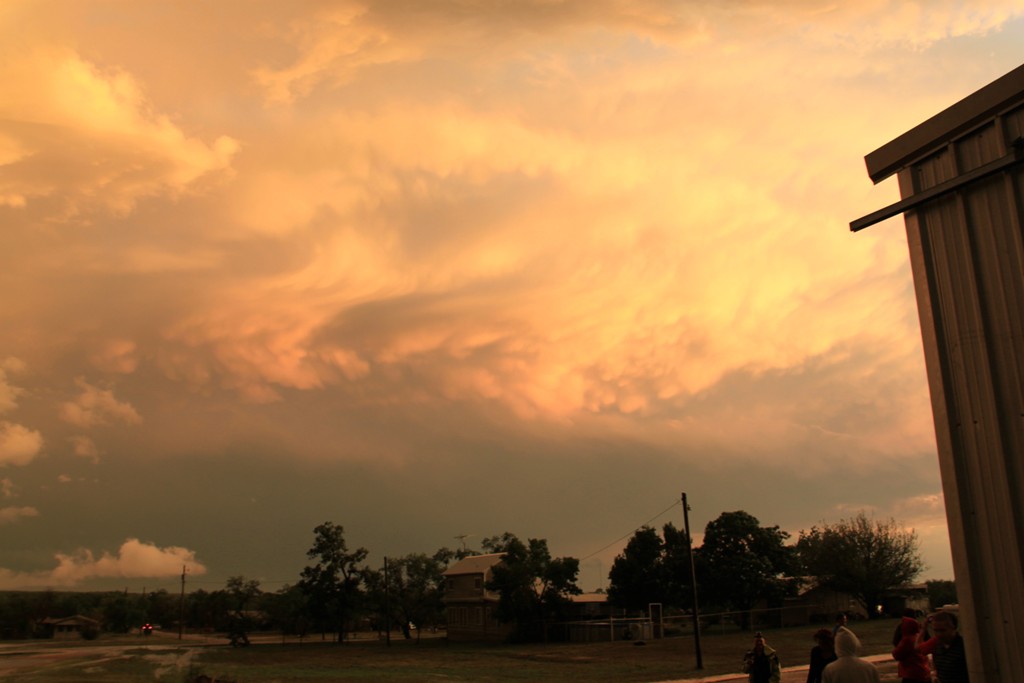
That little issue taken care of, the colors on the rear flank of the storm that
had just passed over us, contrasted with the bright blue sky behind us, were
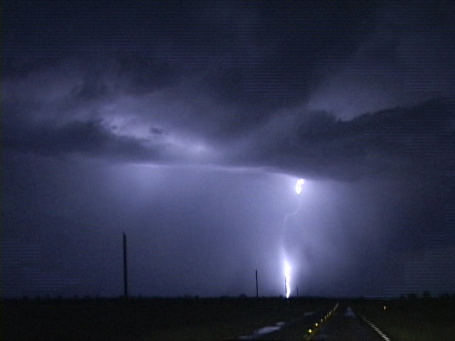
fantastic. As we drove through Throckmorton and Seymour on the way up to Wichita
Falls, we were treated to a nice anvil-crawling lightning show from the bow echo
complex to our southeast and a great cloud-to-ground lightning show on a small
cell just north of Seymour.
All in all a really fun chase day. Mileage for the day was 659.6 miles.
SPC
Convective Outlook SPC
Tornado Prob. NOAA Storm Report
 |
 |
 |
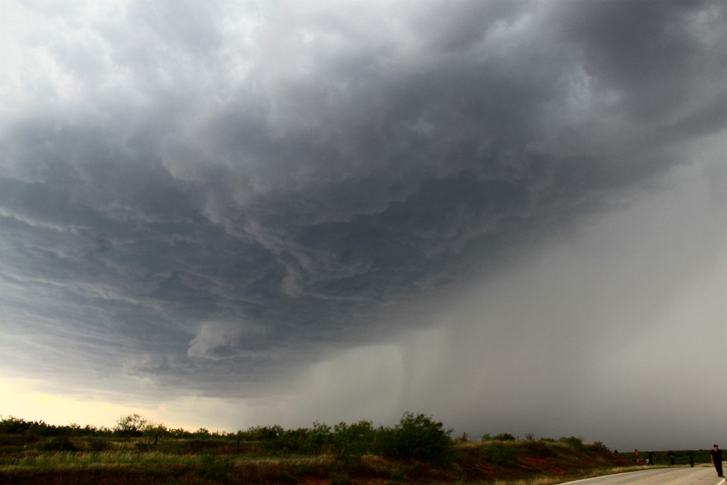 |
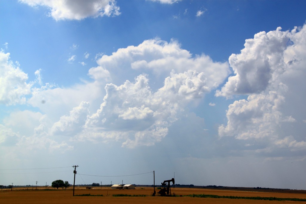
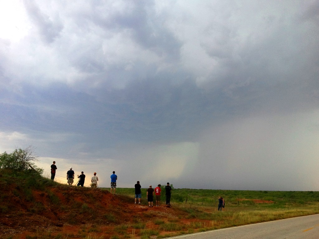
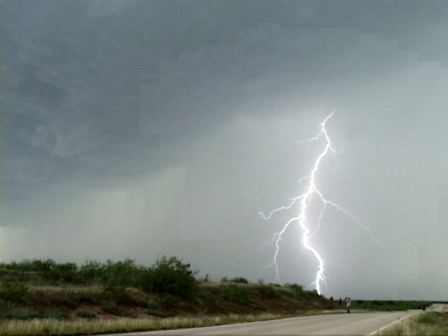
| We made the long journey from Salina, KS to Seymour, TX in great time, arriving just in time for storms to start developing. This updraft to the north caught our interest. Oh yeah, and it was HOT! The weather station in the lead van had the temperature at 103 degrees when we made this stop. | We decided to target the northern storm and headed up FTM 1919 towards the updraft, meeting it about 1/2 way to Crowell as it opened up a big rain shaft. | The guests with a hillside view of the oncoming storm.... until the lightning started flashing. | The storm became a big hailer with 3" hail as it closed in on our location. |
 |
 |
 |
 |
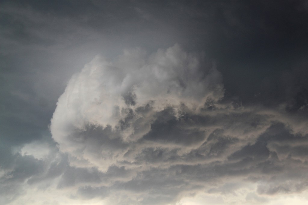
| Time to get away from that hill! | We zipped down the road south a couple of miles to stay ahead of the storm which had become a big high-precipitation monster! | Lots of rotation around the leading edge of the storm. | Broader look. Is the storm trying to form a wall cloud? |
|
|
|
 |
 |
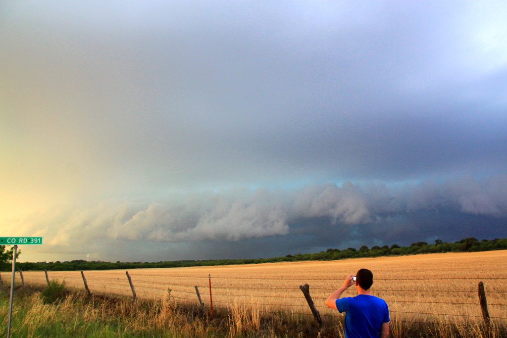
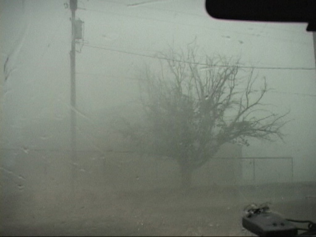
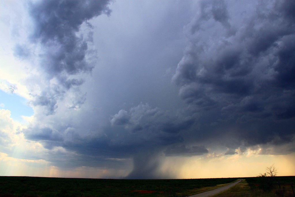
| We ran southeast as the storm bowed out into an intense line. Eventually we realized there was no way to get around it without getting cored, so we decided to seek shelter and let it roll over us. We stopped first to see this nice shelf cloud as the storm approached Woodson, TX. Notice the turquoise glow of the hail suspended in the updraft. | We sheltered the vans behind the wall of a school building and let the storm roll right over us. Unfortunately we missed the hail core but ended up getting hurricane strength wind and rain! | Trees bending over in the distance. | After the storm passed over the colors on the rear flank of the squall line were awesome! |
 |
 |
 |
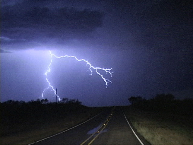 |
| More of the brilliantly colored sky. | One little problem, it rained so hard that the runoff from the building caused one of the vans to get stuck in the mud! Never fear, the Woodson Fire Department is here! | Later that evening we passed by several highly electrified cells. Here we headed towards one as we neared Throckmorton, which had been hit hard by the hail storm and lost power for a couple of hours. | Nice crawling bolt. |
All pictures (C) Richard Hamel 2017.