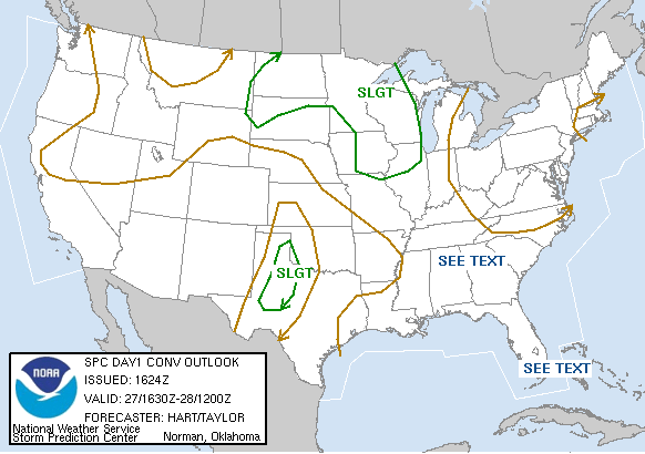
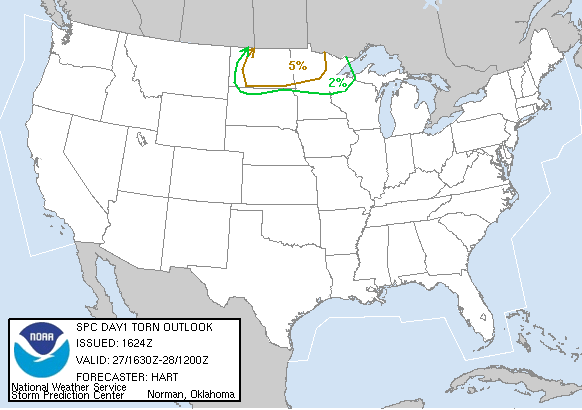
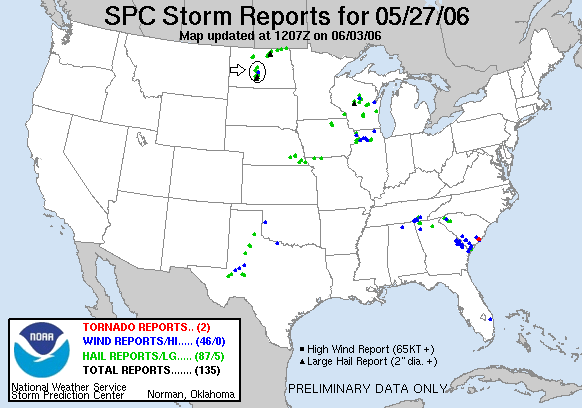
SPC Convective Outlook SPC Tornado Prob. NOAA Storm Report
May 27th, 2006 Bismarck, ND Electrified Storm
Starting in North Platte, NS we got on the road at 06:30 AM targeting Bismarck, North Dakota. We headed North out of North Platte up Rt. 83 to Valentine, then on through Pierre, SD and up to I-94 just east of Bismarck. We already had our hotel rooms booked in Bismarck and we almost just went to the hotel to unload and get data, but the area was starting to percolate with cumulus congestus so we stopped at a truck stop with a couple of other groups of chasers we know well. Towers fired up and down the long, arching occluded front to the northeast of the surface low we were playing until finally the cap broke. This turned out to be about the easiest chasing I've done. The storms were moving almost due north, and we just kept reusing two observing locations about 5 miles apart on either side of the highway.
We watched a train
of 3 clustered storms try to get their act together first, then when they
interfered with each other we dropped south to a small highly electrified HP
supercell that deluged south of Bismarck, showing a nice rain foot and pretty
good structure. After chasing it north back to our original location it tried to
form a wall cloud but couldn't really get it together. We then dropped back to
our southern locale again for the final storm in line and watched the nicely
structured supercell for about an hour, then found high ground for an amazing
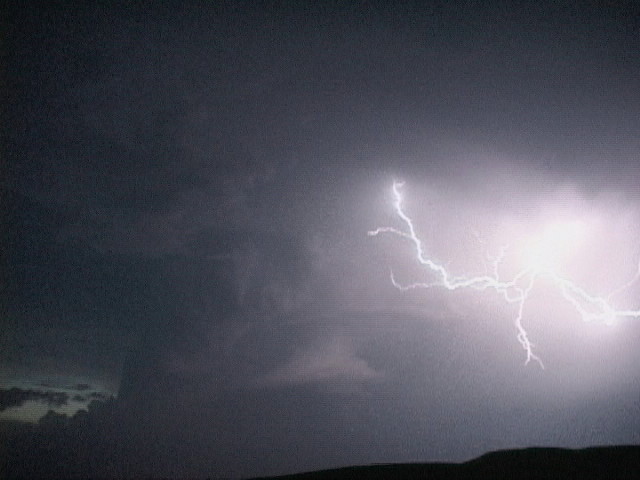
sunset lightning show on the top of a butte. From there you could see clearly
for miles in any direction and we could see Bismarck 20+ miles in the distance.
We watched as the storm approached it and went by, shooting great lightning all the
while.
Click here to see some of the video footage: Bismarck, ND lightning footage.
We got into the hotel at about 11:30 PM. We drove 530 miles this day.
SPC
Convective Outlook SPC
Tornado Prob.
NOAA Storm Report
 |
 |
 |
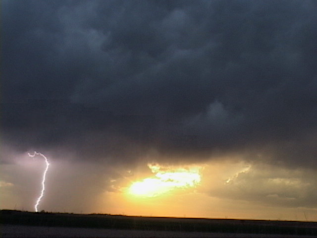 |
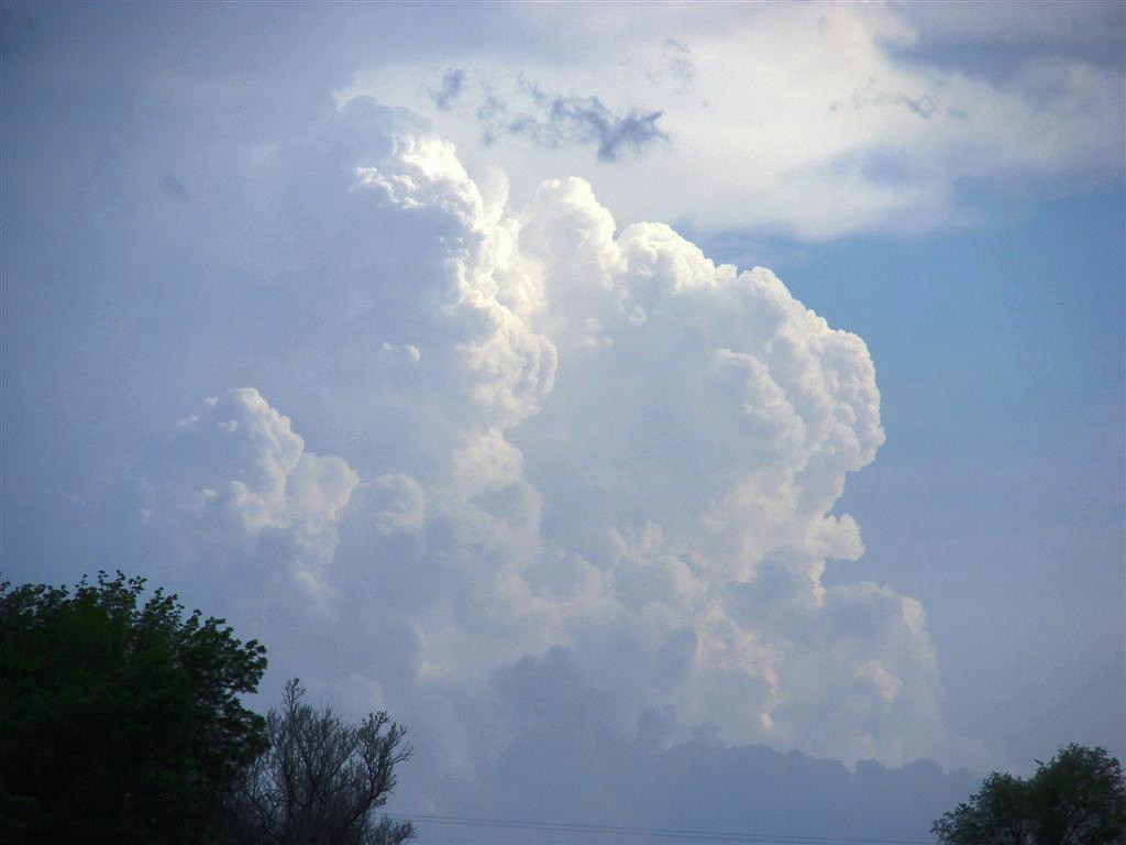
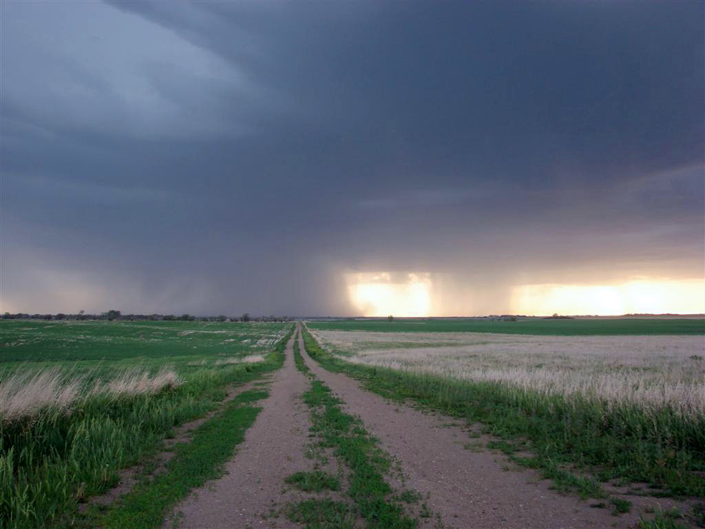
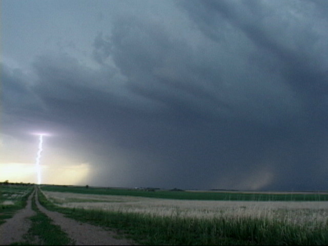
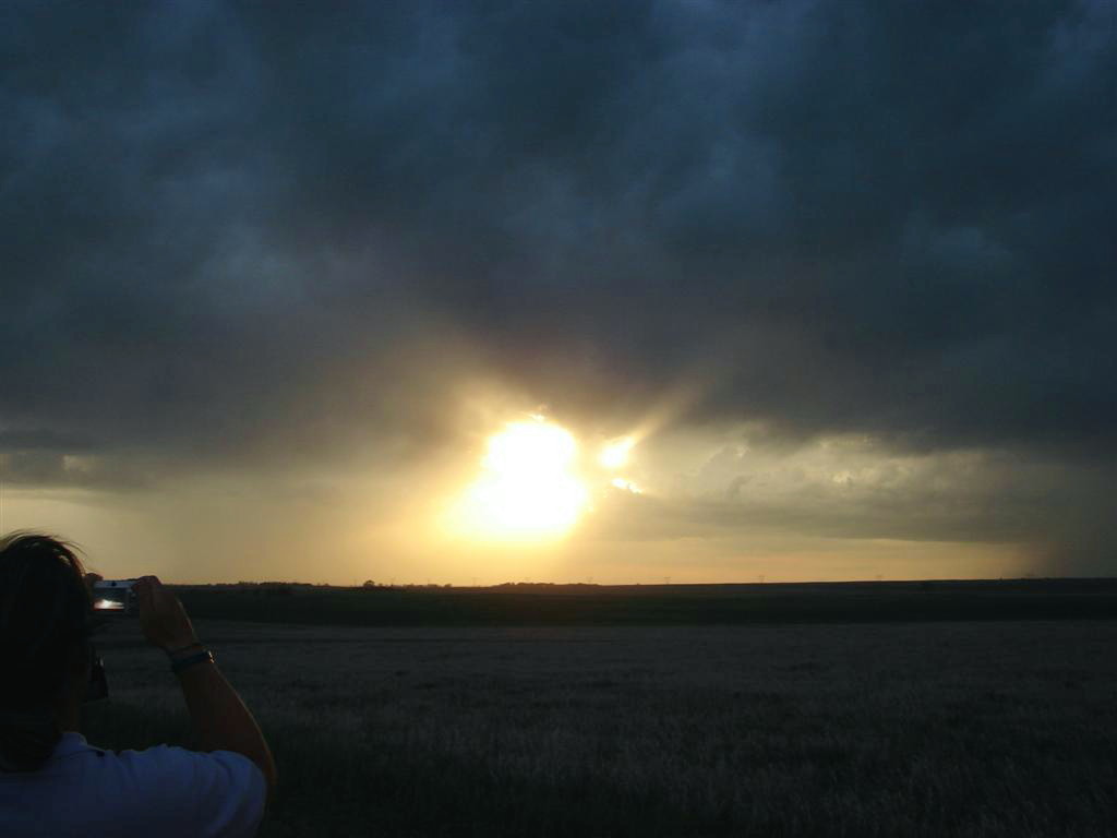
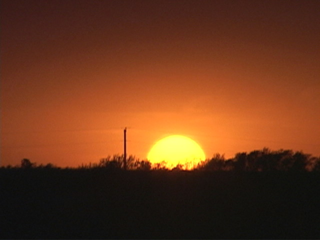
| Towers explode to our southwest as the storms try to get organized. | Off to the west towards Bismarck a large precipitation core opens up. | Lightning on the flank of the core. | As the sun sets, it's time for the lightning show to begin. |
 |
 |
 |
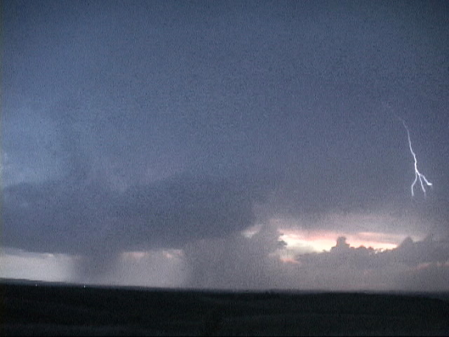 |
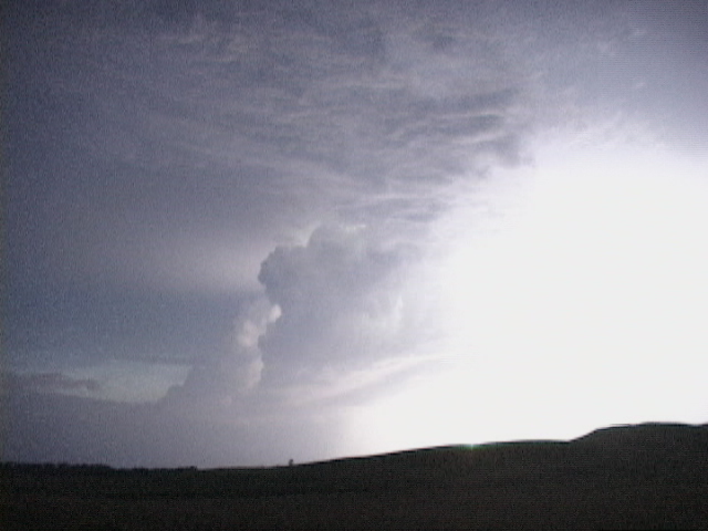
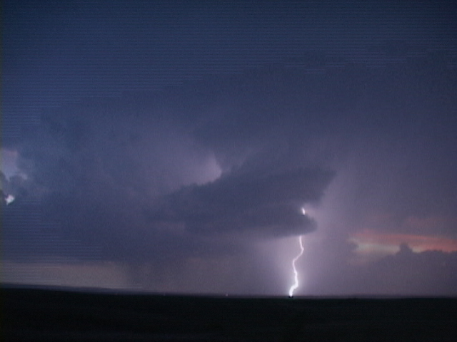
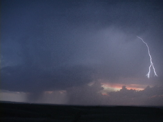
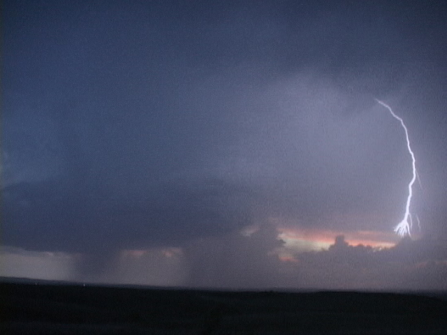
| Now south-southeast of Bismarck we watch a highly electrified hail storm as it passes over the city. | This frame and the next 3 form a 4 video frame sequence of a lightning bolt arcing out of the vault area of the storm. | ||
 |
 |
 |
 |
|
|
|
||
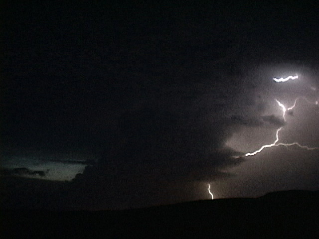
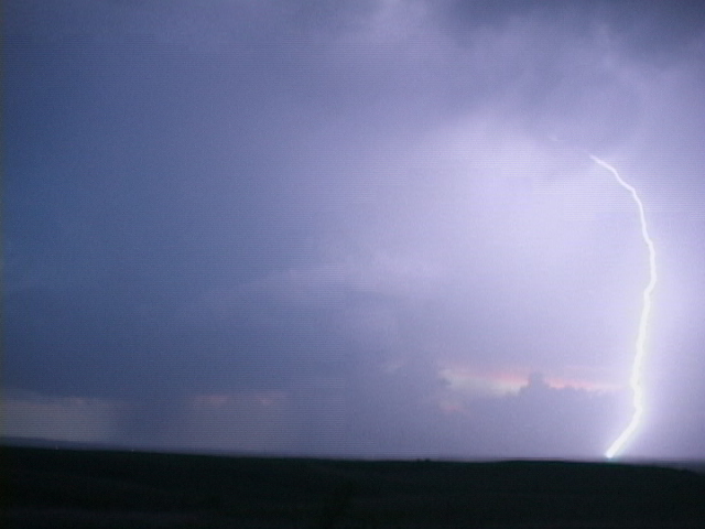
| Lightning illuminates the sky. |
All pictures (C) Richard Hamel 2017.