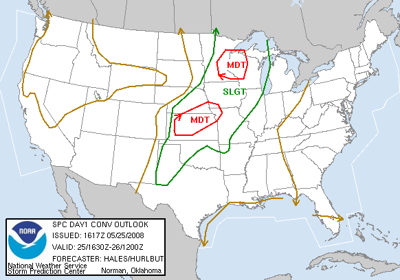
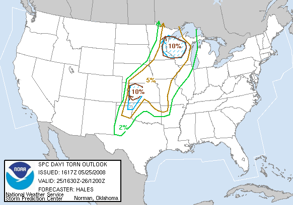
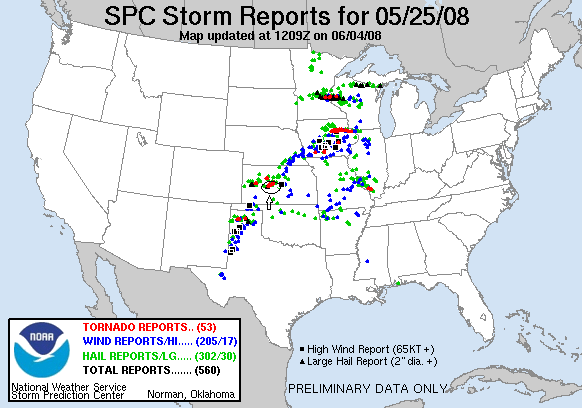
SPC Convective Outlook SPC Tornado Prob. NOAA Storm Report
May 25th, 2008, Timken, KS Landspout
Starting in
North Platte, NE, we headed back into Kansas, making it all the way down
to Hays before lunch. Our play was the dry line in west Kansas and a boundary
draped along I-70. After stopping in Hays for lunch, we headed west and dropped
south out of WaKeeney, yes on the exact same roads we'd been driving up and down
all tour. Leaving WaKeeney we saw clear evidence of wind damage caused either
by the straight line winds associated with the RFD surge we got caught in, or
the tornado itself on May 22nd. We headed for Ness City, but ended up turning
West to intercept the first big supercell of the day. It was closest to the
boundary, and I suspected that it would go bonkers once it got there. We barely
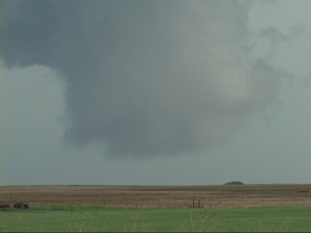
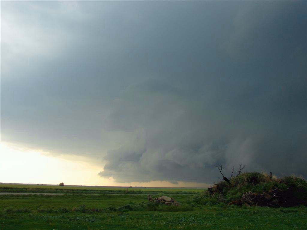
beat the storm into Scott City and came around from the south while a wall cloud
developed to our north. It looked for a bit like it could tornado, but lost
focus as the storm moved off to the north and the storm fell apart. There was a
large RFD kick up of dirt to our south around this time, and one of the rival
storm chase tour companies reported it as a tornado, but it was certainly NOT.
With that storm falling apart, we targeted the next storm down the line which
looked much beefier and was in better air. The storm was already tornado warned
and there was a report of a tornado from the groups that were already on the
storm. We made an easy intercept as the storm moved across the road right as we
got there, so we were able to get into position around the south end of the
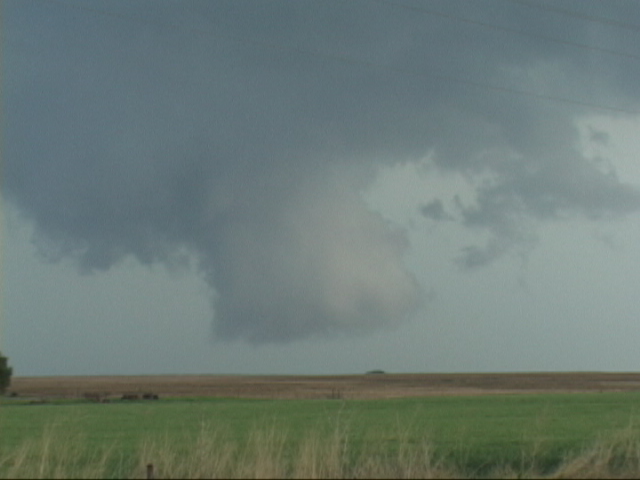
storm without trouble. As we got there we immediately spotted a very large
rotating wall cloud. We got right up to it as it spun wildly and were in the
perfect spot if it had tornadoed, but sadly we didn't see it from our vantage.
There was a report of a brief spin-up, but we didn’t see it. This occurred west
of Alexander. As that wall cloud fell apart, a second cell had crashed into our
storm and soon developed its own wall cloud just east of Rush City. The wall
cloud fell apart, and we proceeded east but just as we left our observation spot
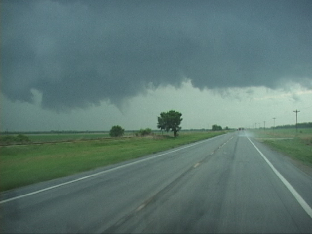
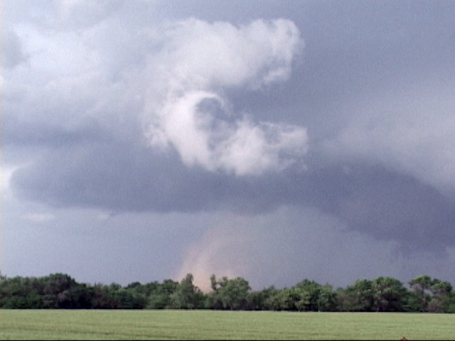
Andy noticed a white horizontal funnel running along side the vans and shortly
there after the nose of the funnel dipped and a large debris cloud formed less
than 1/2 a mile from us! We quickly stopped and observed the tornado for a few
minutes as the tornado sirens in Timken began to sound. It was a strange
looking tornado, with a long kind of cork-screwed wall cloud. We eventually
decided it was a landspout.
We then followed along as the wall cloud recycled, then charged north to see if
it would tornado again, once again getting a wild ride on muddy gravel roads
through Otis and Galatia. Once we arrived in Galatia, the storm had died and
the next storm in line had become a big HP, so we watched for about 20 minutes
as a nice shelf cloud zoomed forward towards us. Finally we gave up and headed
to Hoisington to refuel and keep an eye towards the south to see if anything
would come together, but by now the storms had merged into a very long linear
MCS and the tornado threat was over. We called it a night and went to the hotel
in Salina, KS.
A very interesting chase day with a lot of neat cloud structure, of course
topped off by a very close landspout tornado. The only thing separating the day
from a big tornado day in Kansas was the lack of backed surface wind. At this
point we’d seen at least 7 tornadoes all within about 50 miles of each other on
3 separate days.
Today's mileage: 577
SPC
Convective Outlook SPC
Tornado Prob.
NOAA Storm Report
 |
 |
 |
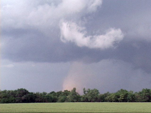 |
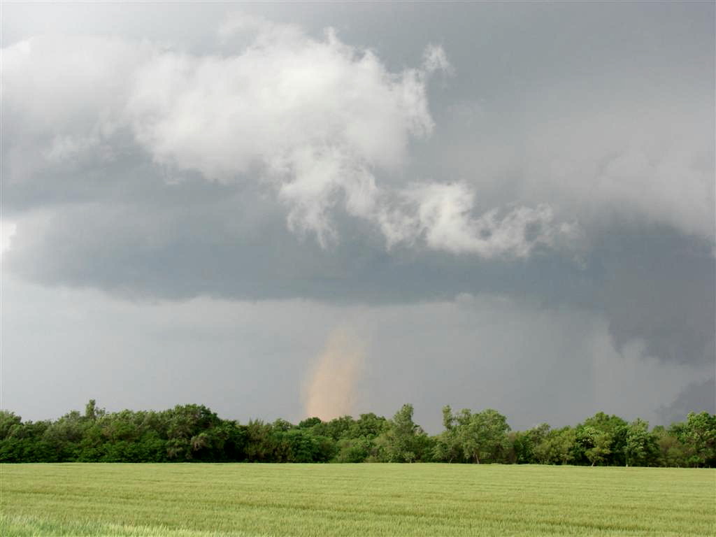
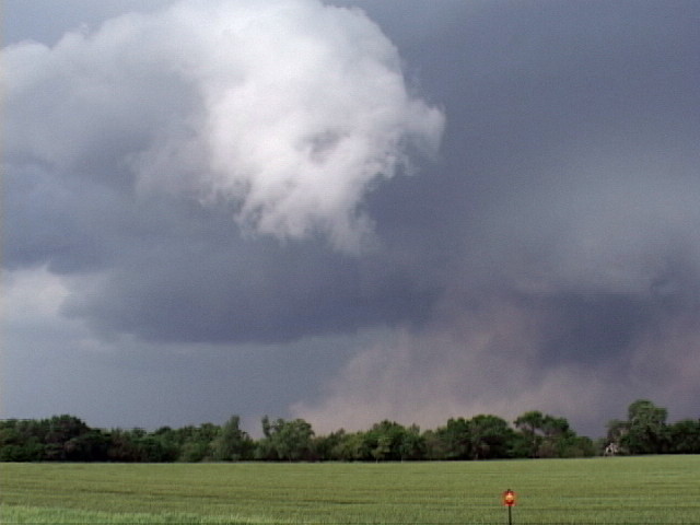
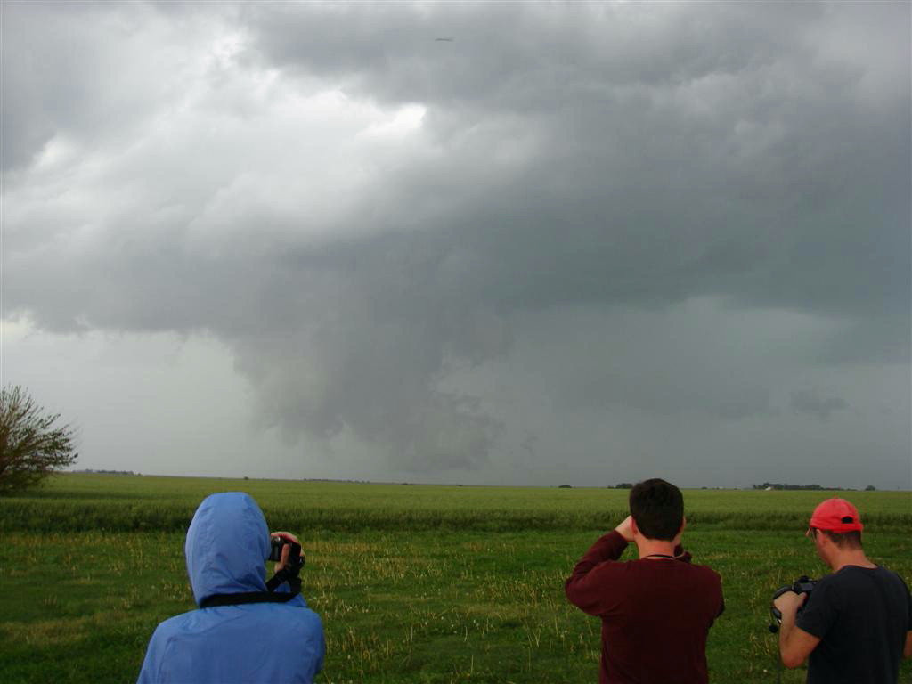
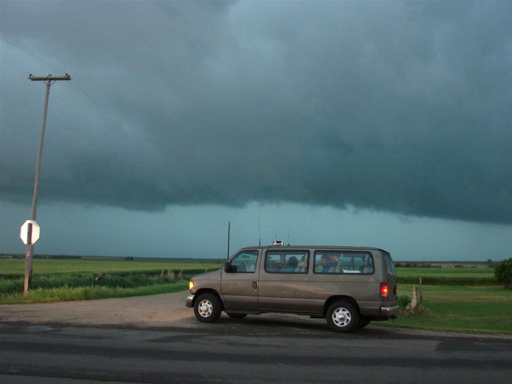
| After chasing a storm near Ness City, we blast east towards a strong storm near Alexander. as we pass south of the storm, a funnel extends about 1/2 way to the ground. | Now stopped, we observe this large soda-can wall cloud spinning like a top just to our north. | There was a brief spin up reported with this storm, but we didn't see it from where we were. | A bit later Andy (one of the other guides) notices a horizontal funnel cloud developing just north of the vans and moments later, landspout tornado! |
 |
 |
 |
 |
| The funnel enters the picture from the top left, extends to about the middle of the picture, then bends downwards over the tan debris cloud the tornado caused. | We get back on the storm as a new wall cloud cycles farther east towards Otis. | ||
 |
 |
 |
|
|
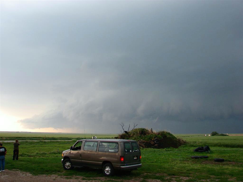
The storm, alas, becomes high precipitation, pretty much ending the tornado threat. Here is the approaching shelf cloud. |
We pause to take one more look near twilight with the blue-green glow of the hail core is off to our west. |
All pictures (C) Richard Hamel 2017.