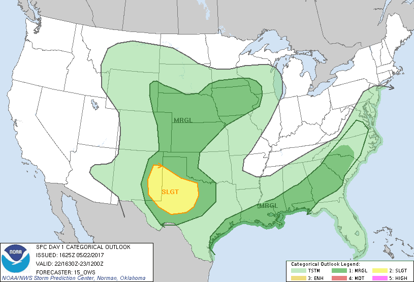
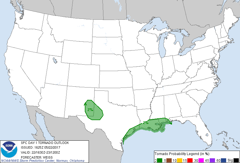
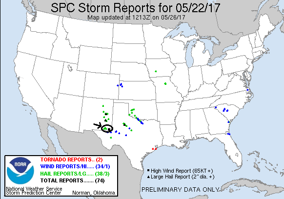
SPC Convective Outlook SPC Tornado Prob. NOAA Storm Report
May 22th, 2017, Jal, NM Storms and Core Punch
I thought we were tornado chasing but we ended up in a
hurricane! Today’s play was expected to be low-precipitation storms given the
significant dew point depressions that were forecast, firing in the mountains of
New Mexico then making their way east into the Carlsbad and Tatum area. With two
targets in fairly close proximity, we planned on putting ourselves in between
the two and reacting as model data was updated and storms started initiating.
Starting in Sonora, TX, we made our way to Odessa, TX and then Midland for
lunch. By the time we finished, there were already storms bubbling up and a
severe storm up near Santa Rosa, NM. We decided to head northwest and up Rt. 385
through Andrews and into Seminole, then west on Rt. 62 to Hobbs where we waited
and assessed the situation for an hour or so.
We now had a cluster of cells that had come off the
mountains to the west, the storm up near Santa Rosa that was still sitting and
spinning, and now another forming south of Tucumcari that was moving southeast.
The best-looking cell, though they were all pulsing up and down, was heading for
Artesia, so we elected to target that storm. Heading west on Rt. 62 out of
Hobbs, we noted that most of the storms around us were elevated and stopped to
take a look at a massively sheared over updraft right to our north which was
spinning furiously as it keeled over and died. We then headed NW on Rt. 529
toward Loco Hills, twice getting heavy delays due to construction.
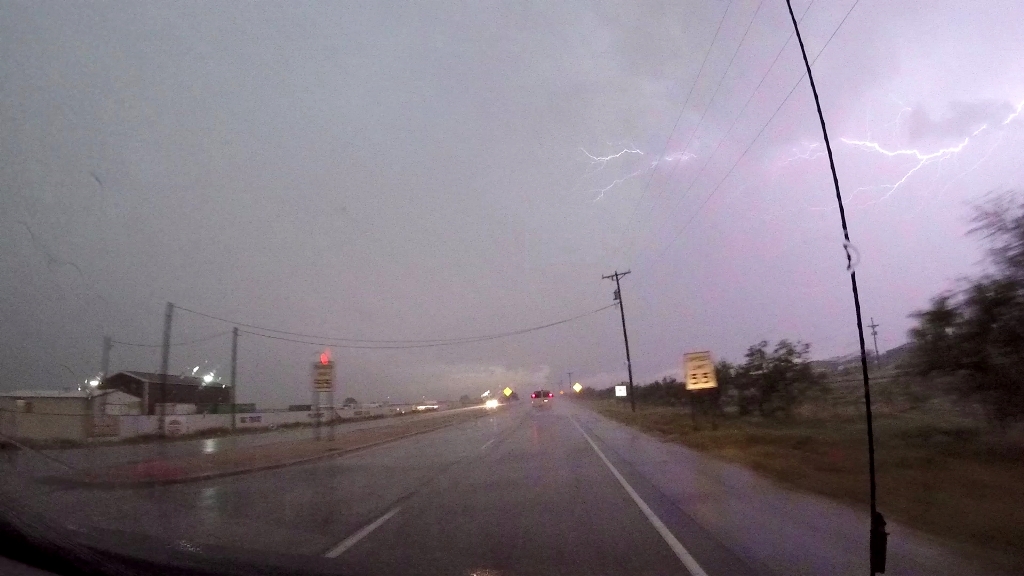
By the time we got to our turn at Rt. 82, there were
again 3 storms to target, the Santa Rosa storm that was finally moving south
towards Roswell, the storm coming down from Tucumcari, and the storm to our west
which had back-built south and was now dive-bombing towards Carlsbad. We
initially turned east to get out in front of the Tucumcari storm, but we could
see the western storm clearly in the distance and it looked too good to give up,
so we turned around and went after it. We headed back west then south on Rt.
222, twisting and winding our way south and southwest over bad roads until
finally connecting with Rt. 360. Once we got there, we found we were now
sandwiched between two storms as a huge core had opened east of us, and the
southern storm was merging with another and extending towards the eastern storm,
lining out. The storm to the east, which was just NW of Jal, was anchored and
had a nice mesocyclone on the SE side, just out of our vision. We elected to go
after that one on blasted down Rt. 31 to come around the SW side, with the
intent of checking that storm out, and once we got to Jal we’d be in position to
head north to get to the now tornado-warned Tucumcari storm.
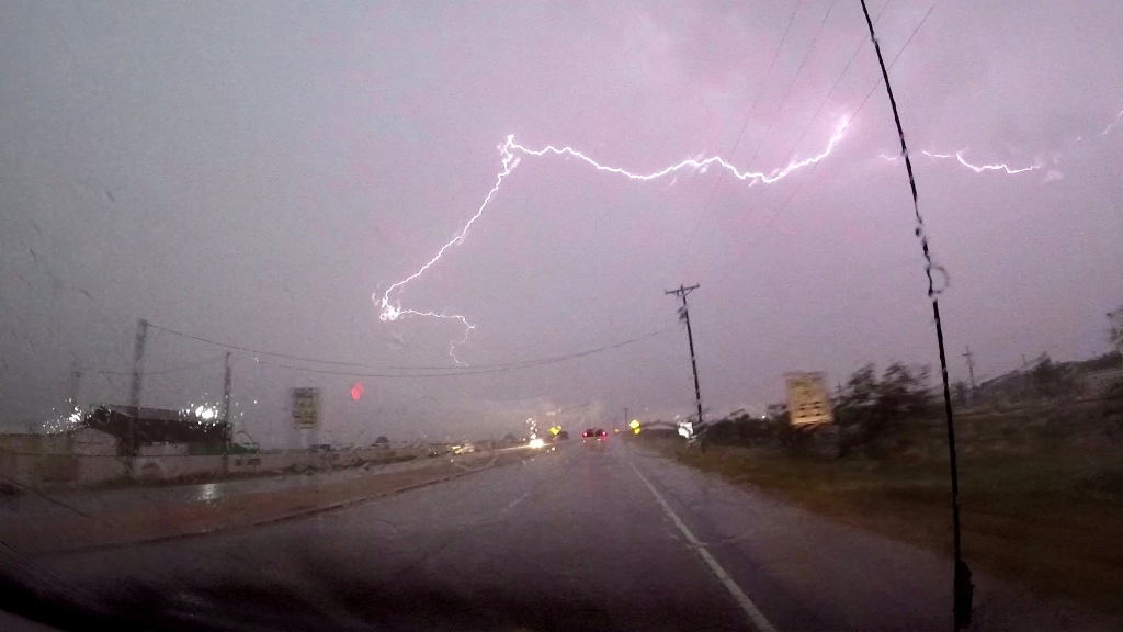
We took Rt. 31 south then went east on Rt. 128, which
seemed almost perfectly situated to skirt the anchored core now straight east of
us. But, as it always seems to go, once we approached, the storm “weighed
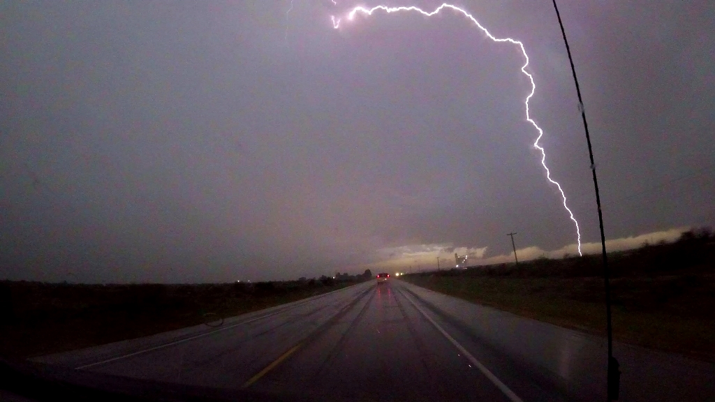
anchor” and came barreling south! We punched the hook area in heavy winds and
were soon engulfed in the precipitation core. Blasting winds hit us from the
north and we saw reports from about half a mile in front of us of 77 mph wind
gusts and power lines down on the side of the road, and we soon saw a string of
about 10 power posts snapped and on the ground, paralleling the road to our
right. Visibility was near zero as the vans were pelted by a huge volume of
nickel and quarter sized hail, and the gusting hurricane force winds blew sheets
of water, tumbleweeds, and other debris across the road. At this point there was
no turning back so we plowed through, and eventually the core passed over us and
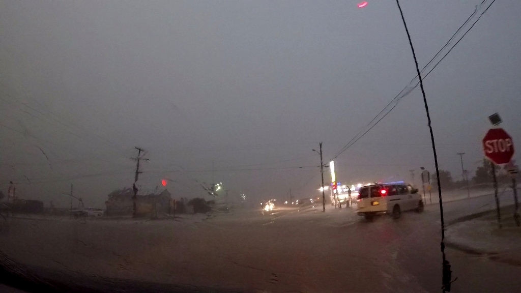
to the south. We entered Jal to find heavy flooding downtown and turned south,
but now the storm was collapsing on radar so we gave up the chase and headed
north, and looking on radar you could see that all of the other storms around
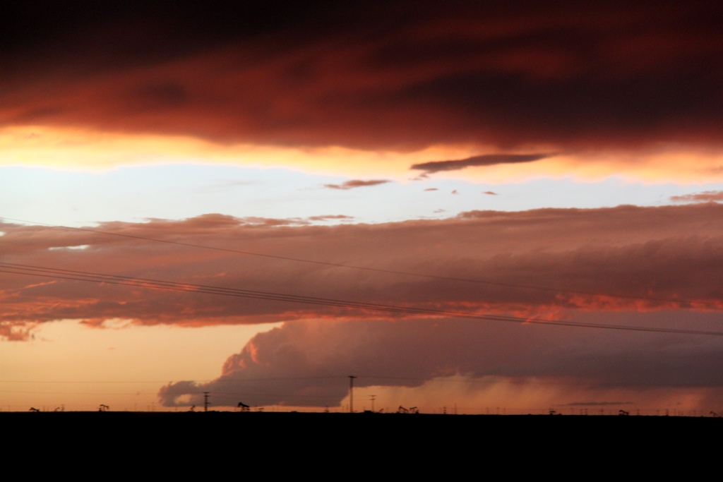
were falling apart as well. Once we got about 5 miles north of town we stopped
and saw an eerie double rainbow against a backdrop of yellow-orange caused by
the setting Sun. We stopped to take pics and then called it a night and headed
back to Seminole, TX for the evening.
This was one of those manic chases where we never really
had the opportunity to stop and observe except at the very end, but still, a fun
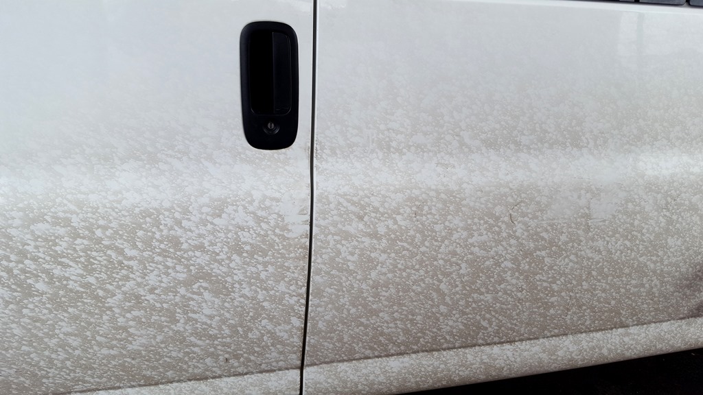
day. Funny looking at the vans later to see the dirt on the left side of the
vans completely pock-marked by the hail while the right sides were clean.
Mileage for the day was 531.
SPC
Convective Outlook SPC
Tornado Prob.
NOAA Storm Report
 |
 |
 |
 |
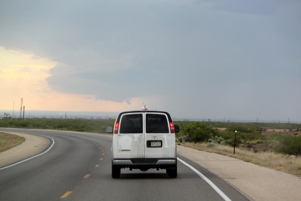
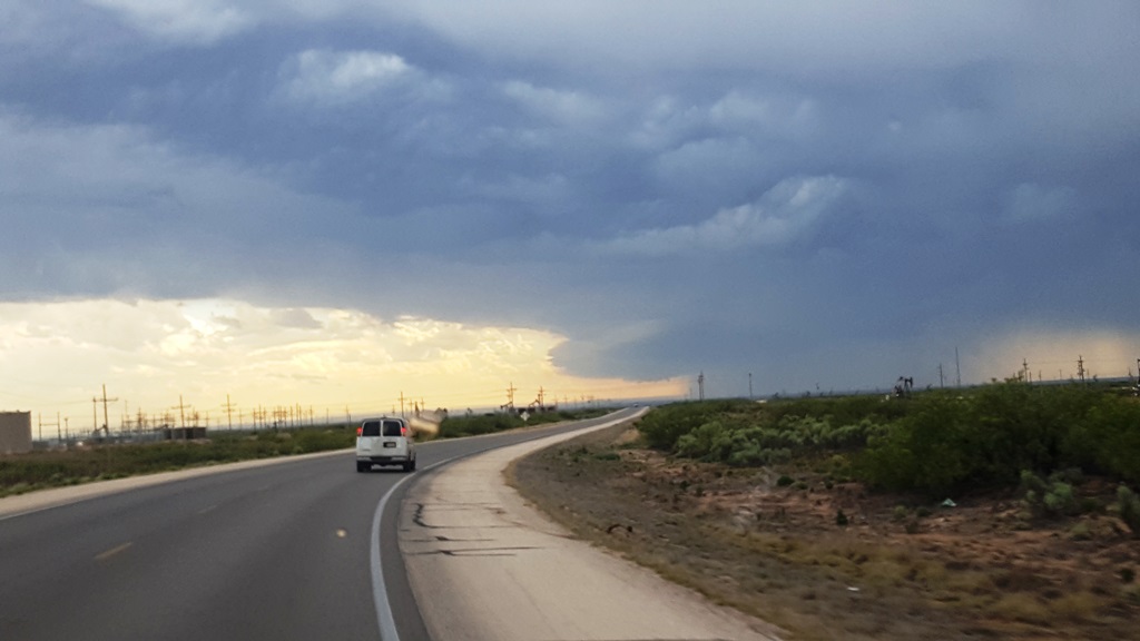
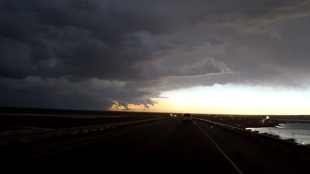
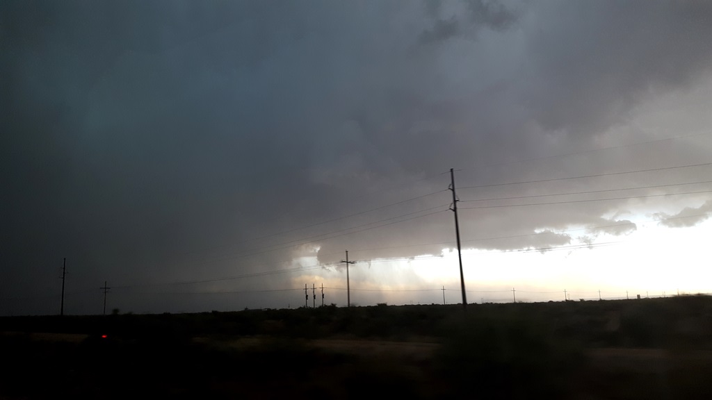
| Off to New Mexico! With the front having scoured the moisture out of the plains, our play was low-precipitations supercells coming off the mountains of New Mexico. | After sitting in Hobbs for a while to assess which of several storms to target, we chose one that was occurring near Carlsbad and headed that way. Here the storm has a distinct lowering come out of the updraft base. | Closing in on the Carlsbad storm near Rt. 62. | Cores started opening up everywhere and soon we were sandwiched between multiple storms. We decided to target an anchored storm west Of Jal. |
 |
 |
 |
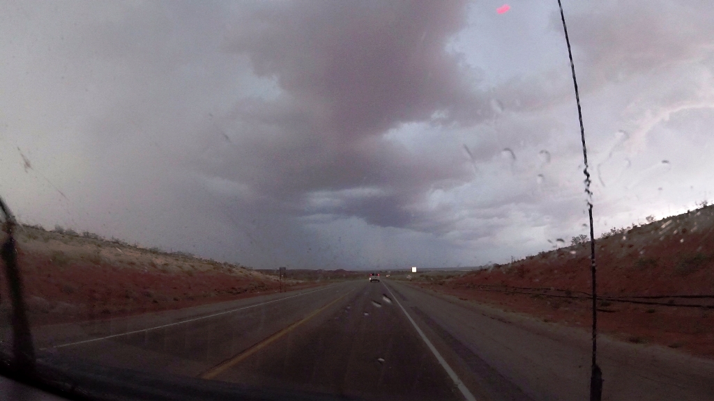 |
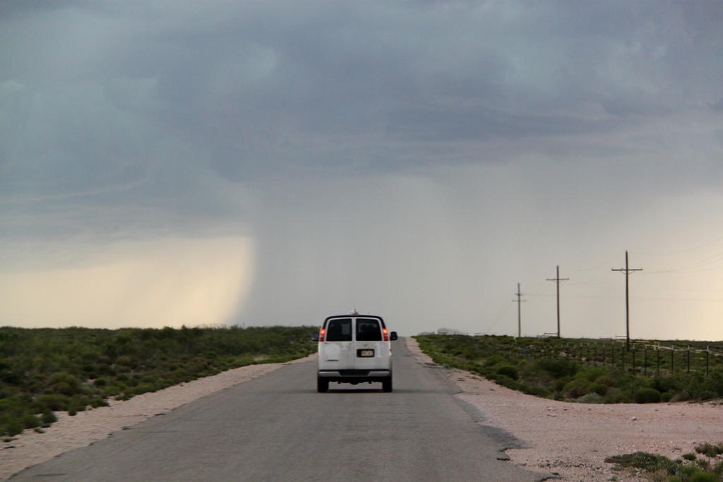
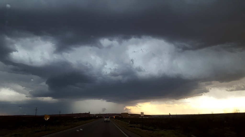
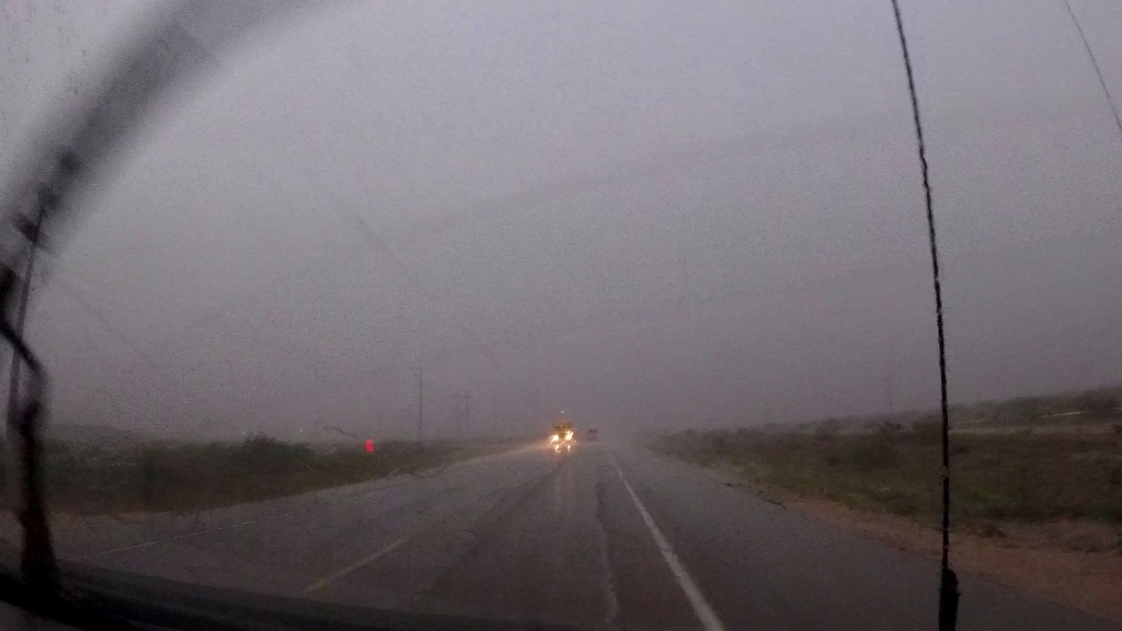
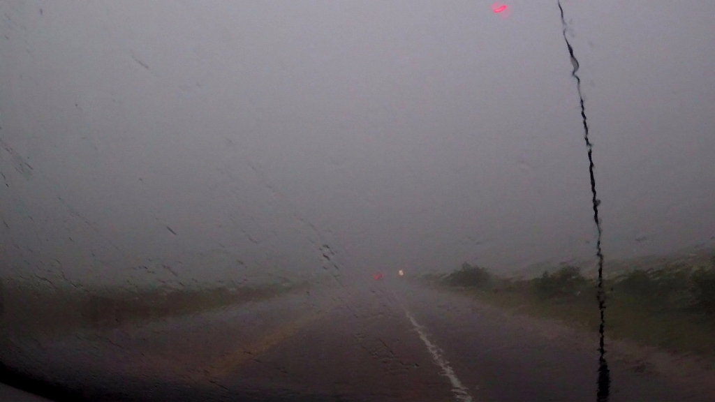
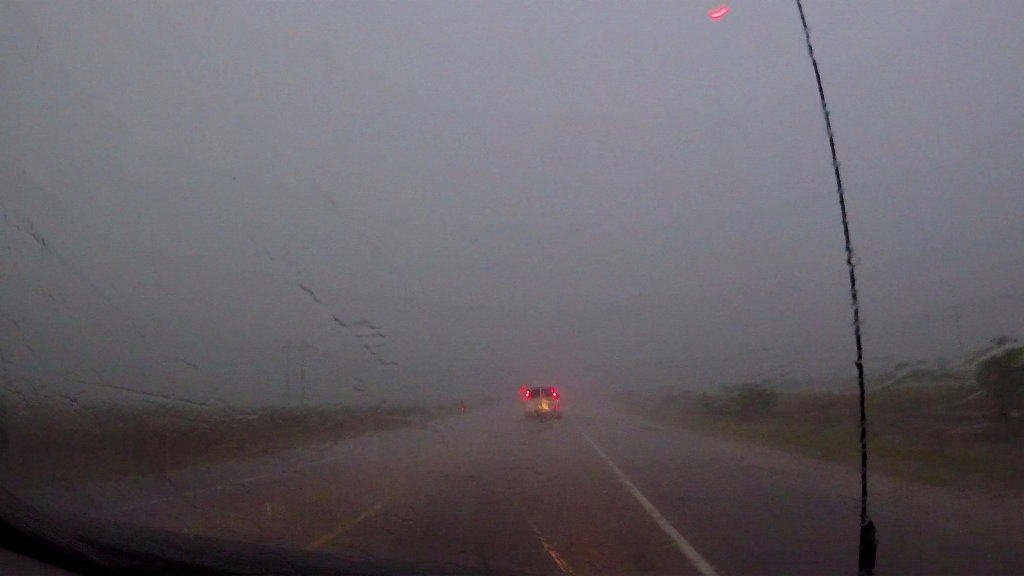
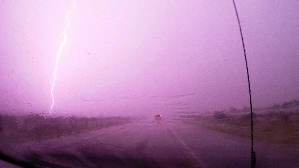
| Closing in on the Jal storm, still anchored. The road we were on skirted just south of the main precipitation core and we blasted south and east to get around to the inflow notch. | Closing in on the storm. It was going to be close as the storm was now starting to drift south. | Closing in, but the edge of the core is now SOUTH of the road. Not looking good! | The core crosses the road in front of us, but we're now committed so it looks like we're blasting through... |
 |
 |
 |
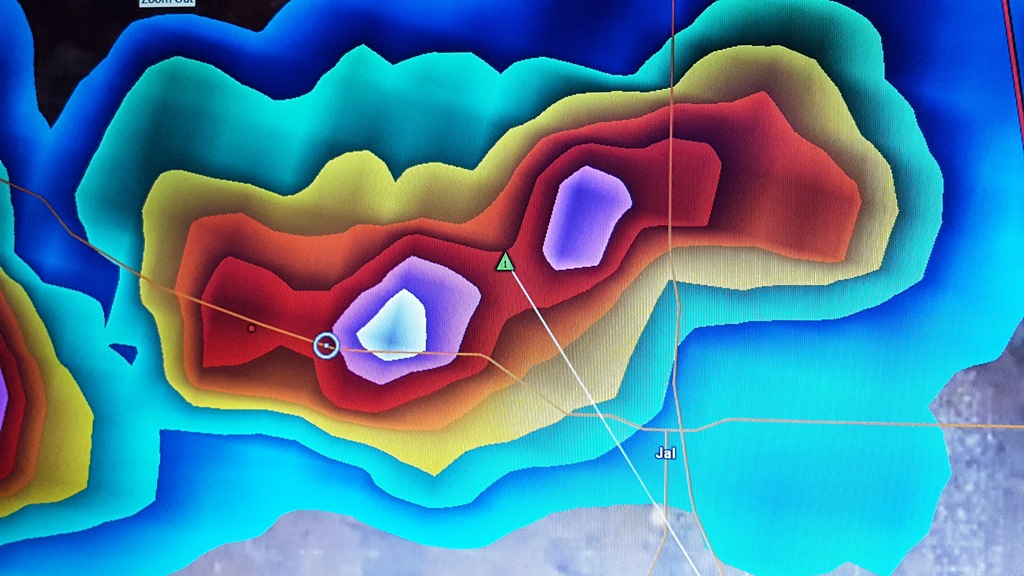
 |
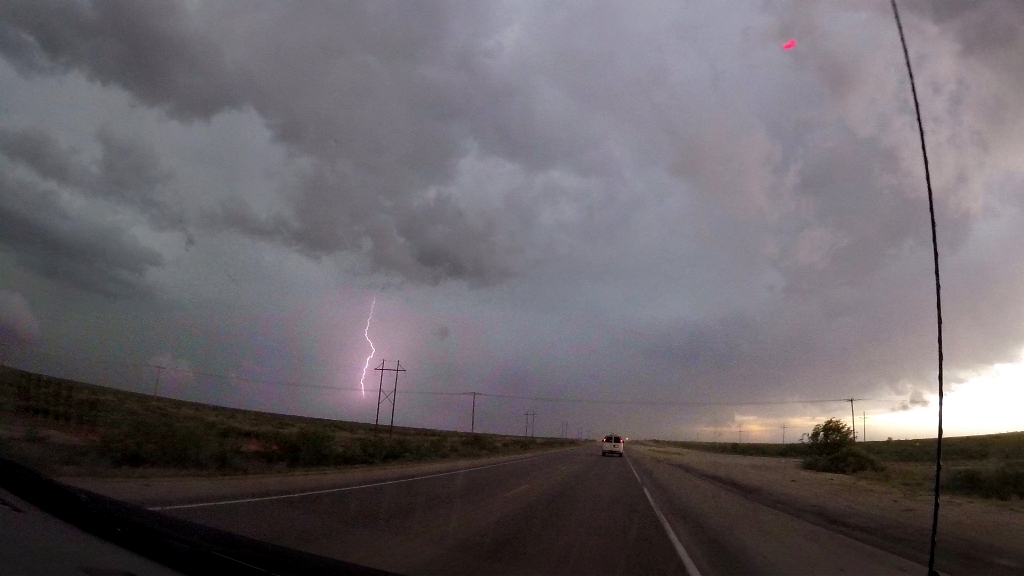
| Just about in as we start seeing numerous cloud-to-ground bolts around us. | Here's the derived VIL imagery just before we hit the core. the white is the BIG hail... | And we're in a hurricane! Blinding rain and heavy crosswinds with hail mixed in blasted us as we went through the core which was now surging south. | There were numerous power lines down on the south side of the road as we met the main part of the core. |
 |
 |
 |
 |
| In these cases, you just lock onto the tail lights of the van in front of you and hang on... | Blam! | We finally made it to Jal, which was flooded. The storm was now surging south more quickly that we could likely keep up with. | Heading south now out of Jal with the main core just to our west. |
 |
 |
 |
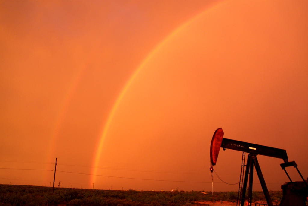 |
| Wild cloud to cloud lightning just overhead. | Lightning illuminates a lowering well to our south. Unfortunately the core was going to cross in front of us before we could down there, so we decided to turn around and make our way towards the hotel as all the storms in the area seems to be pulsing downward on radar. | A few miles north of town we stop to observe a beautiful orange-lit double rainbow at Sunset. | |
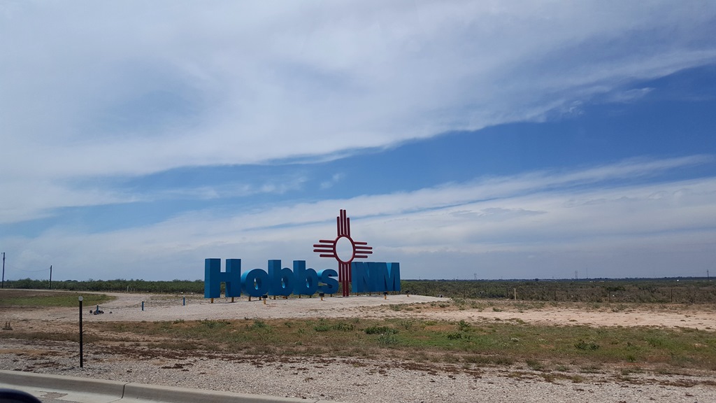
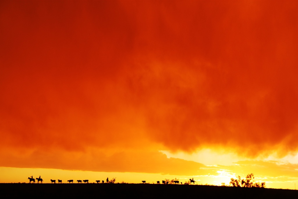
 |
 |
 |
 |
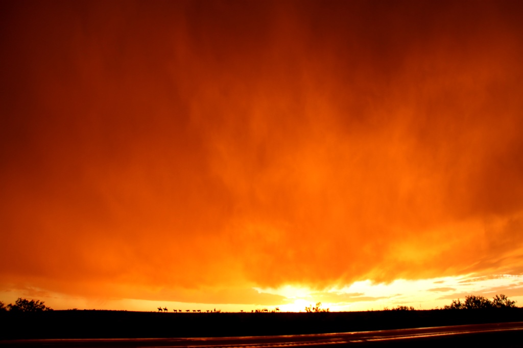
| Are those cowboys under the setting Sun to the west? | A closer look. This is a clever monument on the hill to the west of the road. | Off in the distance, another updraft gets sheered over as the storms continue to die out. | The dirt on the side of the van pock marked from all the small hail hits. |
All pictures (C) Richard Hamel 2019.