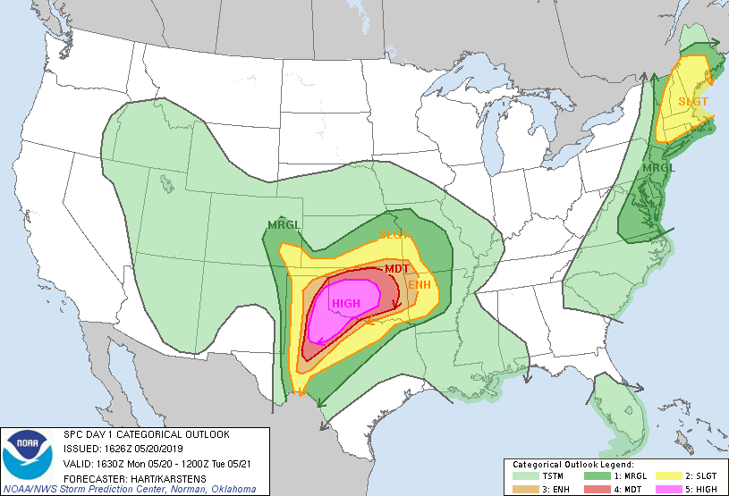
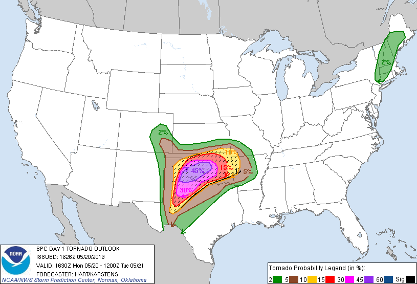
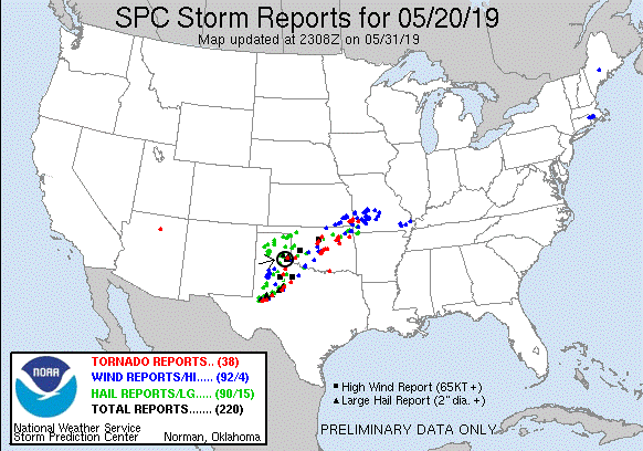
SPC Convective Outlook SPC Tornado Prob. NOAA Storm Report
May 20th, 2019, Paducah, TX Tornadic Supercell
A high-risk day for the eastern Texas Panhandle and
western Oklahoma! Forecast conditions for this day: dew points in the 70’s, CAPE
in the 3000-5000 J/kg range, and strong shear had tornadoes written all over it,
at least as long as the storms could remain isolated. That was the main concern
as the day also came with a weak capping inversion, meaning the storms might not
remain isolated for long. The forecast and target area also suggested that the
chaser hordes would be out in force. Our plan was to head southwest out of
Oklahoma City and play with the initial storms in the warm sector first before
they congealed into a line, then head further southwest to the dry line where we
expected the biggest, meanest storms to be later on. The hope was also that most
of the hordes would stick with the warm front storms as they put OKC under the
gun toward evening. It was an ominous forecast: Some schools in the OKC area
were closed in anticipation of a major severe weather event.
We departed OKC and headed southwest to Lawton, then west
through Altus, heading for our target Childress, TX where we would stop and
adjust accordingly. At Altus AFB, they were getting ready, with all the big
military planes on the taxi line revved up and ready to get out of harm’s way.
Arriving in Childress, the chaser hordes were already there, and we hung out for
some time at a Pilot in town with dozens of other chasers waiting for the warm
sector to initiate.
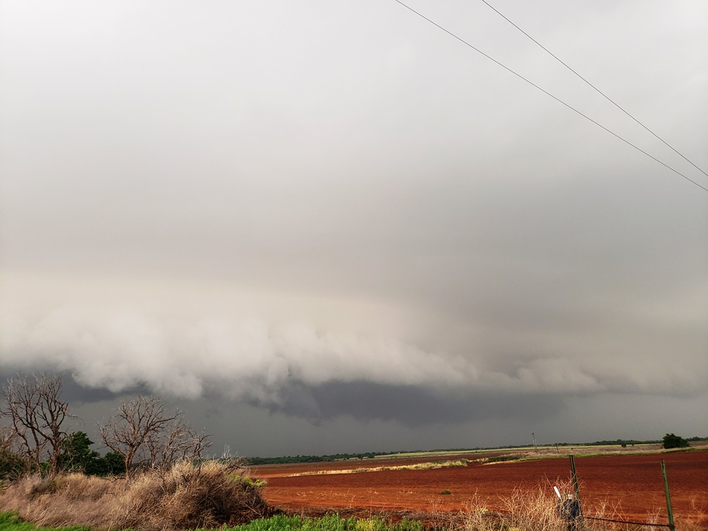
After waiting almost two hours in Childress, storms began
firing and soon our attention was drawn to a storm heading up from the southwest
towards Paducah, so we headed south on Rt. 62 to intercept. But, as we got close
to town just minutes ahead of the rotating area of the storm, we ran into
construction and were stopped in our tracks waiting for a lead car to return and
take us into town. Seeing that we were not go going to beat the storm into town
and get to our east option to stay with the storm because of the construction,
we headed east on FTM 314 through the mud then south on FTM 301 trying to get
back to pavement.
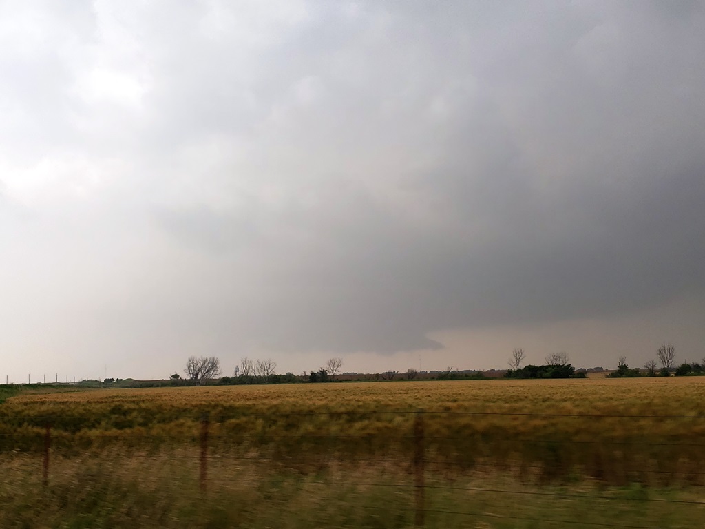
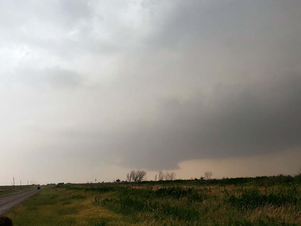
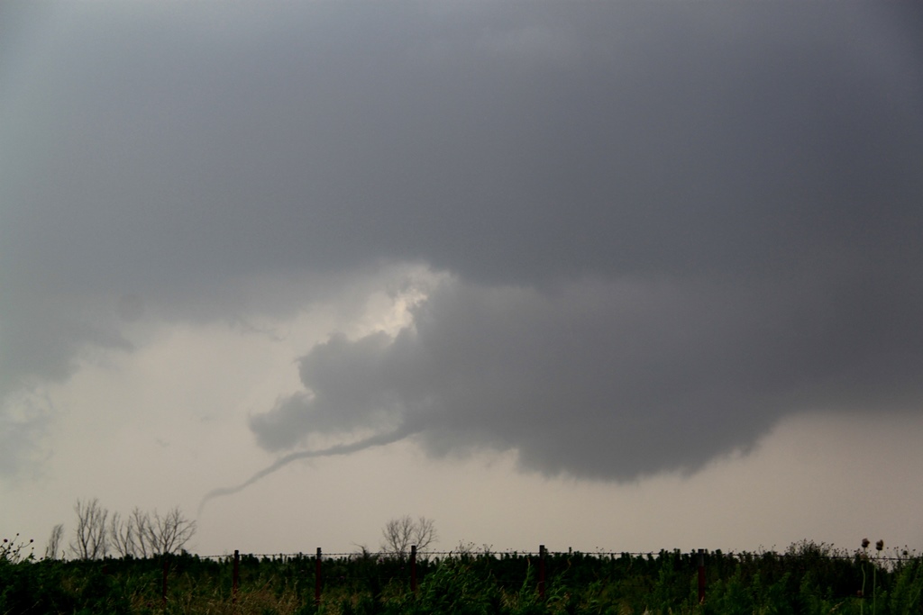
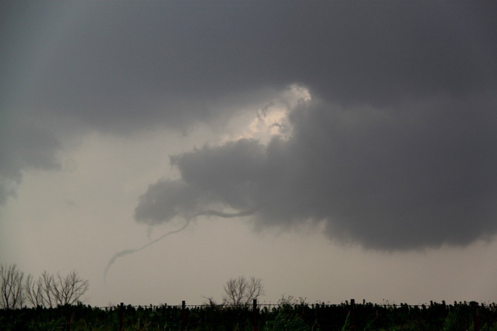
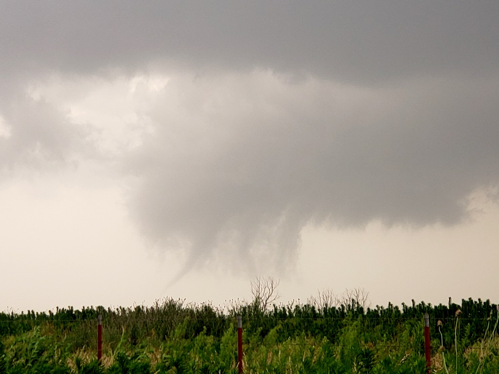
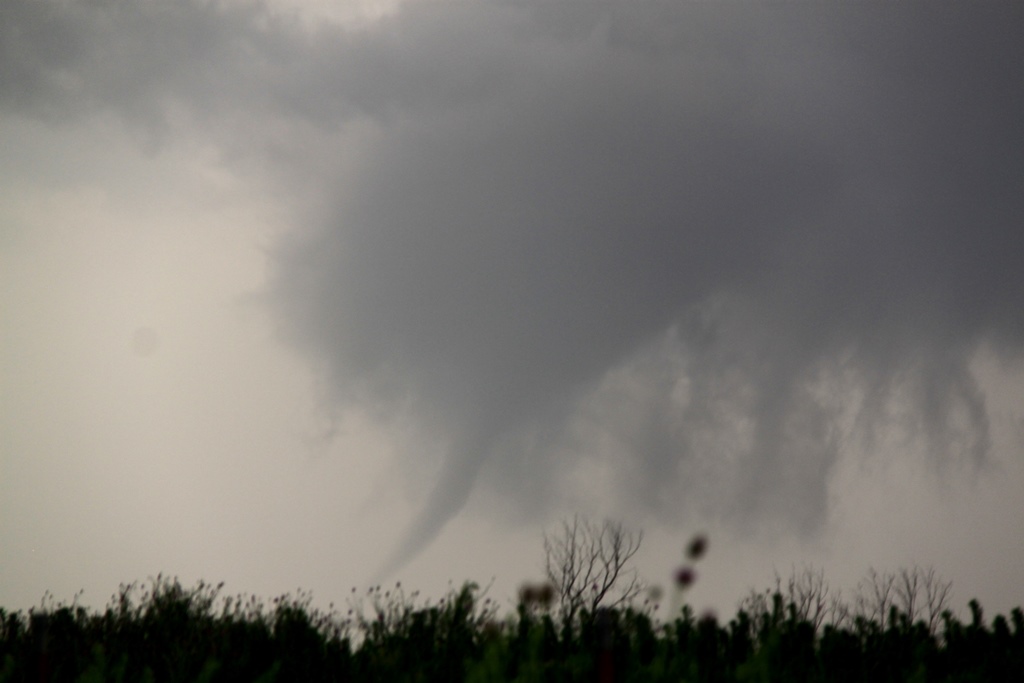
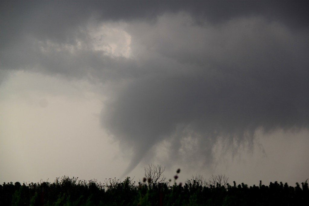
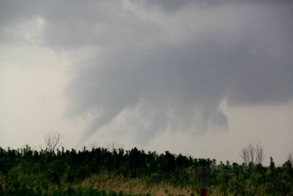
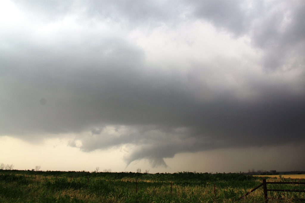
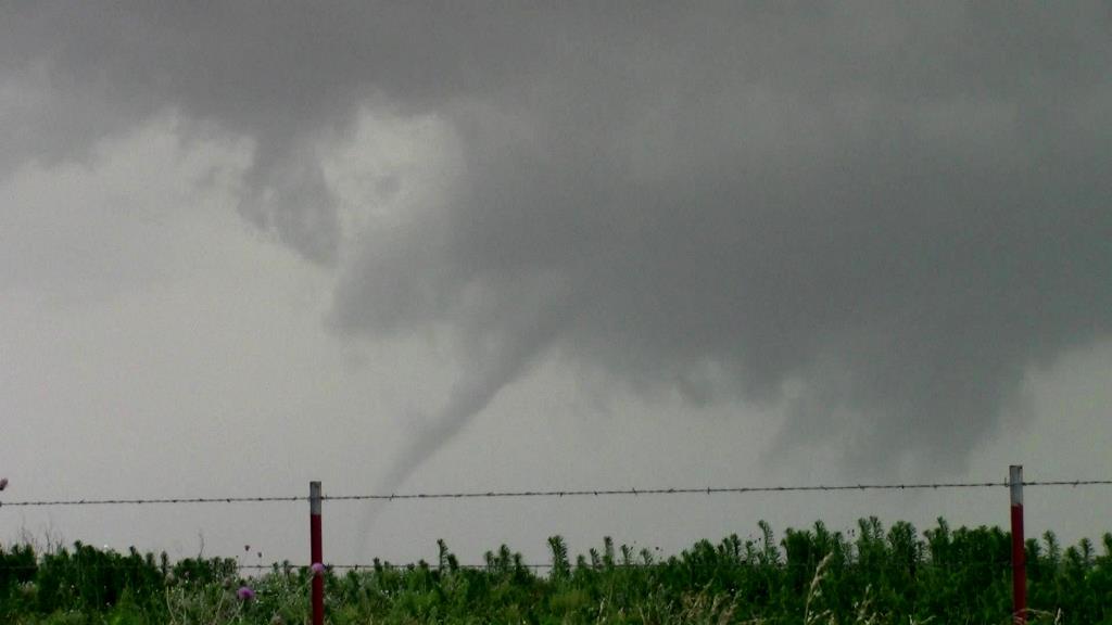
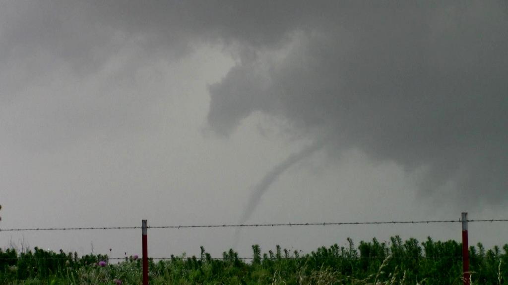
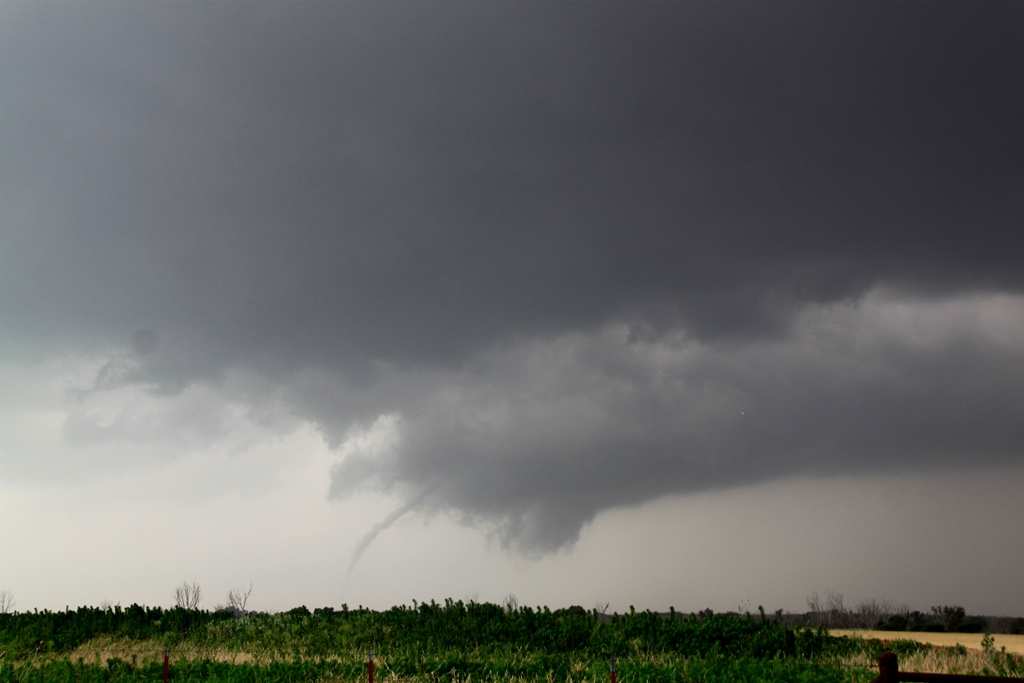
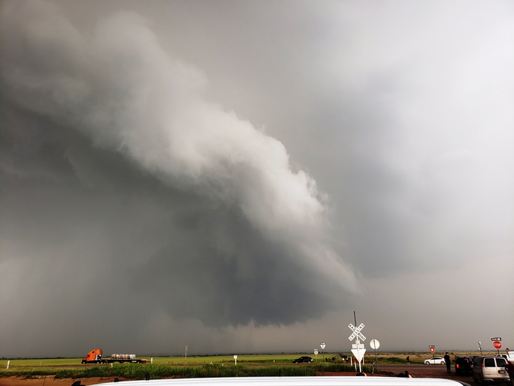
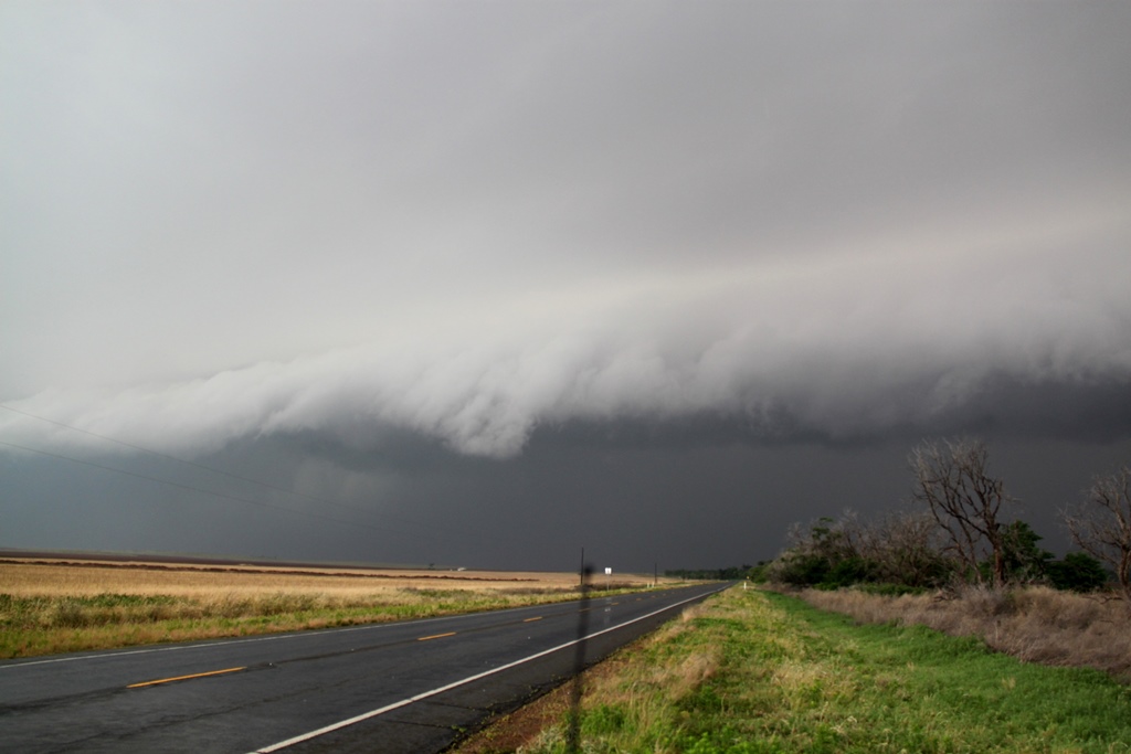
As we got to the junction of the paved FTM 2876, we could
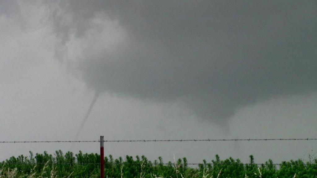
observe the wall cloud of our storm just to the west, and soon, tornado! The
storm produced a slender elephant trunk tornado hanging off the back of the wall
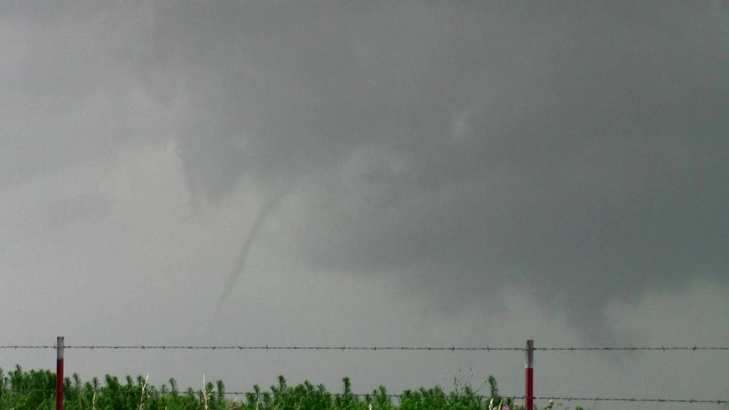
cloud, fully condensed to the ground. The tornado lasted about 7 minutes before
roping out into a long-arced needle funnel.
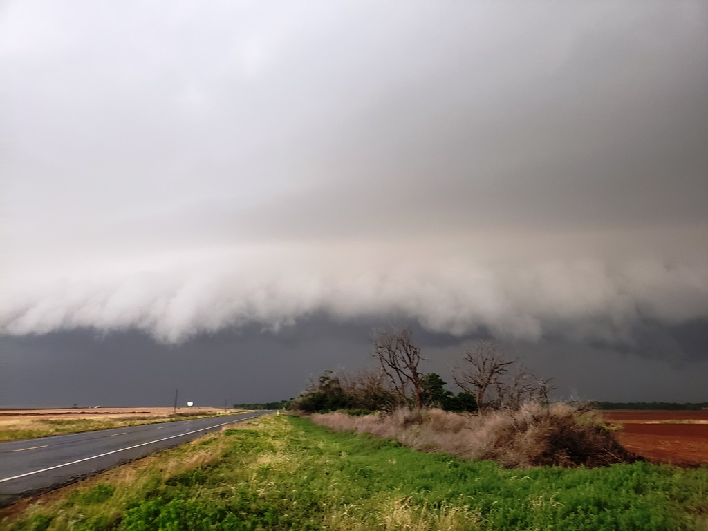
We headed northeast on FTM 2876 and FTM 104 to stay with
the storm, which looked to by cycling to our west. After some maneuvering
through Kirkland about 30 minutes later, we head briefly west on Rt. 287 and
pulled off in the mud near some railroad tracks as the old occluded mesocyclone
passed by, and waiting for the new meso to catch back up to us. Once the
precipitation core cleared and the mesocyclone passed it was clear the storm had
turn HP, but still had a rock-solid updraft as it passed us by.
As the storm passed just to our west, we were faced with
a decision: Follow the storm northeast and cross the river back into Oklahoma
and thus give up the dry line play, or let the storm go and head back west to
set up for the dry line storms that were already firing. We chose the latter and
later found out that our storm had produced a strong tornado near Mangum, OK a
bit later. Apparently however the chase had been hindered by an enormous line of
chase vehicle traffic, so it is unclear if we could have actually gotten to it.
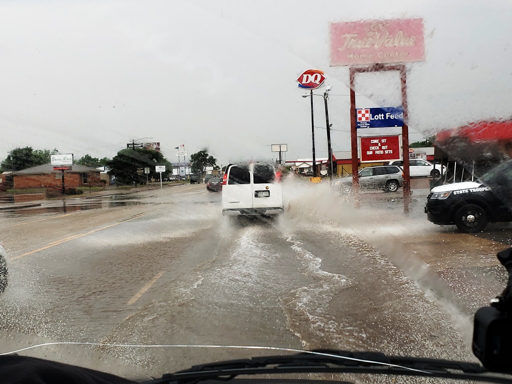
We headed back into Childress and stopped back at the same Pilot gas station and
waited again, passing through flash-flooded roads caused by the front-flank
precipitation core of our previous target storm as it passed through.
After a fairly short pause in Childress, we had a
number of cells to choose from as the dryline was now firing, but unfortunately
the worst-case scenario was developing: With no cap, too many storms were
initiating and they were all interfering with each other and starting to line
out. Examining
the storms coming towards us we elected to target a storm showing rotation and
still somewhat isolated to our northwest heading for Estelline. We headed
through Estelline and west out of town a few miles on Rt. 86, but the storm was
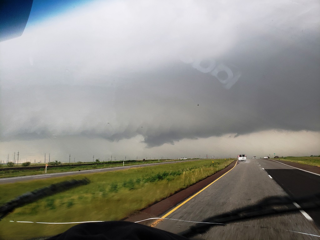
a big HP mess, burping out a big shelf cloud as it approached from our west.
At this point, things were looking grim for our chase as
the storms were becoming more or less a solid line. Close to giving up, we
targeted an HP supercell that was embedded in the line coming up from the south.
We passed through Childress again, then Paducah on Rt. 83, and headed west on FM
193 to get towards the inflow notch and area of rotation. Passing through
Dumont, we continued a few miles further before determining that the storm was
right turning and threatening to cut us off. We blasted back east then south
towards Guthrie, passing the area of rotation to our west just north of town.
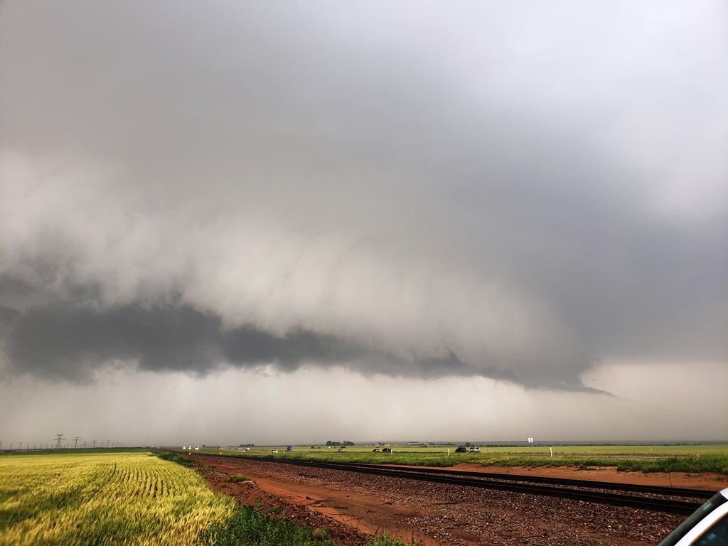
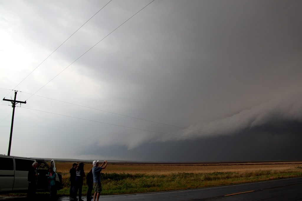
Parked along Rt. 83, it was clear there was a tornado embedded in the big core
to our west as the sirens went off in town, but there was no way we were ever
going to see it so we had to continue south to get out of the way. We made it as
far south as FM 448, waiting for the last storm in the line to meet us, but by
the time it got to us it had weakened greatly. After waiting and throwing the
football around for a while, we gave up and headed east on Rt. 82 and Rt. 277 to
our hotel in Wichita Falls, TX for the evening.
The excitement wasn’t <quite> over yet though since as we
settled into our rooms there were not one but two tornadic supercells heading
almost directly for the hotel about 2 hours away. But after keeping an eye on
them for a while it became clear that they would pass north of town and it was
off to bed to get ready for the next day. Somewhat of a High risk bust, though
there were tornadic storms chugging away through the night keeping just about
the whole state of Oklahoma on alert.
SPC
Convective Outlook SPC
Tornado Prob.
NOAA Storm Report
 |
 |
 |
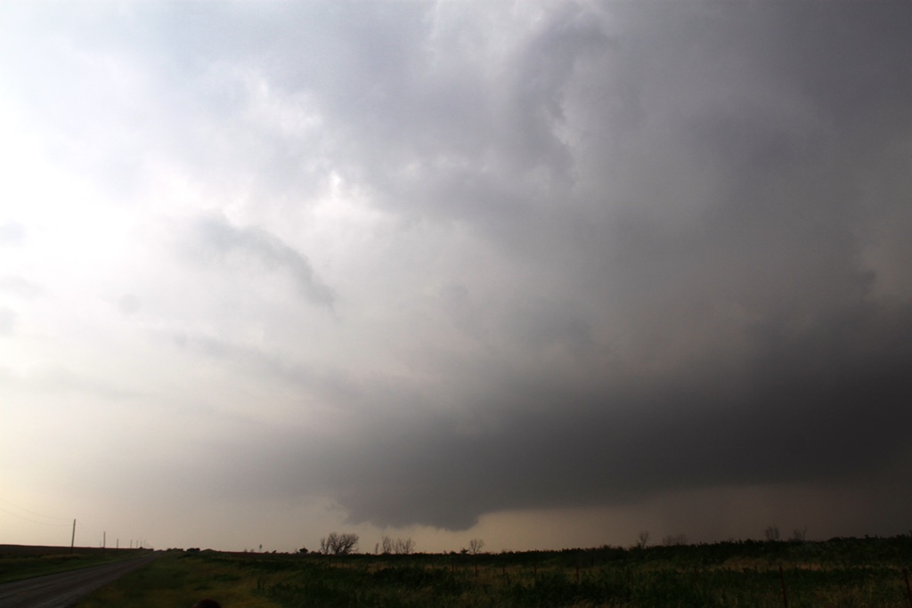 |
| A High risk day on the TX/OK border. After waiting a long while in Childress, TX, we blasted south towards Paducah to intercept a tornado warned storm. Here comes the wall cloud through the murk! | Solid wall cloud getting clear. | Closer view. | We scooted off the main road to the east to give ourselves a little room as the wall cloud passed to our west. |
 |
 |
 |
 |
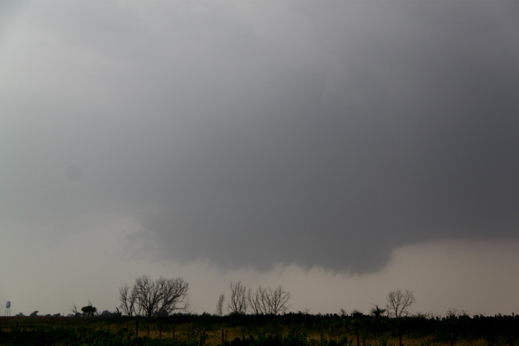
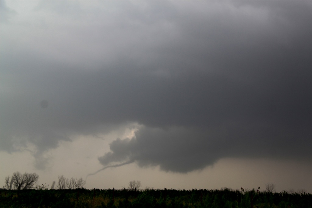
| Needle tornado forms north of Paducah, TX! | Tornado stretching and roping out. | New tornado forming out of the same meso. | |
 |
 |
 |
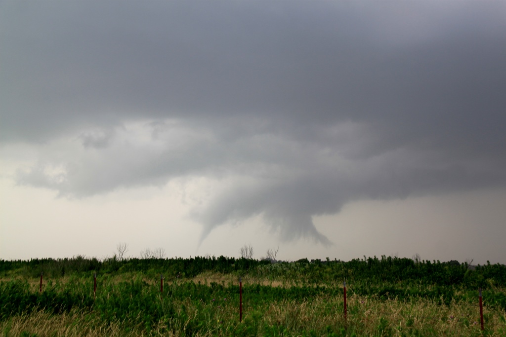 |
| Much stronger funnel this time! | Tornado solidly on the ground. | Zoomed out to capture the greater structure. | |
 |
 |
 |
 |
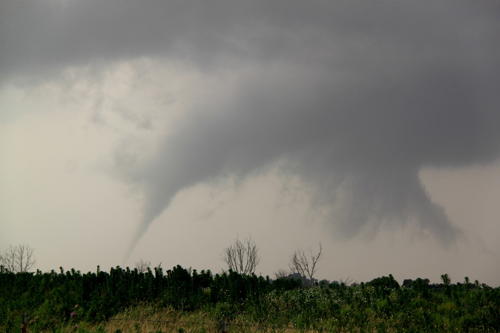
| Elephant trunk mode with almost vertical tail cloud extending from the meso. | Wider view. | ||
 |
 |
 |
 |
| Roping out for the final time. | Last gasp. | We paralleled the storm to the northeast, meeting it near Kirkland about 30 minutes later, but as it crossed Rt. 287 the storm was cycling. | |
 |
 |
 |
 |
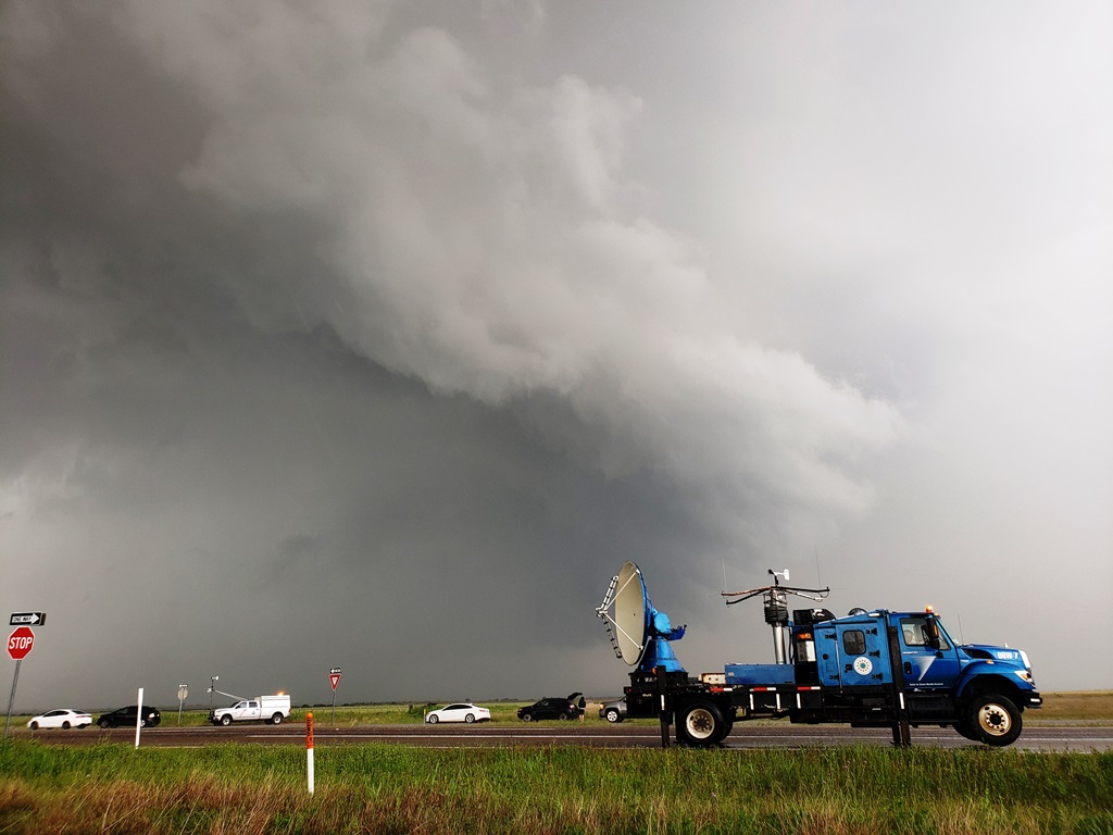
| The storm crosses the road. We decided to wait for the next storm coming right behind this one as getting across the river into Oklahoma would have been a challenge. | Shelf cloud to our north. as the first storm goes fully HP. | The DOW doing it's work. | The last of the meso's passes by but was disorganized and we decided to abandon the storm and head for the dry line. |
 |
 |
 |
 |
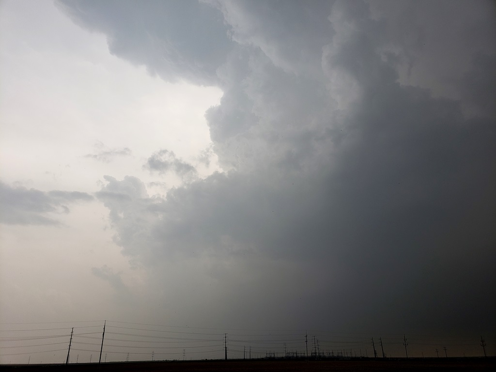
| After we gave up the storm would later cycle and drop a tornado near Mangum, OK in the midst of a massive convergence of chaser traffic. | We returned to Childress to wait for the dry line to flier, driving through flash flooding from our previous storm. | With little cap the storms quickly became a line with embedded supercells. We headed west to Estelline to intercept but the storms were a hazy, HP mess. | Shelf cloud west of Estelline. Soon we'd be getting chased back towards Rt. 62 again, and back south towards Paducah. |
 |
 |
 |
 |
| A quick stop before we had to run. | Here it comes, and time for us to go! | We worked up and down the line trying to find discrete cells to no avail. Here, just north of Guthrie, there is almost definitely a rain wrapped tornado in there, but we'd never be able to see it. | Here comes the precip core. with no visibility, it was time to give up for the day and head to the hotel in Wichita Falls. |
All pictures (C) Richard Hamel 2020.