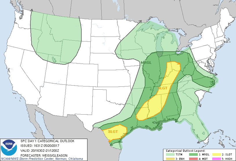
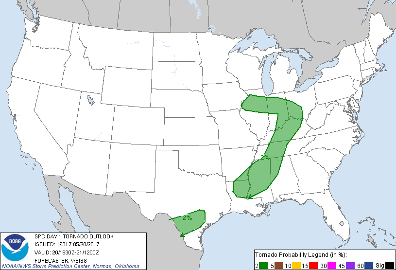
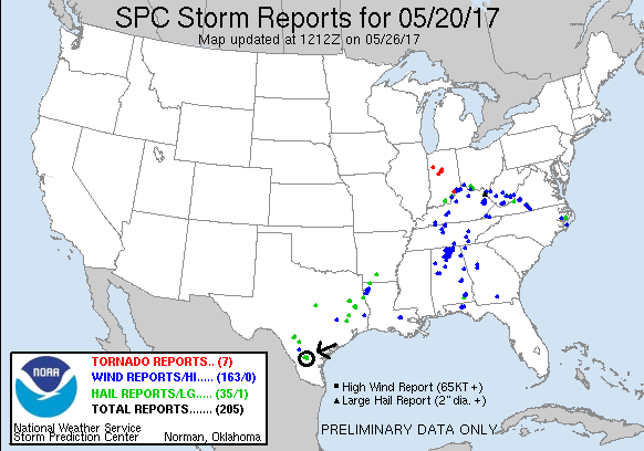
SPC Convective Outlook SPC Tornado Prob. NOAA Storm Report
May 20th, 2017, Freer, TX Supercell
This day was a surprise structure-fest. Having elected
not to go to Arkansas or Illinois to play the warm front (thank goodness we
didn’t as there was not a single storm report in either state before dark) we
had no choice but to play the cold front as it pushed into far southern Texas
south of San Antonio. The models were pretty gloomy in their outlook for the day
but as there was nowhere else to chase today or tomorrow, we headed south out of
Weatherford on I-35, passing through Waco and Austin, two Texas cities I’d never
been through. In fact, the chase area today was the farthest south I’ve chased,
never before having chased south of San Antonio.
After battling our way through heavy traffic all the way
to the northern approaches of San Antonio, we targeted a storm to the southwest
of the city that had been anchored there all day since the morning and according
to one report had produced 7” of rain in a 2-hour period at one point. The HRRR
model projected that the storm would finally start moving with the front into
Duval County, and as we got closer it appeared it was doing just that and was
showing big hail, a well pronounced hook echo, and strong rotation. The 19Z HRRR
run also showed a meso-low developing in the area, enhancing the 850mb and 700mb
flow and creating enough shear such that it could support discrete supercells if
the model verified.
We skirted San Antonio to the east to stay out of the
traffic, eventually connecting with I-37 and heading south from there as our
storm had back-built, with the southwest cell taking over the show near Encinal.
One plus of chasing near a city is that there are usually good road options. At
George West, we turned southwest toward Freer on Rt. 59 (having passed right by
the hotel we were staying at later) and were now finally within 50 miles of the
storm after driving all day. But, as we got close, a small storm coming up from
the south crashed into our target storm, and with our storm moving into the
rain-cooled air from the crash, it looked like it was fading quickly.
As we got to Freer, however, the storm cycled back up and
regained its look on radar, and as we turned northwest out of Freer on Rt. 44,
we began to see glimpses of classic supercell structure. The road was set up
perfectly to allow us to drive right up to the updraft but stay just clear of
the hail core that was sporting 3” hail. Stopping a few miles up Rt. 44, we saw
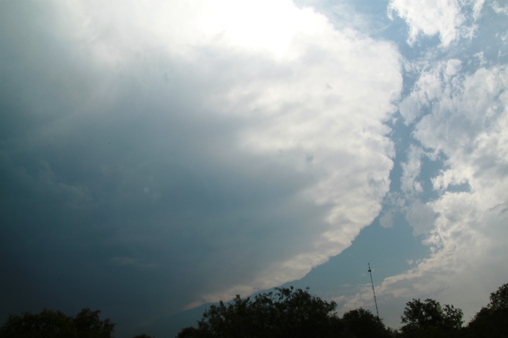
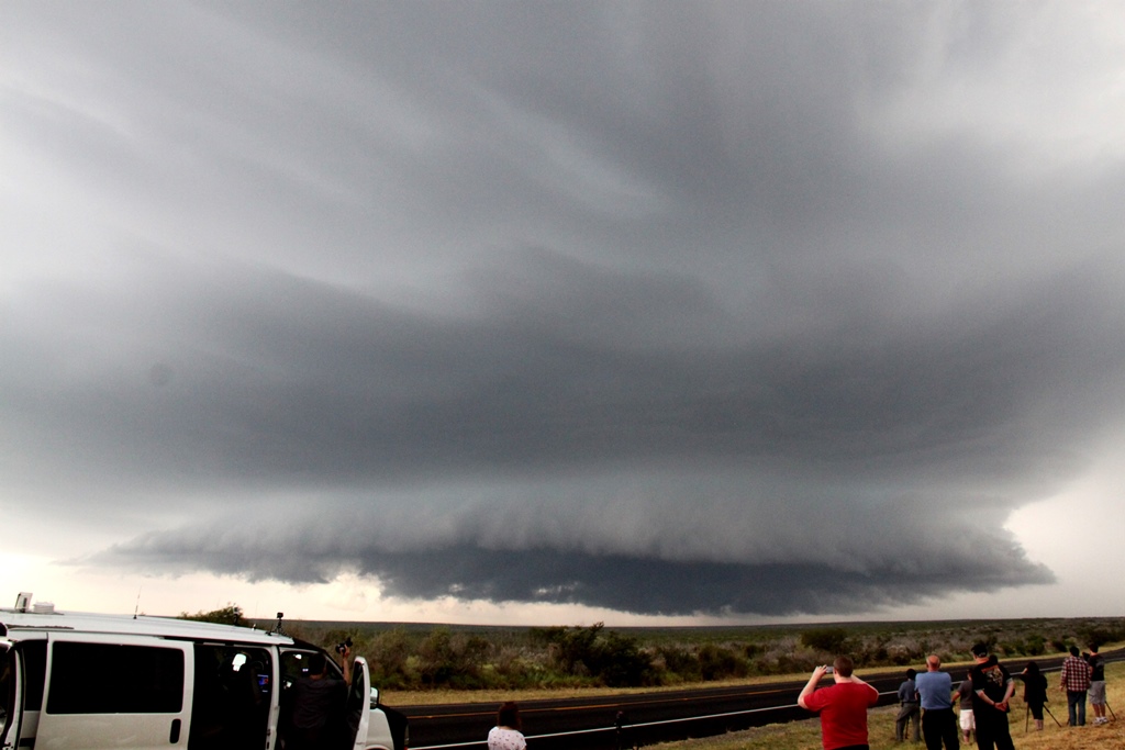
laid out in front of us a classic supercell with fantastic structure, something
extremely rare this far south in the humid, maritime Gulf air. The storm had a
great meso-cyclone and striations around the updraft with a cow-catcher wall
cloud, and was spitting out cloud-to-ground lightning at a rapid rate. We
watched the storm for a solid 30 minutes before the hail core got close, and
then we backed off through Freer, then south on 16 to get into perfect position
to watch the storm as it passed just north of us. The storm was still spitting
out lightning all around (and now behind us), and still had fantastic structure,
but it was clearly weakening. Finally, the updraft collapsed all together
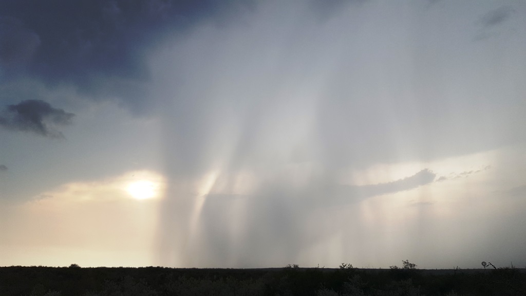
presenting neat looking rain and hail curtains as it collapsed in the fading,
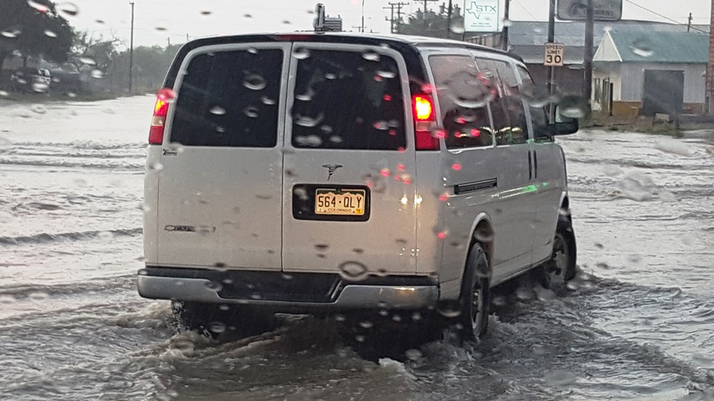
yellowish Sunset. We headed north to find Freer flooded in the main part of
town, but after picking through the flooded areas we were able to get to our
hotel in George West about an hour later to call it an early night and go get
steak dinner to celebrate our two tornadoes for the tour so far.
Mileage for the day was 494.
SPC
Convective Outlook SPC
Tornado Prob.
NOAA Storm Report
 |
 |
 |
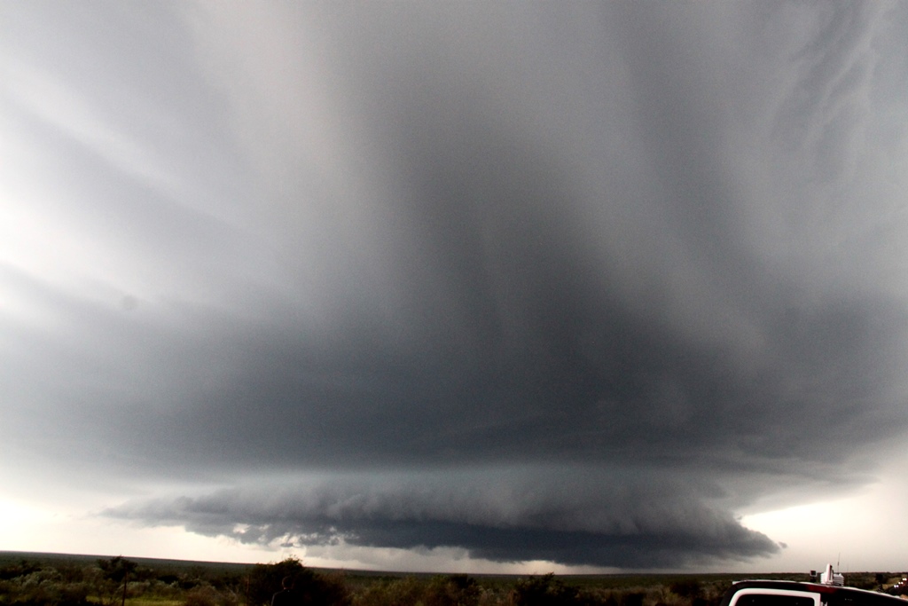 |
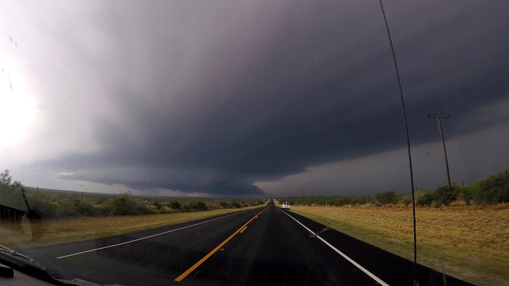
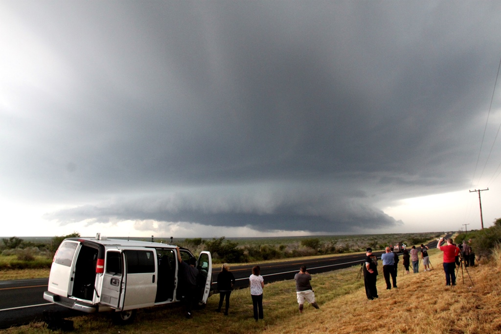
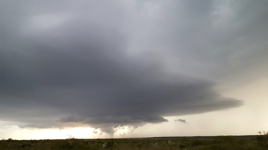
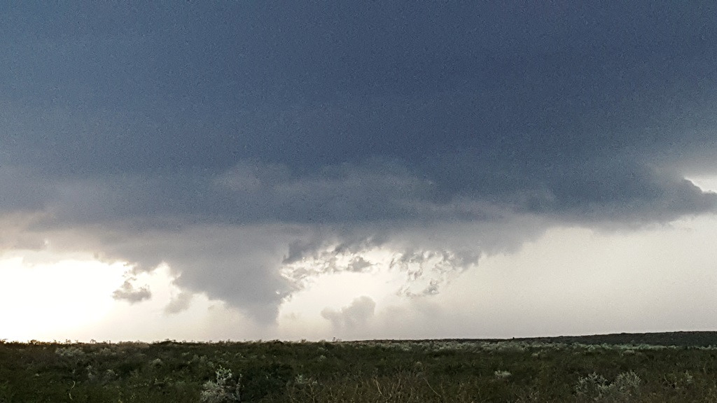
| Headed to deep south Texas! As we got south of San Antonio, we passed under the anvil of our target storms that had been anchored and spinning in place for several hours. | Our target storm, the southwestern of three cells, finally started moving and we charged to close on it near Freer, TX. | Surprisingly good structure for a storm this far south! | Nice Mothership! |
 |
 |
 |
 |
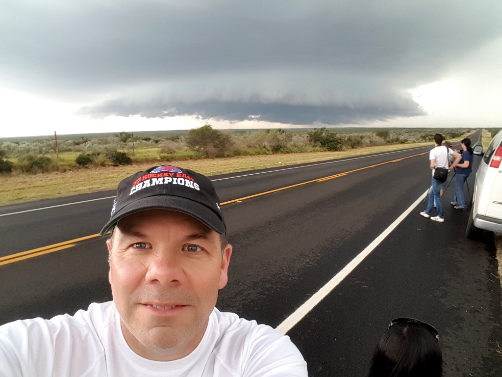
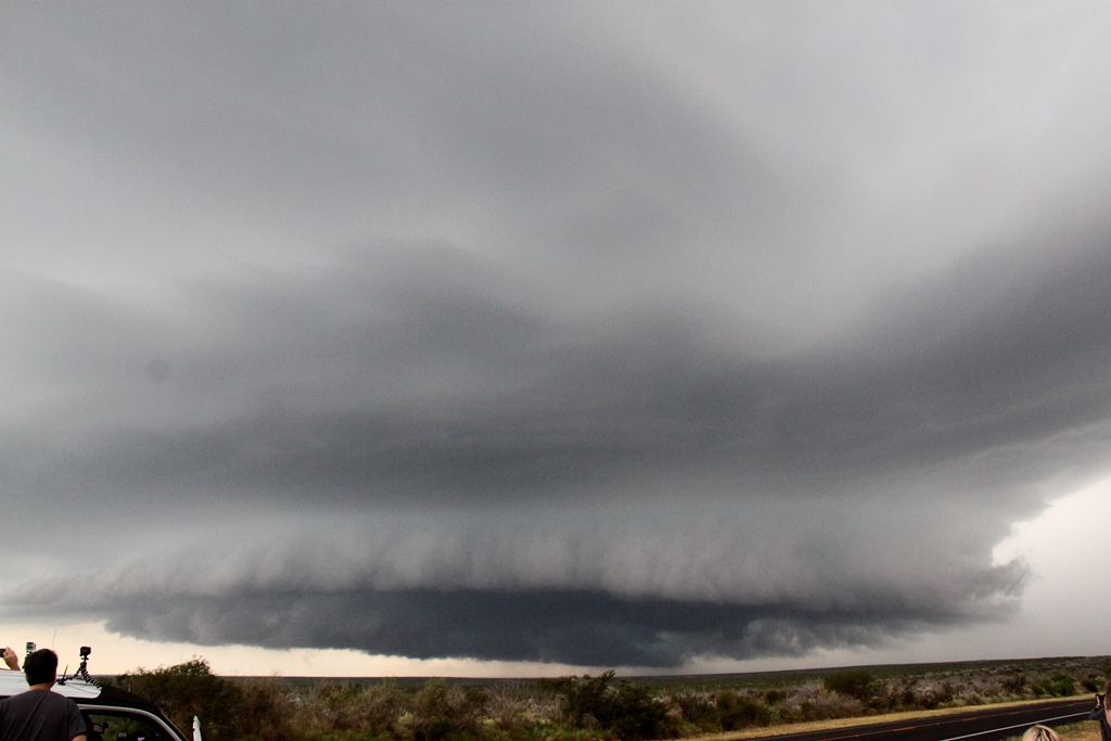
| Storm selfie.. | The updraft gets a little raggedy as the storm gets closer. | A couple more structure shots as the lowering gets more disorganized. | |
 |
 |
 |
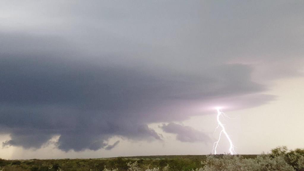 |
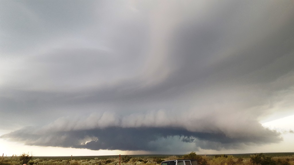
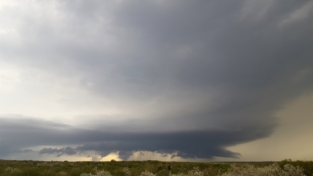
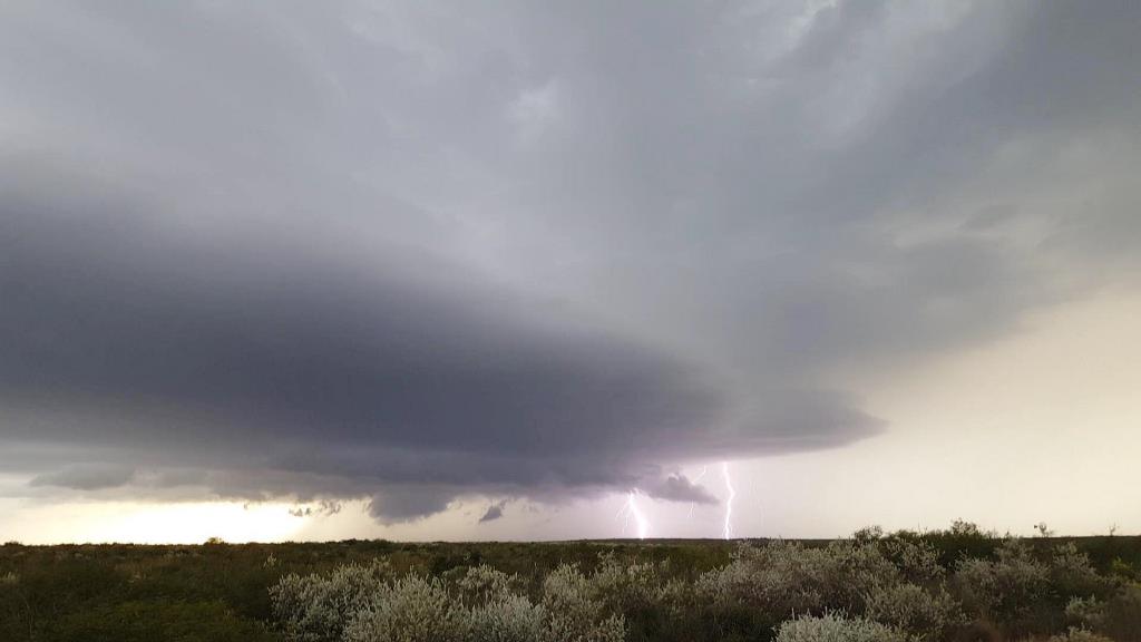
| Now south of Freer, we let the storm pass to our north. The storm was highly electrified but soon began falling apart. | Even as the updraft shrinks, the storm produces a large lowering. | Closer view of the scud bomb in the distance. | Still spitting bolts as the storm collapses. |
 |
 |
 |
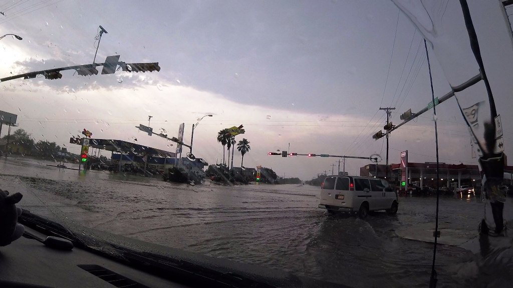 |
| Two CG's at once. Video still. | As the storm rains out, spiraling rain/hail shafts. | Passing back through Freer where there was flash flooding, we headed for the hotel. |
All pictures (C) Richard Hamel 2019.