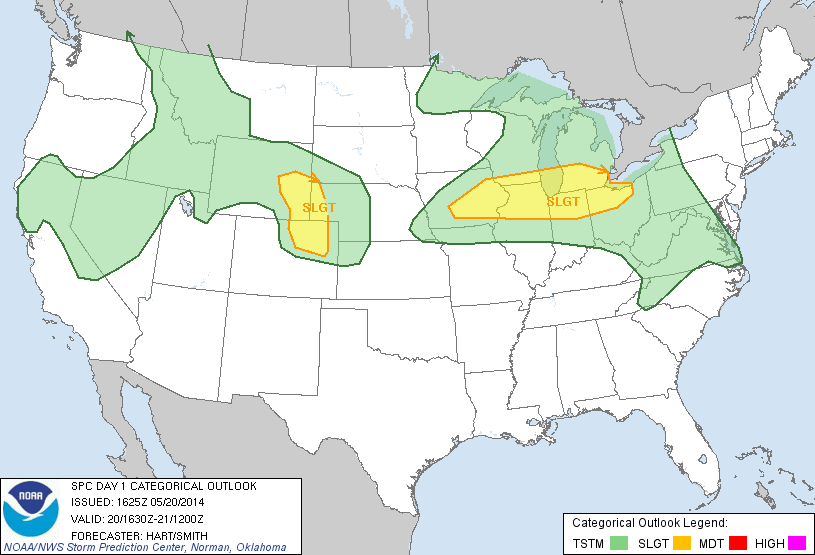
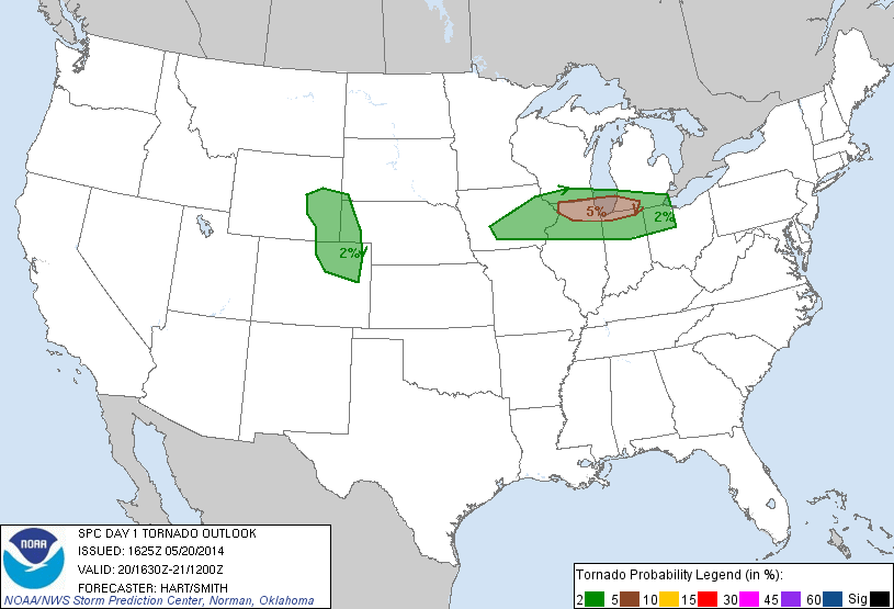
SPC Convective Outlook SPC Tornado Prob. NOAA Storm Report
May 20th, 2014, Bennett to Burlington, CO Supercell
An awesome chase day to start the tour! We left OKC early with the expectation of heading all the way up to Scott's Bluff, NE to play the frontal boundary on the Nebraska Panhandle. We stopped for lunch in Hays, KS and decided to continue to head west before deciding on our target as the HRRR model was now showing two distinct target areas: Nebraska as advertised, but now it also developed storms near Denver riding right along I-70 all the way into Kansas. We decided to continue to Burlington, CO before deciding, and once there chose the southern target as the models were now killing the activity up in Nebraska by 02-03Z but kept the Denver storms going all night. That, along with the fact that a Denver intercept was far easier, made the choice simple.
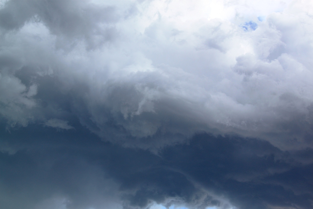
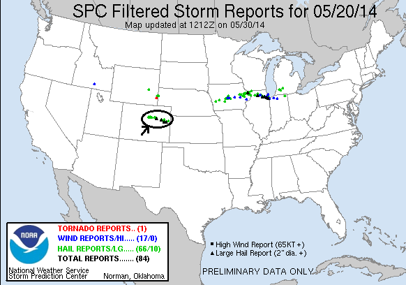
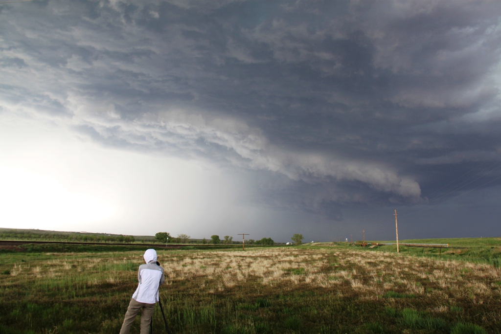
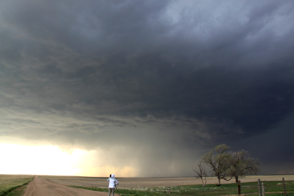
By the time we reached Limon for a quick pit stop, there was already a severe warned storm over Denver heading east-southeast right towards us. We set up in Byers as the storm approached from Bennett. As it got closer, it organized a broad, blocky wall cloud for a few moments, but it soon dissipated. Cold inflow was the rule of the day as it seemed to be streaming in from where we were at every stop, yet somehow it never appeared to choke off the storm. After the first wall cloud dissipated a second briefly formed, but as the storm neared our position and had large hail in it, we repositioned to Deer Trail for the second stop. Once there, we saw that the storm had become a huge HP hailer with a very broad base and a “nose down” wall cloud / tail cloud look. Soon the hail core encroached on us again and we drifted down to Agate. With the storm moving southeast now, we then had to bolt all the way to Limon to try and get north towards Last Chance and beat it to an east road.
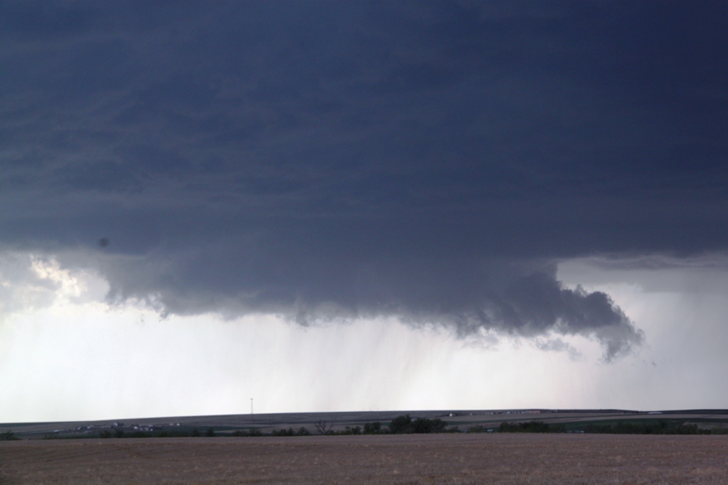
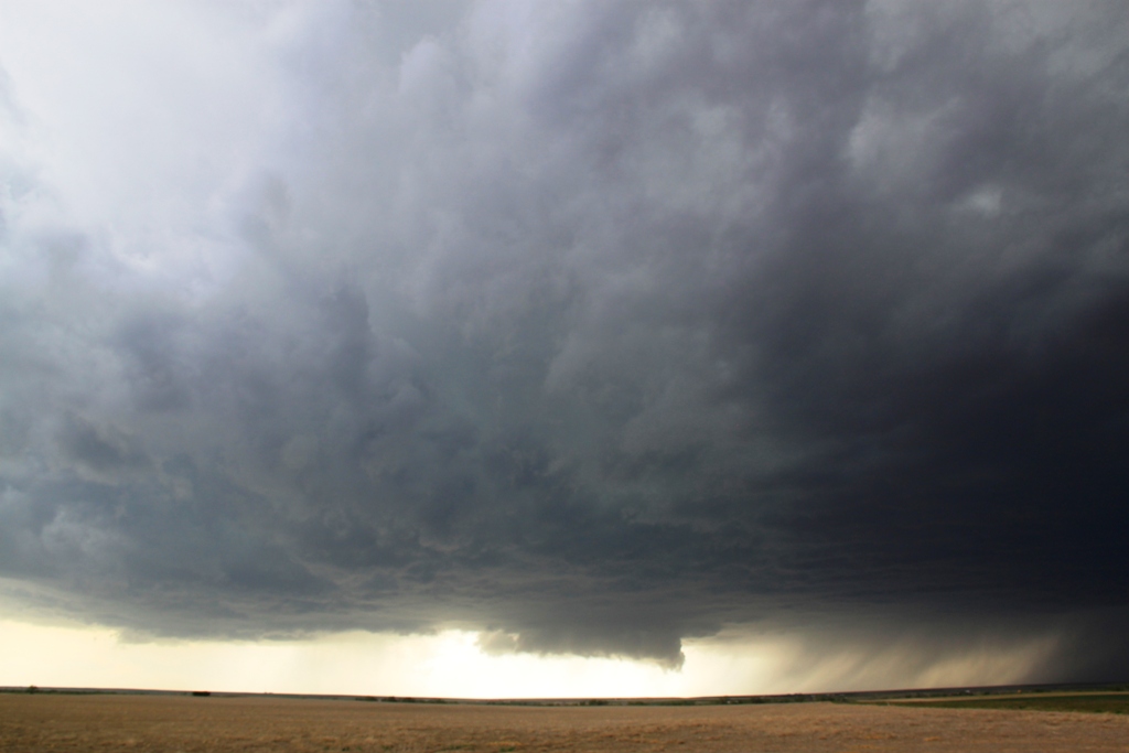
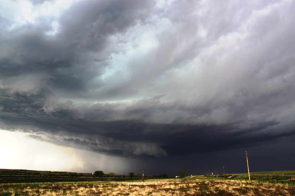
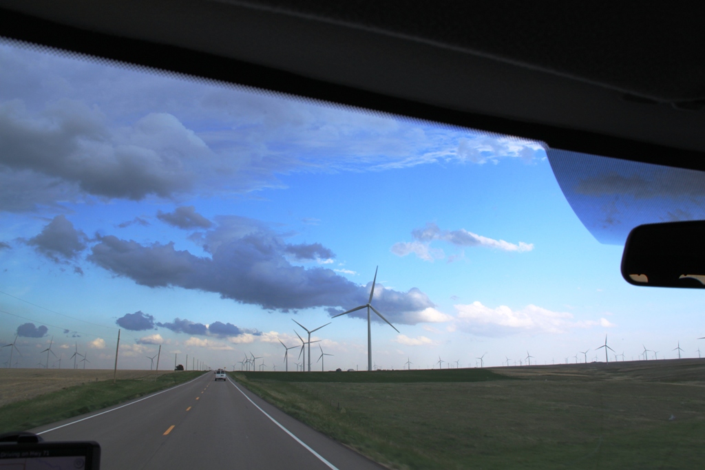
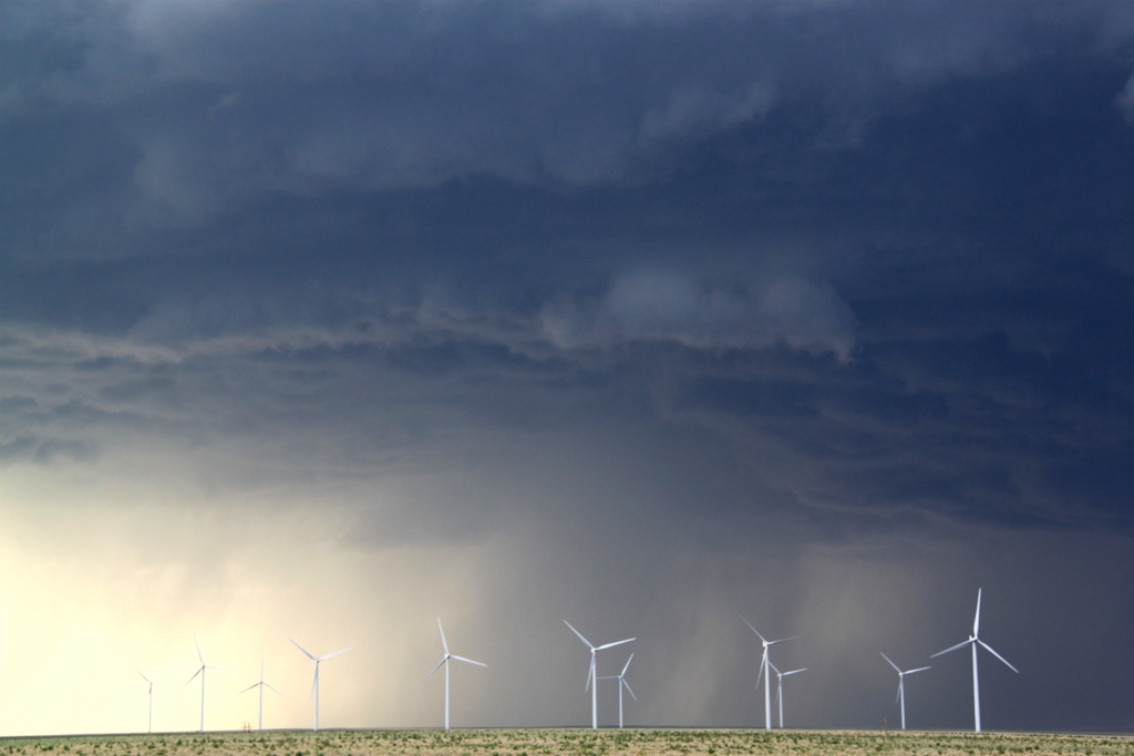
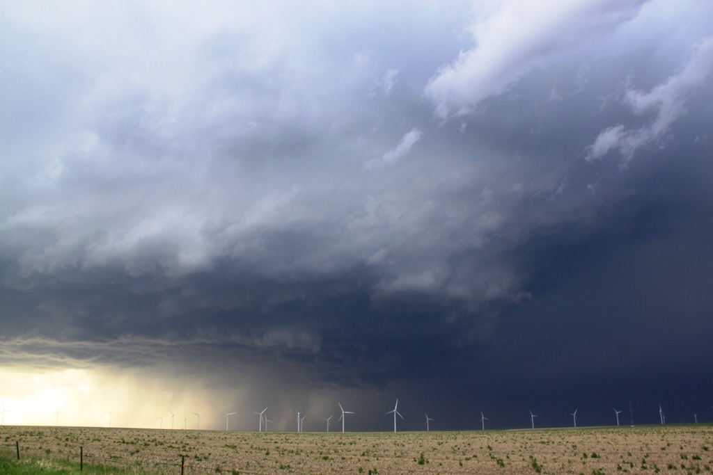
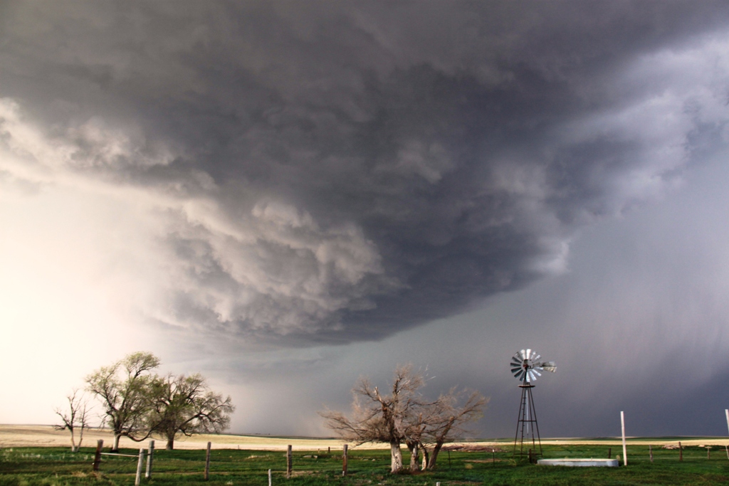
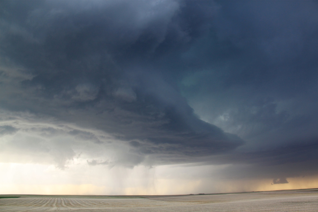
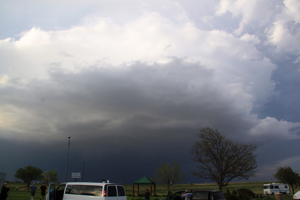
As we headed north out of Limon and into the huge wind farm in that area we just had to stop and take some shots of the huge beast with the wind farm in the foreground. We stayed there for about 10 minutes, at which point our north road was cut off by a hail core sporting baseball sized stones, so we headed towards the interstate, but then decided to head east on County Road 3. We stayed just out ahead of the storm until finding great spot for a photo opportunity and stopped and observed again. With the storm to our northwest, there were definite signs of rotation developing and, then behind us to the southeast there was rapid motion and a “cinnamon swirl” vortex above us, spinning hard enough that we thought we might get a landspout. That eventually dissipated and we had to quickly run east and south as rain and hail began to fall in our location and we were worried about getting swamped on the dirt roads. We made one more stop north of Arriba to shoot the fantastically structured liberty bell updraft, then stopped at a rest area along the highway for a break, but you could see the “stack of plates” look just above us and the clouds curving into the storm above us, so we headed east again to stay in front of the storm.
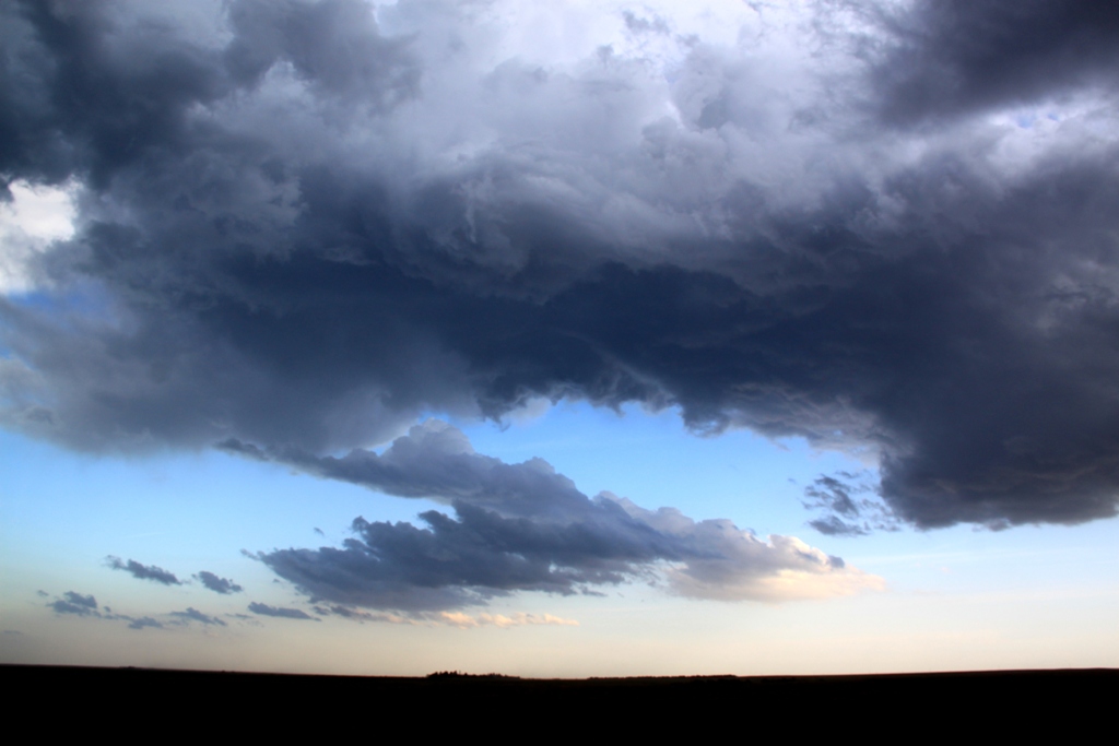
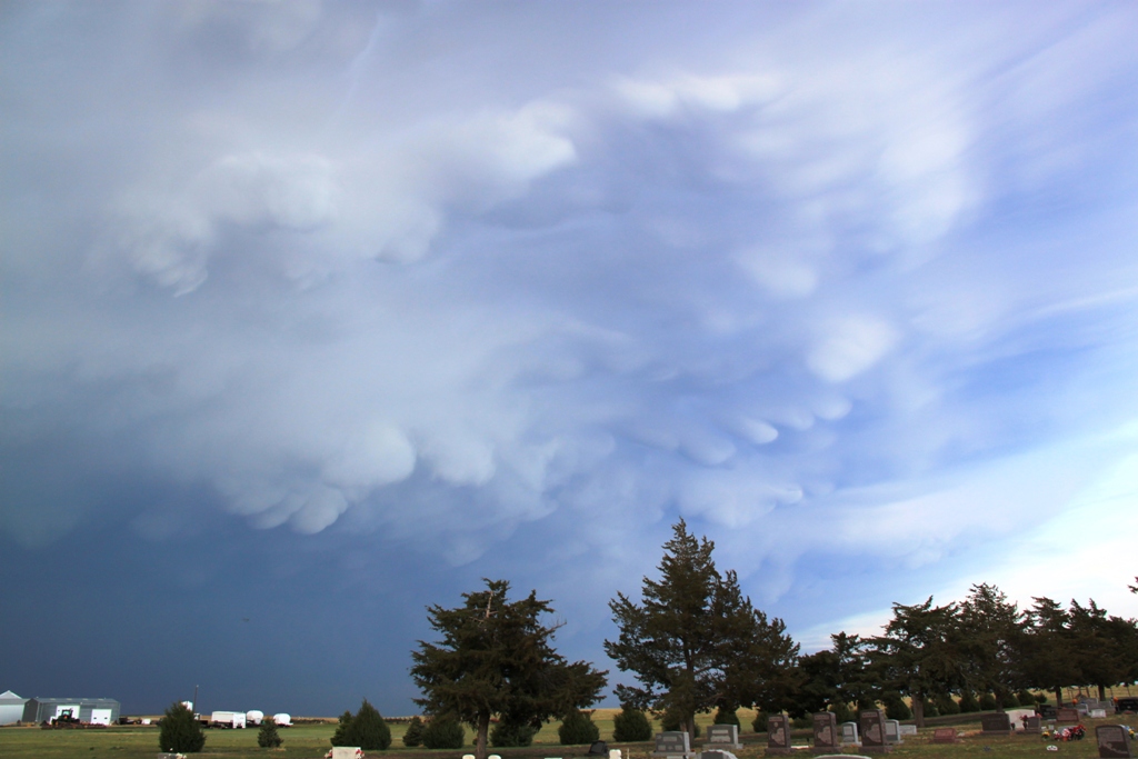
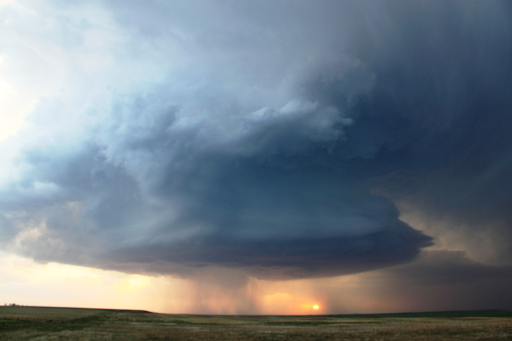
We continued east to Vona and as the sun set were treated to the spectacular structure of the storm backlit by the orange sunset! The storm also had a nice array of mammatus clouds hanging off the front part of the anvil.
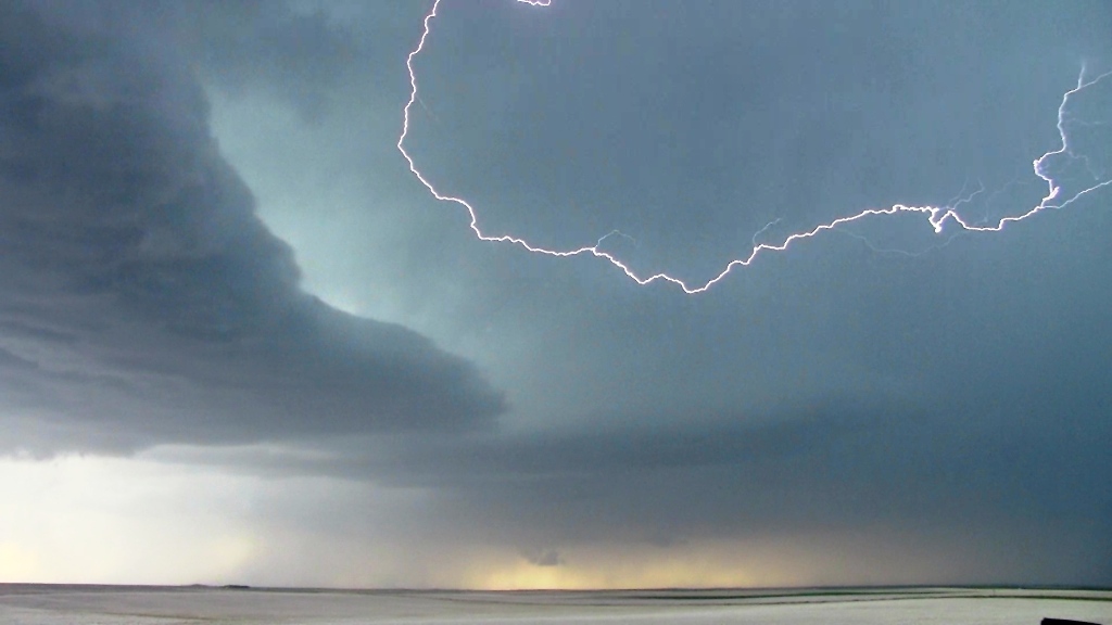
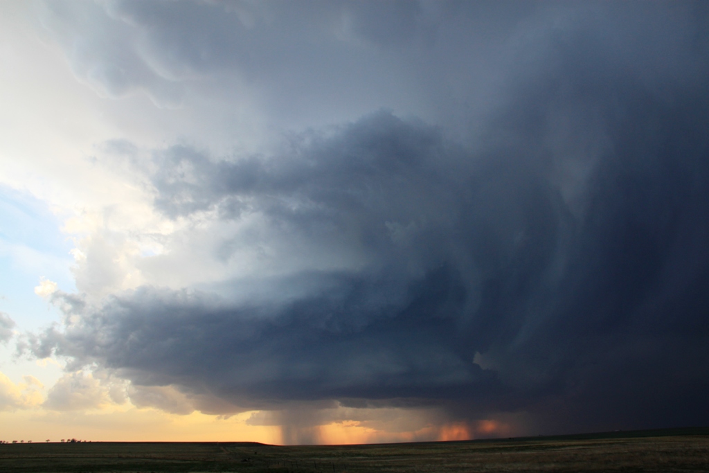
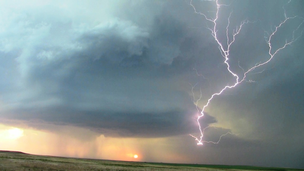
At that point it seemed like the storm was finally dying, but as the sun set, perhaps the low level jet kicked in because the storm re-intensified yet again into a tall soda can look. We made another stop in Bethune, then another in Burlington, and the structure at dusk just kept getting more and more amazing! By now the storm was highly electrified, but interestingly it was almost all cloud to cloud, with very few ground strokes. It was sort of eerie as the spinning updraft came almost right over us, then off to our southeast a huge bob of dirt flew up from the rear-flank downdraft, right around the time that they tornado warned the storm! It was obvious that the storm was way too high based to tornado though and we waited south of Burlington for the storm to zoom by, and then got back on the highway, retracing our steps 150 miles back to the hotel in Denver.
A day that greatly exceeded expectations! The HRRR model was dead on, as the Nebraska storms blew up, one went tornado warned, and then in about 2 hours they were gone, while the Denver storm raged right down I-70 into Kansas well into the evening as advertised.
962.6 miles for the day!
SPC
Convective Outlook SPC
Tornado Prob.
NOAA Storm Report
 |
 |
 |
 |
| We drove all the way to Denver, intercepting our first storm near Byers. | First wall cloud of the trip under a nice rain-free base! | Near Deer Trail the storm has cycled and gone HP with a nose down wall-cloud. | Watching the shelf cloud pass to our north. This storm cycled several times. |
 |
 |
 |
 |
| We followed the storm down I-70, heading north of Limon towards Last Chance, and into a big wind farm. | The storm was HP, but was highly electrified with great structure. | Wider structure shot. We got cut off at this point and had to head east on county roads. | Big precipitation core to our west. |
|
|
|
 |
 |
| Meanwhile, right above us, a "cinnamon swirl" spinning like crazy! | Wider view of the rotation. We thought we might get a land spout out of this. | Storm passing over a classic Great Plains windmill. We paralleled the storm as it traveled east. | We headed east on county roads, keeping ahead of the storm and out of the hail. |
 |
 |
 |
 |
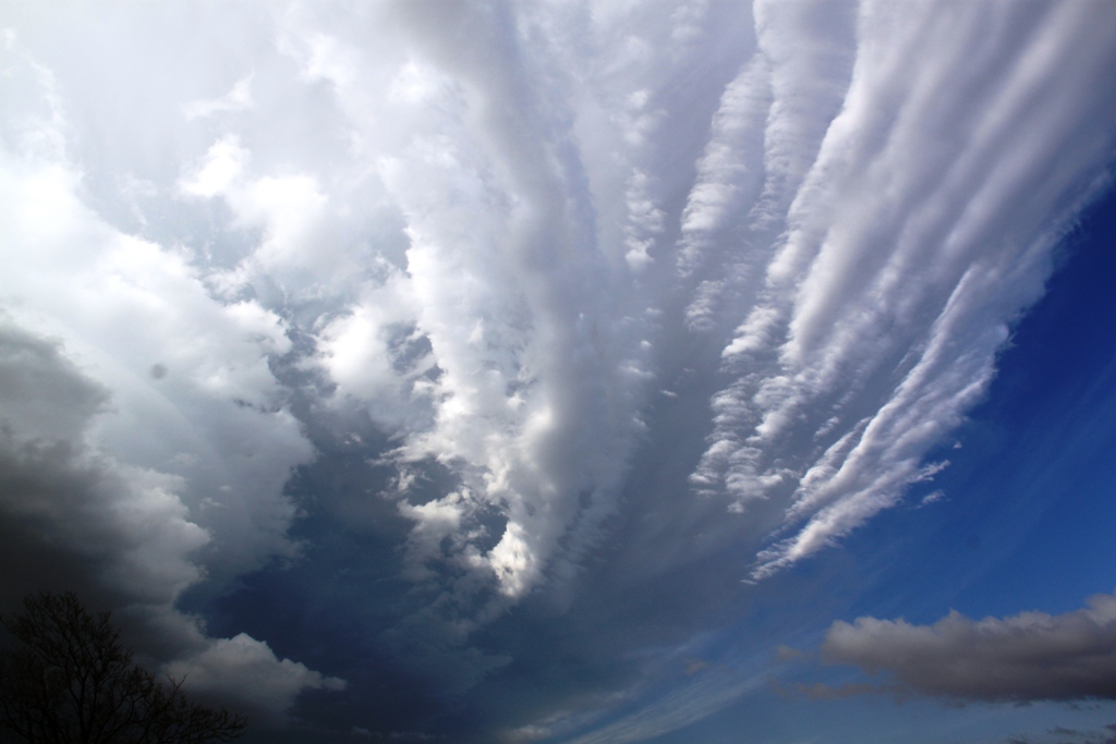
| The storm got highly electrified at this point. Lightning in the vault area of the storm. | We stopped at a rest area in Arriba with the storm spinning like crazy overhead. | Nice stack of plates. It seemed like the storm was starting to fizzle around this time. | But, the storm cycled again near Vona, this time showing strong signs of rotation. |
 |
 |
 |
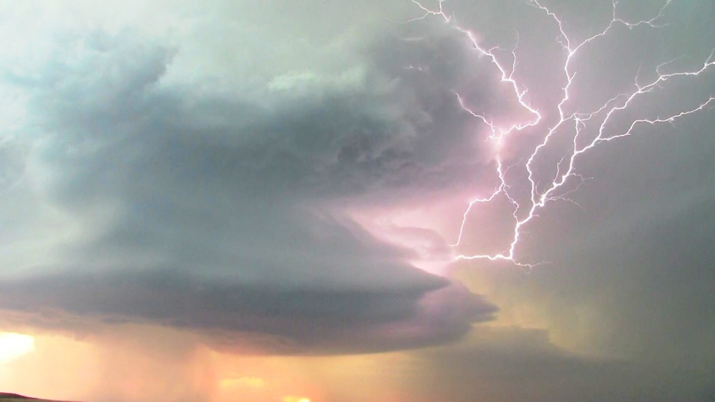 |
| The storm also had a nice mammatus field. | Structure show continues as the Sun sets in the background. | Spinning like crazy, the storm was still highly electrified as dusk arrived. | More lightning in the vault region. |
All pictures (C) Richard Hamel 2017.