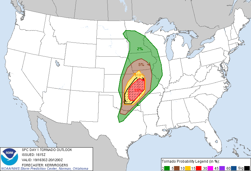
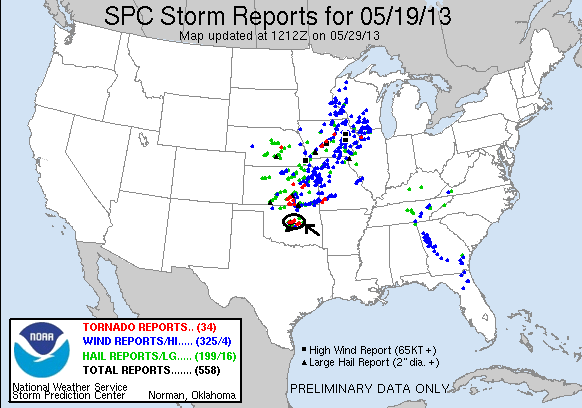
SPC Convective Outlook SPC Tornado Prob. NOAA Storm Report
May 19th, 2013, Edmond and Shawnee, OK Tornadic Supercells
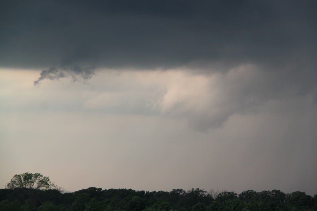
May 19th was a unique experience in
storm chasing for me. Awakening in Boston, MA, I got on my 9:50 AM flight to OKC
through Dallas. Looking at the models while on the plane, it was obvious that I
needed to chase, but would I get there on time with a scheduled 3:20 landing,
and would the storms form far enough south to make chasing realistic, since
Oklahoma City was at the extreme southern end of the target area? Sitting on the
right side of the plane as we came up from Dallas, it looked like things hadn’t
gotten started yet as there was nothing but a high-based line of cumulus clouds
to my east. But, as the plane circled to land from the north, I suddenly found
myself looking straight up at a mammatus field and off to the immediate
northwest was well developed supercell! My plane’s wheels hit the ground at
exactly 3:16 PM and I scooted to get by bag while Boris Konon arrived to pick me
up for the chase.
Finally, after about half an hour waiting for my luggage, we hit the streets,
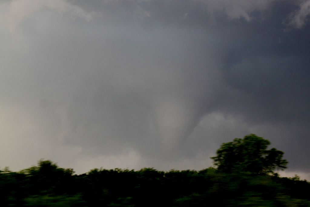
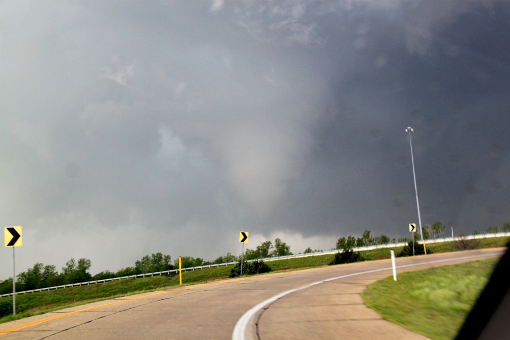
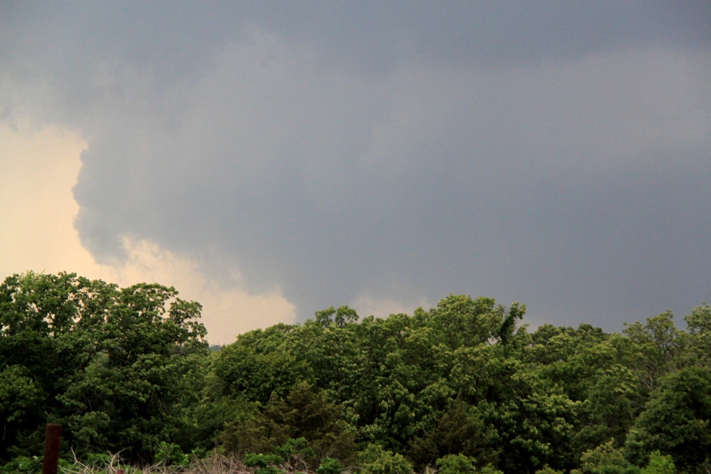
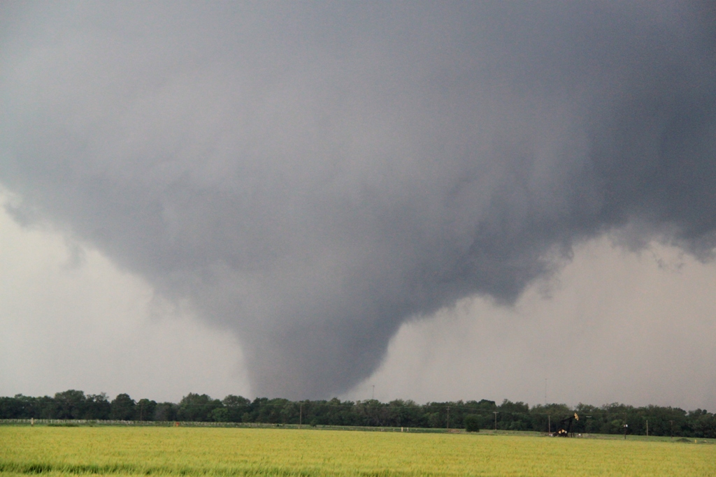
driving directly to Edmond to intercept the storm I’d seen from the plane. Just
as we got there, voila, a white cone tornado dropped about a mile right in front
of us as if by order! The time? 4:28 PM, exactly one hour and 12 minutes after I
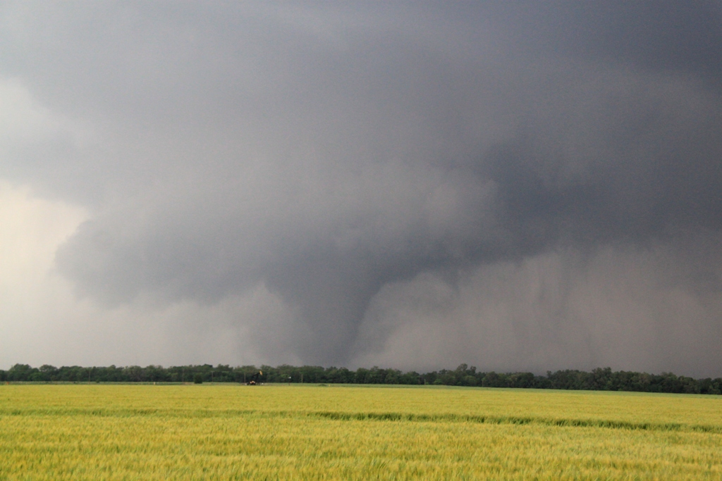
landed. We watched the tornado for several minutes from atop an overpass on
I-44, then as it dissipated we paralleled the storm east-northeast along I-44,
fighting the endless trees to try and get a glimpse of what was being reported
as a big multi-vortex tornado in progress (that did significant damage in Carney
as it turned out). Along the way I made a big navigational error: as we got
toward Carney, I planned to navigate to route 177 to get out in front of the
tornado…. But there is no exit off the turnpike at route 177!! Crushed, we were
forced to travel another 10 miles to the next exit until we were way out in
front of the storm.
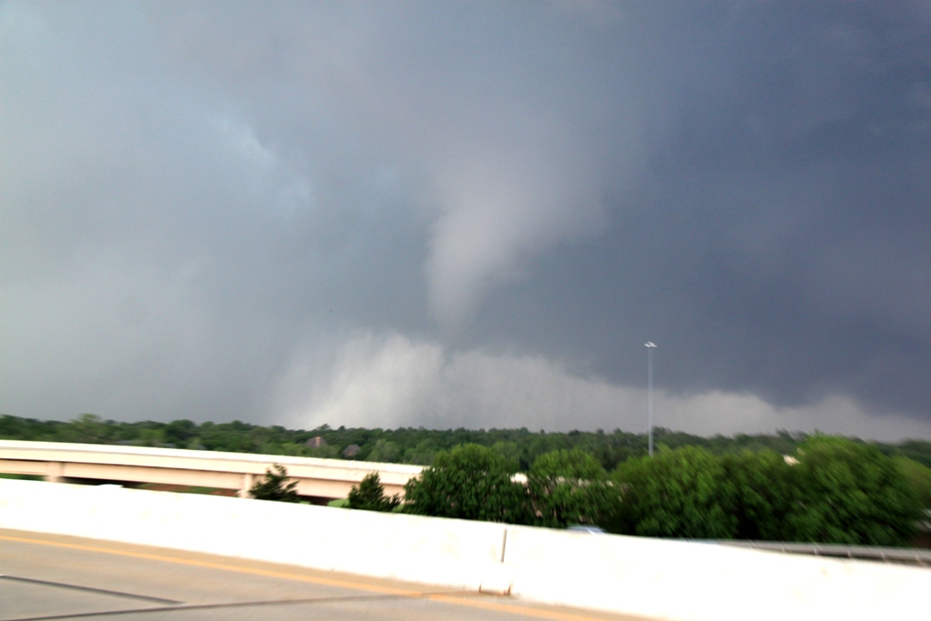
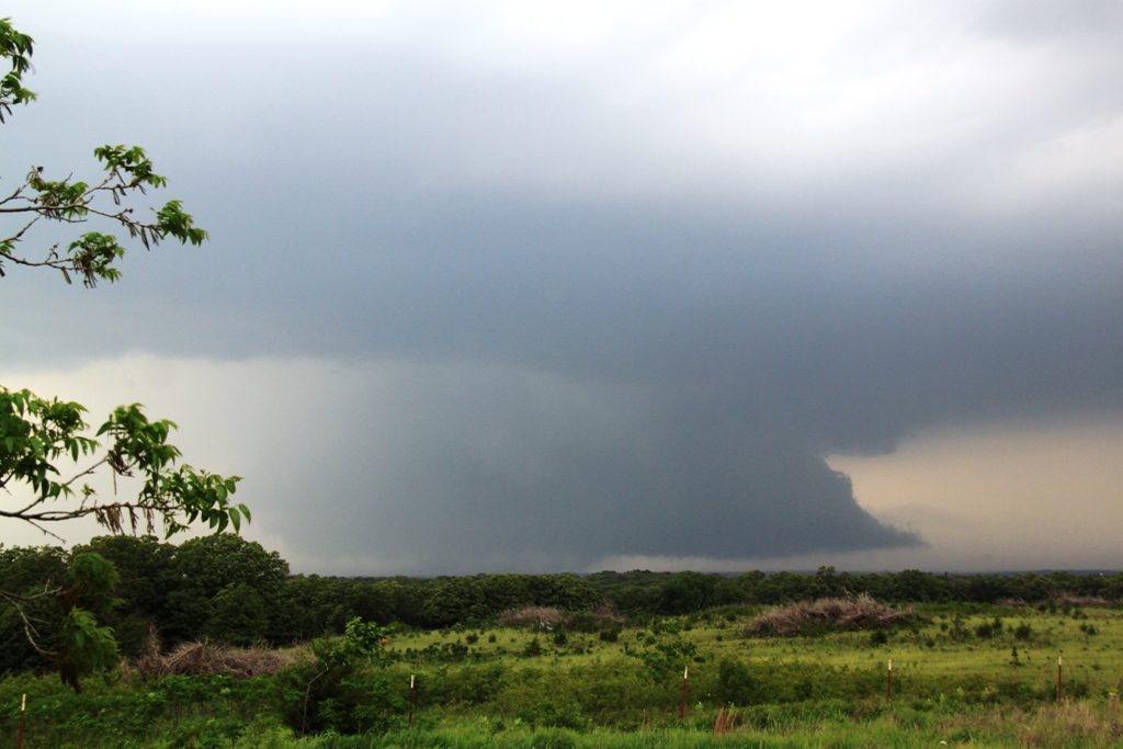
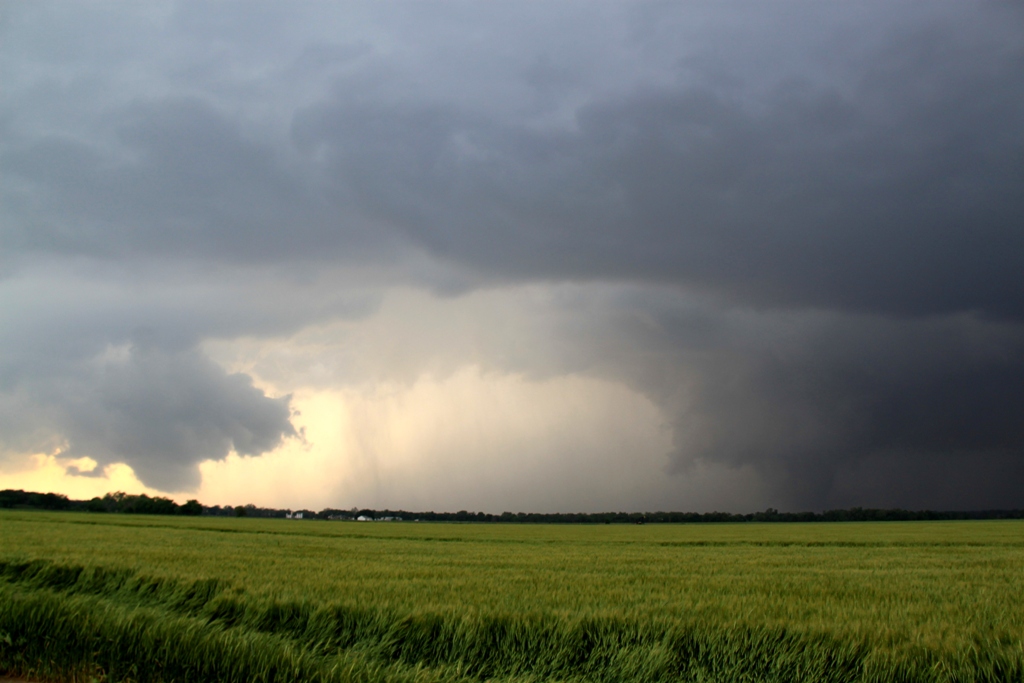
We eventually got off at route 18 and headed north towards Agra, and as the
storm finally approached we observed a strong cone tornado again visible in and
out of the trees a few miles to our west. Once that tornado ended, the wall
cloud became obscured with rain and the storm looked to be going HP, so we
decided to jump south to intercept another storm that had just gotten tornado
warned near Norman, OK. We continued south on Rt. 18 past one storm to head for
the tail end storm, passing through Meeker, then took I-40 west to Dale and
south on Rt. 102, trying, through the trees again, to keep an eye on what was
being reported as a mile wide tornado crossing Thunderbird Lake (we feel this
was an exaggeration. The tornado was repeatedly reported as a mile wide, and
while it was certainly a quarter mile wide or bigger at times, I don’t think it
was ever nearly that big).
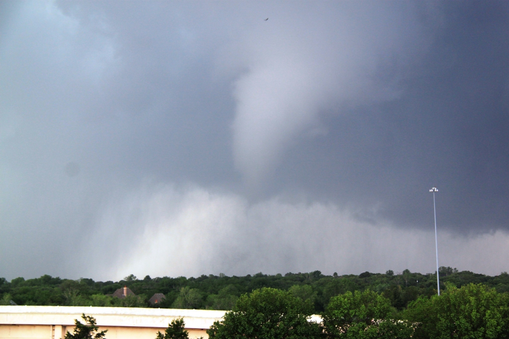
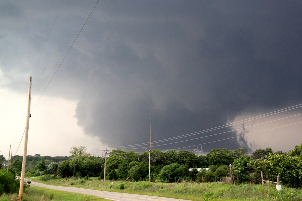
Near Shawnee Reservoir we knew the tornado was close, but again, the trees were
killing us and we headed down a dirt road to the east side of the lake, figuring
we’d get a good view there. Wrong! The tornado was clearly getting close now but
we could only get fleeting glimpses of the multi-vortex tornado approaching. The
area we drove through was the location on the east side of the reservoir where
all the homes were destroyed when the tornado passed through. We eventually
crossed Rt. 102 and went east into Bethel Acres and finally found a high spot to
watch the tornado approaching. While the base was again obscured by trees, the
motion was incredible and the roar of the tornado was clearly audible as it
passed by to our north. We headed east for another few miles, and about 15
minutes later we finally found a nice clear area with a good pull off and
watched for about the next 10-15 minutes as a large cone tornado crossed to our
north and became a wedge tornado as it headed off to the east. Even after that
tornado wrapped up in rain (and went on to damage northern Shawnee and cross the
highway, destroying several tractor trailers and cars and closing I-40 for
hours), we held our position as another mesocyclone formed and looked like it
was going to drop another tornado right in front of us. The second wall cloud
did not produce however, and we proceeded into Shawnee, then north to I-40,
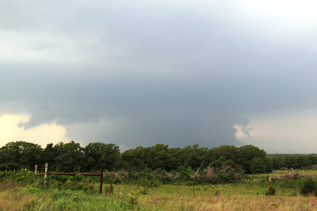
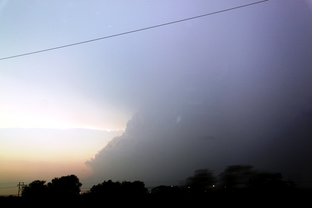
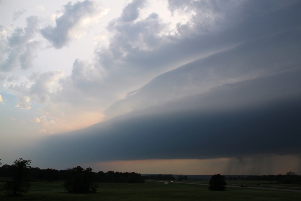
heading east to Okemah where we stopped and watched the storm pass to our north
with Rocky Rascovich and William Hark. The storm produced a fairly robust white
funnel just to the north of the highway, but it soon dissipated and we continued
east to Henryetta before finally stopping and returning to OKC (getting stuck in
the I-40 mess which was still going on at 10 PM).
A great arrival day chase and 3 tornadoes intercepted, though it’s always sad to
see the wide areas of destruction caused in Shawnee and Carney. My thoughts go
out to the folks who lost property or were hurt during those storms. Ultimately
we drove about 300 miles on the day.
For the full NWS report on the Edmond and Shawnee tornadoes including tornado tracks, radar images, damage reports, etc., go to Norman, OK NWS office page on the event at the following link:
http://www.weather.gov/oun/events-20130519
Some videos from the event:
Shawnee Tornado passing over Shawnee reservoir
Full view of the Shawnee Tornado as it passed to our north
SPC
Convective Outlook SPC
Tornado Prob. NOAA Storm Report
 |
 |
 |
 |
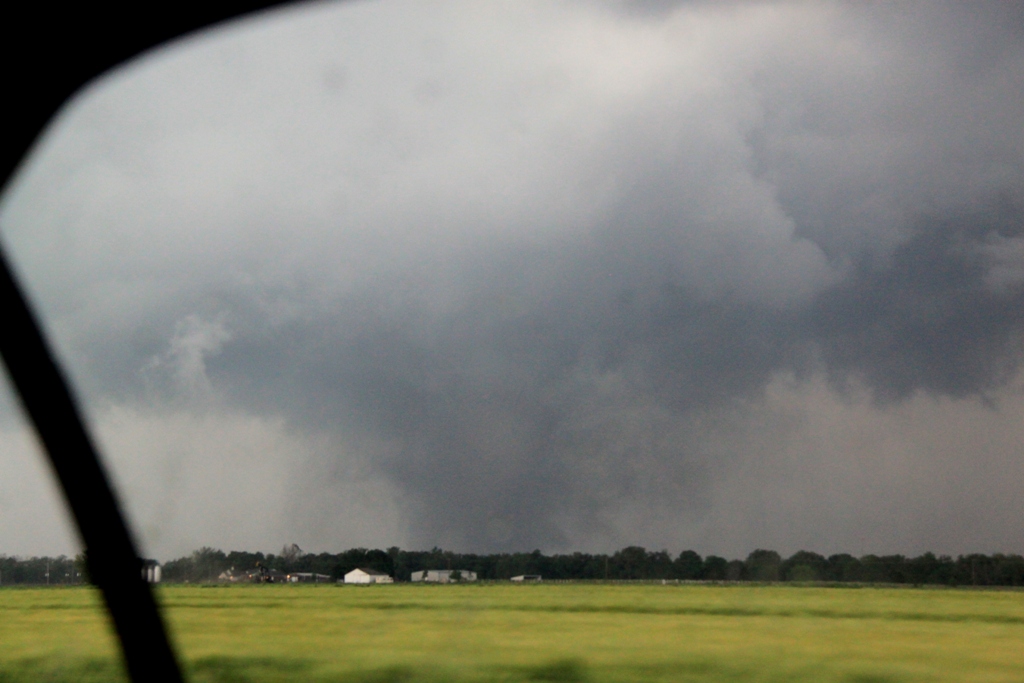
| Contrast enhanced shot of the forming tornado as we drive south back towards I-44 on I-35. | As if made to order, exactly 1 hour and 12 minutes after my plane touched down Boris and I intercept our first tornado of the trip near Edmond, OK. | Now watching on the I-44 bridge, the tornado moves through Edmond to our north. | Closer view. |
 |
 |
 |
 |
| We followed the storm northeast towards Carney, but I made a navigation error (no exit to get off onto Rt. 177??!!) and we were forced to go up to the next exit, missing a good intercept opportunity. Now, south of Agra, the storm approaches with a large block wall cloud low to the ground. | The Carney tornado, still on the ground as the storm approaches. It was hard to get a good view through the trees in this area. | Large block wall cloud as the storm passes to our north but the tornado has dissipated and rain begins to obscure the base of the updraft. | With more tornado warned storms to the south, we left the Carney storm and blasted south towards Shawnee. This is the updraft of our new target as we got around the front flank core and into position to intercept. |
 |
|
 |
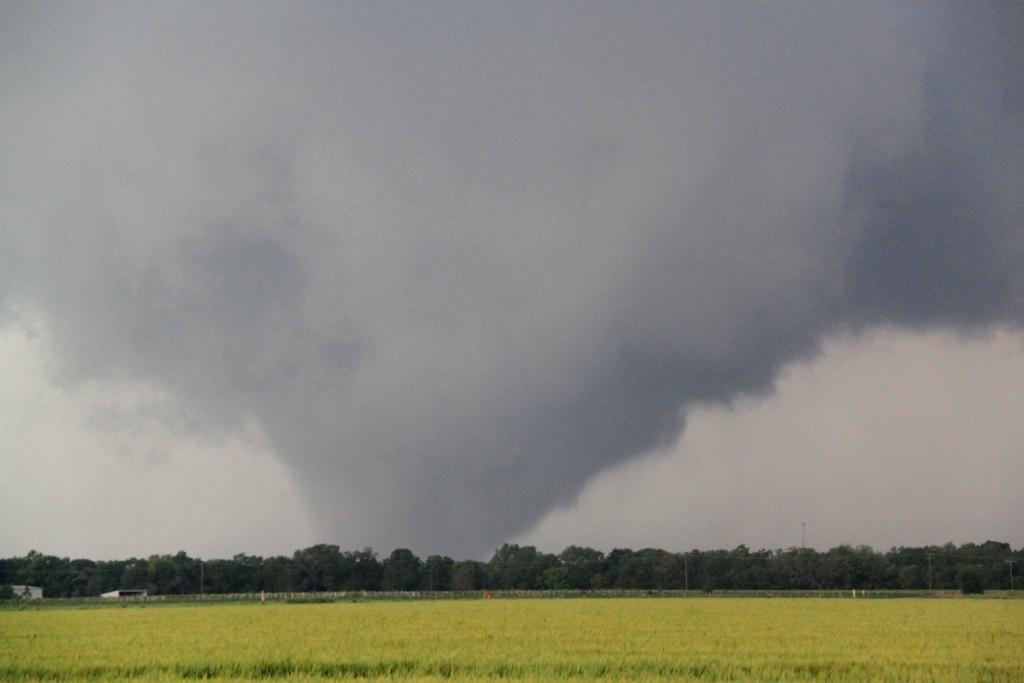 |
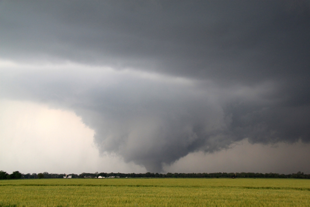
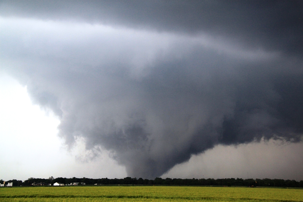
| Now south of Shawnee in Bethel Acres, we intercept a tornado coming across the Shawnee Reservoir. Again we struggled to get a vantage through the trees. The motion was incredible at this point and this was probably the loudest tornado I've heard. | About 15 minutes later we headed east and finally found an open field where we could get a good view of the tornado as it entered Shawnee. The tornado was eventually rated EF-4. | The rain around the funnel clears to reveal a big cone tornado! | Shawnee tornado wedging out! |
 |
 |
 |
 |
| Greater view of the whole mesocyclone. | Structure shot. | Another shot... | ... and another... |
 |
 |
 |
 |
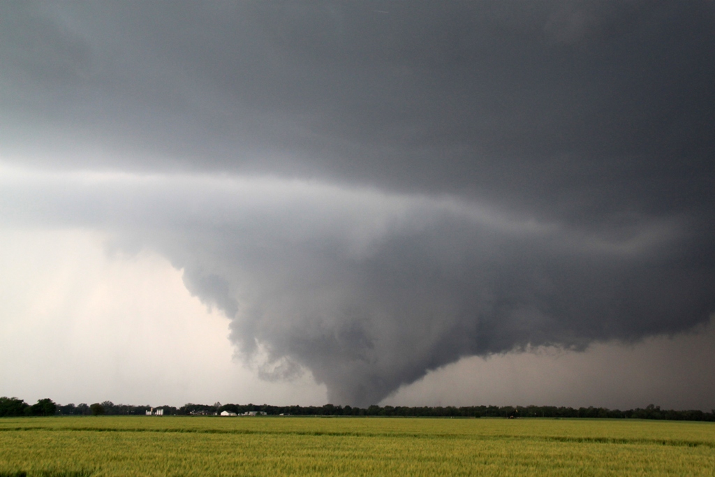
| Tornado starts to wrap up in rain again. This was right around when it crossed I-40, destroying a couple of tractor trailers and closing the highway for hours. | As the first tornado gets rain-wrapped, it looked like we might get a second one on the next mesoclyclone in line, but it did not produce. | We followed the storm north, stopping when we got to I-40 as the base was completely rain-wrapped and too far ahead of us anyway. Nice shelf cloud to our west as we sat and watched with Rocky Raskovich and William Hark. | As the storm moved away to the north, we spotted a robust white funnel but it soon dissipated and it was time to head back to OKC. |
All pictures (C) Richard Hamel 2017.