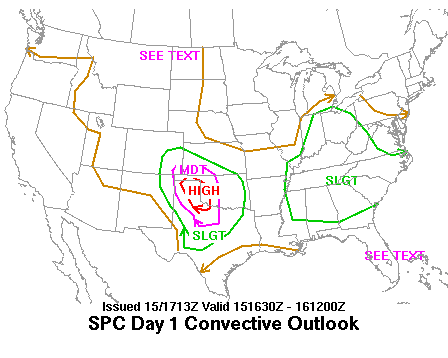
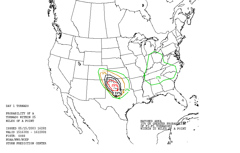
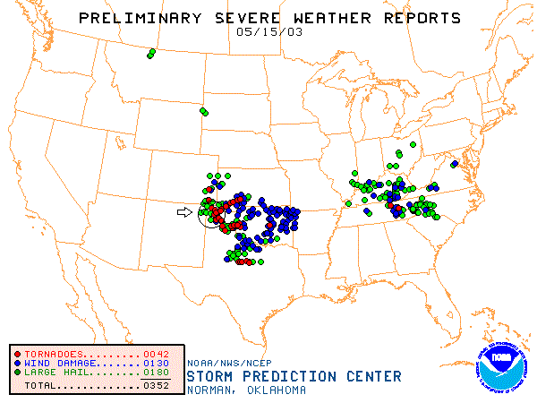
SPC Convective Outlook SPC Tornado Prob. NOAA Storm Report
May 15th, 2003 Panhandle Tornadic Supercells
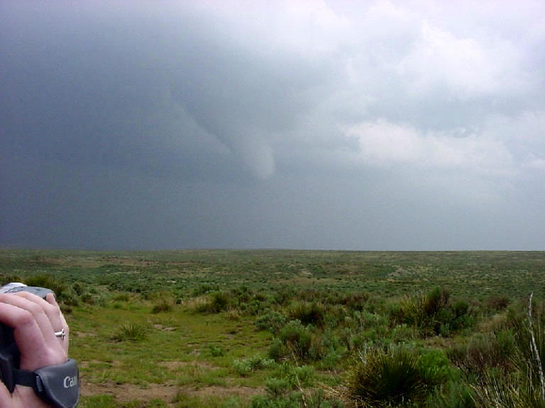
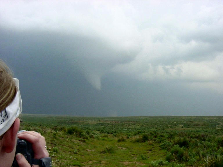
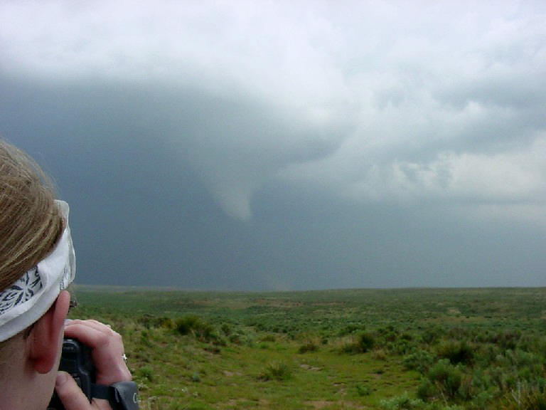
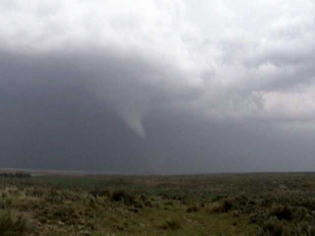
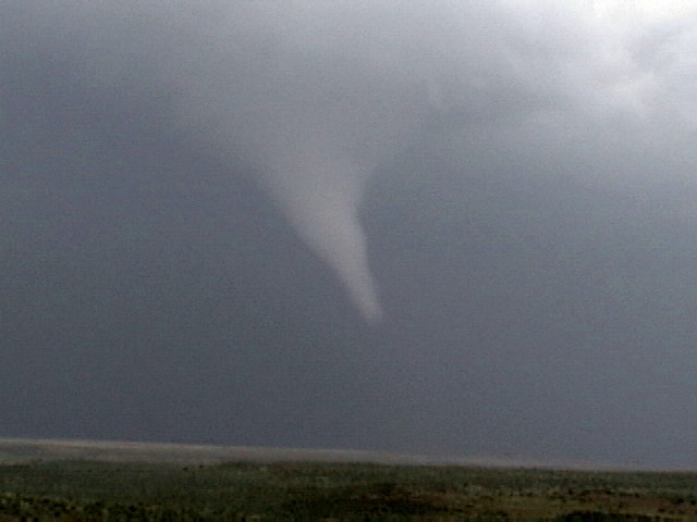
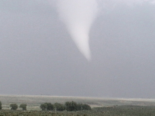
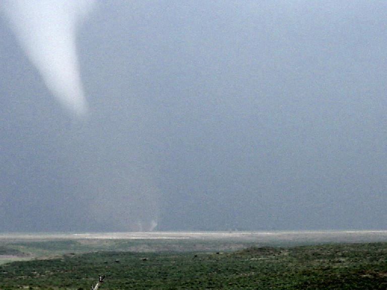
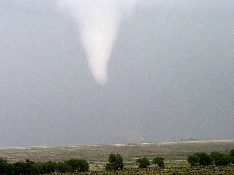
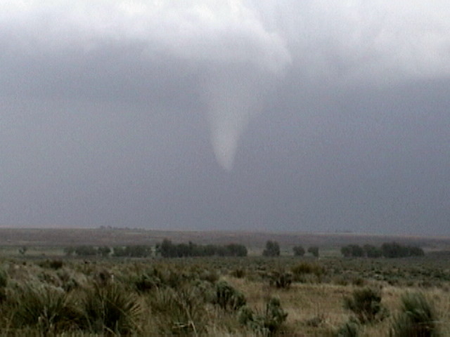
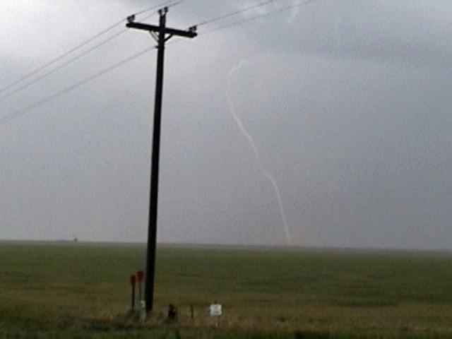
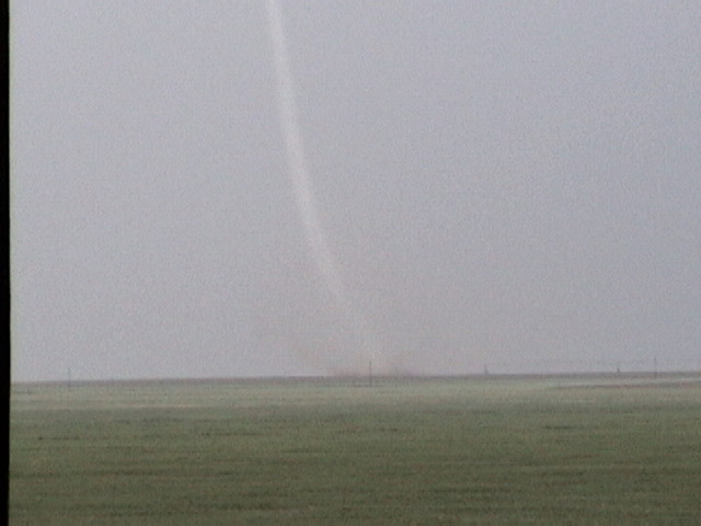
SPC had a high risk of severe weather on the Texas Panhandle just north of Amarillo. We headed north just west of Amarillo after noon with high expectations. After passing through Dalhart, TX on route 385 we reached the Rita Blanca national grasslands and storms began to fire. The first storm we got on was a nice barberpole LP supercell that was tracking almost due north. As we got under the updraft we were received by small hail. We then stopped to observe the storm and decided to head back south as a more classic type supercell was forming in that direction. The LP storms updraft was shredded by the classic to the south and a clear slot appeared in the storm well up into the mid level area of the storm. We got on the next storm and followed along to the north until we were just south of Boise City, OK and observed a tight lowering develop to the right of the road. We stopped as a funnel began to drop and soon there was a beautifully contrasted white elephant trunk tornado on the ground about 400-500 yards away. We stopped and watched as it tracked NNE and then jumped into the vans to follow. We were able to observe the tornado all the way through its cycle. As we neared the outskirts of Boise City, the tornado exhibited clear downward motion and began to rope out. The rope phase was absolutely spectacular as the funnel zig-zagged back and forth and the debris cloud was still visibly doing damage. Finally the RFD of the storm blasted the funnel apart from the cloud base, but the funnel remained on the ground and “exited stage left” to the northwest at about 50 MPH, doing damage for about another minute after it detached before it finally fizzled out just to the west of town. Though we did observe a couple of power flashes, the storm luckily did not get into any significantly built up areas. After the tornado ended the updraft died a rapid death. Receiving nowcast information from Dave Gold we head east and south for the next monster in line, a big tank of a supercell near Griggs, OK. The storm had a tornado warning on it and after sprinting east out of Boise City we cut south on a farm road attempting to beat the core. We could see a well-defined wall cloud to the southwest but could not confirm the presence of a tornado. We then ran into quarter to golf ball sized hail and shortly could see a line of very big hail approaching and we were forced to turn around. Unfortunately, this probably cost us a couple of tornadoes.
We then blasted east and back south into Texas to get after the next storm down the line. We were forced to make an emergency gas stop at this point in Texhoma, TX. With more nowcast information we heard of a tornado on the ground near Stratford, TX so we blasted southeast. Unfortunately we got to the show a little late but from a distance of about 3-4 miles we could see a large barrel/wedge tornado on the ground with an additional needle tornado to it’s west. The mesocyclone was fantastic but from our position on the storm the tornadoes were fairly low contrast. The inflow on this storm was incredible!! At one point I was driving my van about 75 MPH directly towards the meso and we were being passed on both sides by tumbleweeds flying into the storm! We continued to follow the storm back the way we came but the mesocyclone became disorganized and weakened so we dropped off the storm and head southeast yet again.
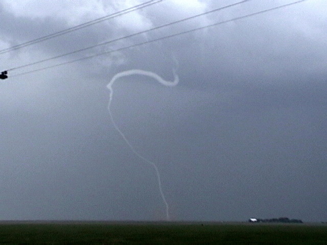
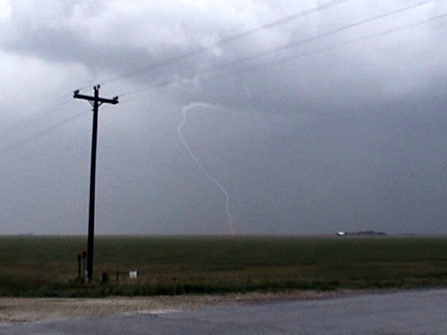
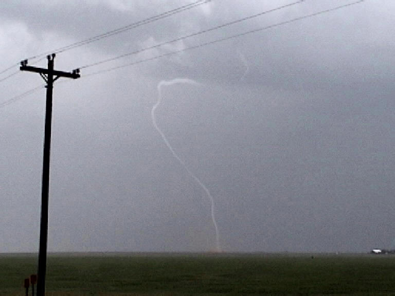
We soon ran into yet another tank of a supercell near dark between Sunray and Gruver Texas. This storm had a very well defined wall cloud and tail cloud and was very low based. It was also highly electrified and had a brownish look to it in the waning sunset. As we followed the storm towards Gruver it produced two more short duration tornadoes, one a ropey-elephant trunk and the other a needle with a clear debris cloud on the ground. Neither lasted more than a minute or so. Finally darkness was falling so we parked near Gruver, TX and took some lightning photography until the precipitation from the storm caught up with us.
After deciding to call it a night we stopped in Spearman for bathroom breaks and food and to top off the tanks. Little did we know that we would not be let off the hook so easily!! It started nicely enough with a very nice CG show as we approached Spearman from the west, but soon we were in heavy rain as we headed towards Elk City, OK to set up for Eastern, OK chasing the next day. As we proceeded through Canadian, TX the rain got much heavier and the wind picked up and soon we were hearing tornado warnings in Beckham and Roger Mills county in Oklahoma and Wheeler county in Texas. As we headed southeast we had supercells to the east generating tornado warnings near Cheyenne, OK and a series of warnings to our west from McLean to Mobeetie from the strong squall line approaching from the southwest. Around Wheeler we were absolutely blasted by outflow from the squall line with winds of at least 60-70 MPH and extremely heavy horizontal rain. We saw a number of tree limbs down in the road and leaves were everywhere. Finally near Shamrock we got clear of the line and hit I-40 and proceeded east to Elk City.
There was one last surprise for us on the night though: Minutes after we had arrived in Elk City at the Super-8, (I had just enough time to park the van under the canopy and unload our guests’ luggage) the city’s tornado sirens went off and in seconds we were back in the down pouring rain and heavy outflow winds. Concluding that it was in fact outflow (it was freezing cold), we checked in and went to bed. The sirens only lasted a minute or two and then were off for the rest of the night.
SPC
Convective Outlook SPC
Tornado Prob.
NOAA Storm Report
 |
 |
 |
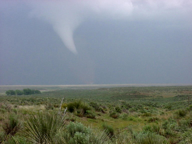 |
| Elephant trunk tornado forms south of Boise City, OK. | Tornado! Notice the debris fan on the ground. | ||
 |
 |
 |
 |
| Notice the multiple vortices on the ground. (enhanced to bring out detail). | |||
 |
 |
 |
 |
| Unfortunately I didn't get good video of the elephant trunk tornado in its mature stage because I was driving. We stopped during the rope out. RFD blasts the funnel sideways. | |||
 |
 |
 |
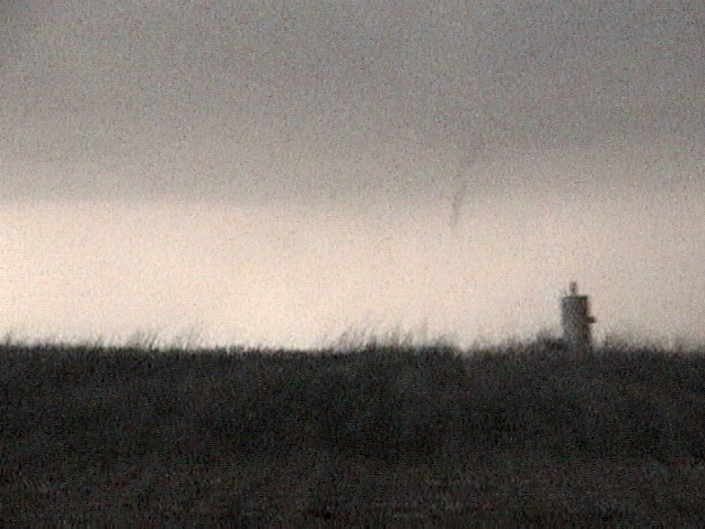 |
| The RFD disconnects the funnel from the cloud base entirely, but it continues to do damage on the ground. | Now disconnected, the funnel streaks off to the northwest at about 50 MPH! | Close up of the rope funnel still doing damage after it disconnected from the cloud base. | Later in the day near Sunray, TX, a brief needle tornado on the ground. |
All pictures (C) Richard Hamel 2017.