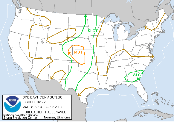
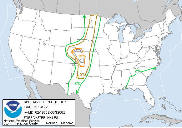
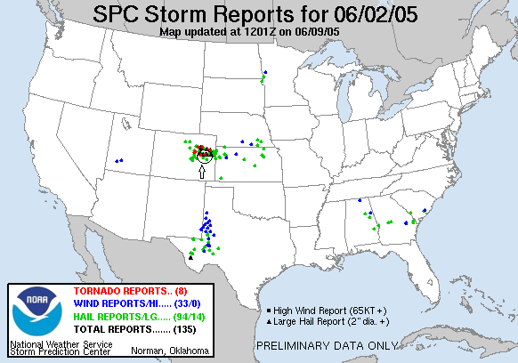
SPC Convective Outlook SPC Tornado Prob. NOAA Storm Report
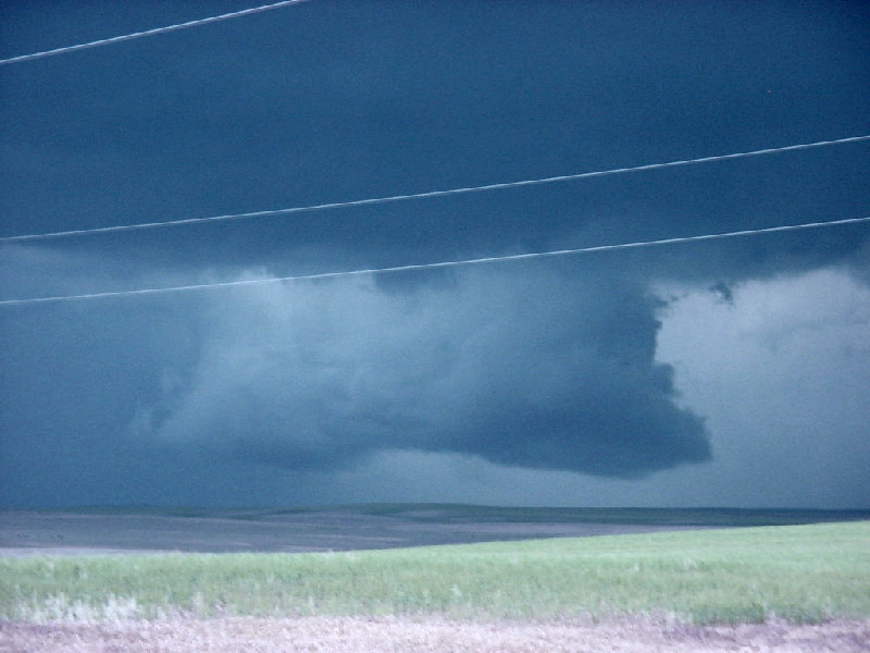
June 2nd, 2005 , Southeast of Limon, CO Supercell
We started the day in Goodland, KS with
quite a dilemma: SPC had a moderate threat issued for Southeast Kansas, but the
best conditions in our eyes were in Eastern Colorado near Limon. Adding to the
complication was that we needed to be back in OKC that night. We spent quite a
bit of time in Goodland and then up the road in Burlington, CO looking at data
and talking to other chasers, most of whom were streaming down to the Kansas
option.
Things seemed to be developing late and finally we made a mad dash for Kansas,
but on arriving in Sharon Springs it was clear that with only 3 hours of light
left, the cap was not going to break down there and we blasted west back into
Colorado. Eventually we intercepted a monstrous HP supercell that was
progressing down I-70. We came up from the south up the county roads which,
while dirt, were in good shape and not wet. Due to our late arrival we were
unable to get east of the storm, but I think this was actually a good thing
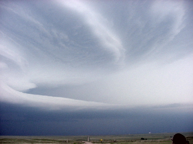
since the storm was similar to the monsters we'd seen on day 7 and 8, but from
our greater distance you could get a much better idea of the mid-level structure
of this tank.
Also, the storm produced a needle tornado for about 30 seconds that we were able
to catch, plus I think I may have seen the multi-vortex tornado that was
reported while I was driving but I can't be sure so it can't be counted. Finally
we gave up and started our well documented trek south. One thing that was very
cool on the drive back was that there was a massive supercell in Kansas to our
Northeast as I drove late into the night that was very, very electrified, and
the structure was very easy to discern illuminated by the constant lightning. If
it weren't for the long drive home it would have been a great one to stop and
get some lightning footage of. At least it gave me something to look at while I
drove.
SPC
Convective Outlook SPC
Tornado Prob.
NOAA Storm Report
 |
 |
 |
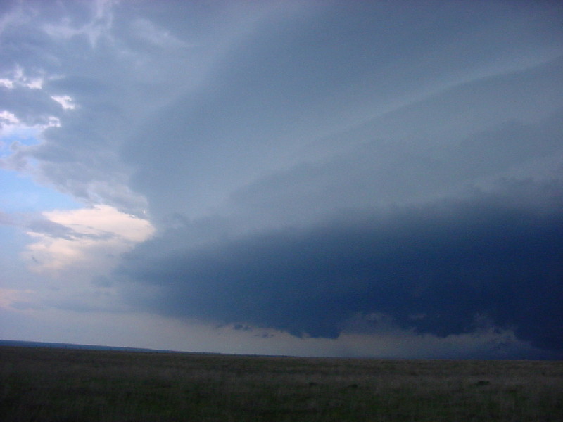 |
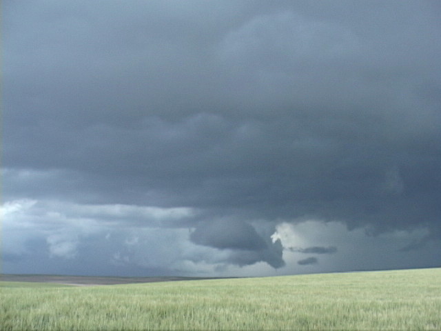
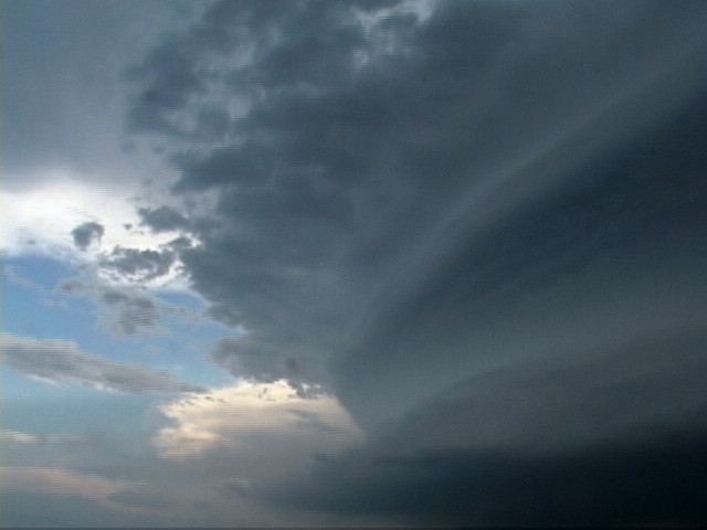
| A large block lowering. this storm had several lowerings in different stages of cycling up and down. | This is like "Where's Waldo"! There's a tornado in this picture, can you find it? | One advantage of getting to the storm a little late was that being far away we were able to get a good look at the tremendous upper level structure. | What striations! |
 |
 |
 |
|
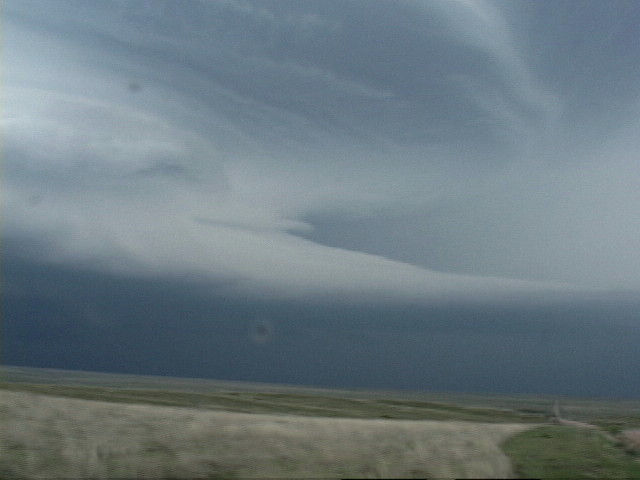
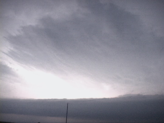
| The vault and beaver tail look almost like they were airbrushed. | This storm was very electrified, but sadly it was almost all intra-cloud.. |
All pictures (C) Richard Hamel 2017.