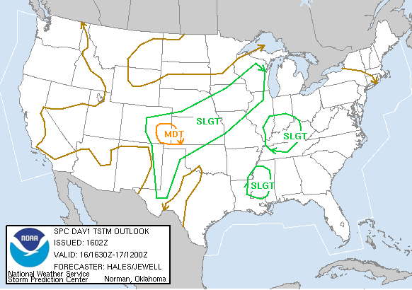
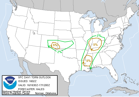
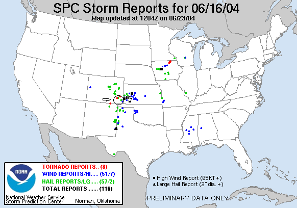
SPC Convective Outlook SPC Tornado Prob. NOAA Storm Report
June 16th, 2004 Toonerville, CO Tornadic Supercell
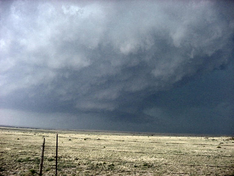
We intercepted an extremely powerful supercell the west of Lamar, Colorado near Toonerville and saw 5 tornadoes along with the complete cycle from development through classic and HP phase, onto a vicious bow echo linear system with bookend vortices and then into a squall line. The road network was absolutely killer and it hampered us all day and made for an extremely chaotic chase. This was probably the most violent storm I've ever chased. It was one of those days where you spend more of your time trying to get away from the storm than you do chasing it.
As storms began to fire we moved west
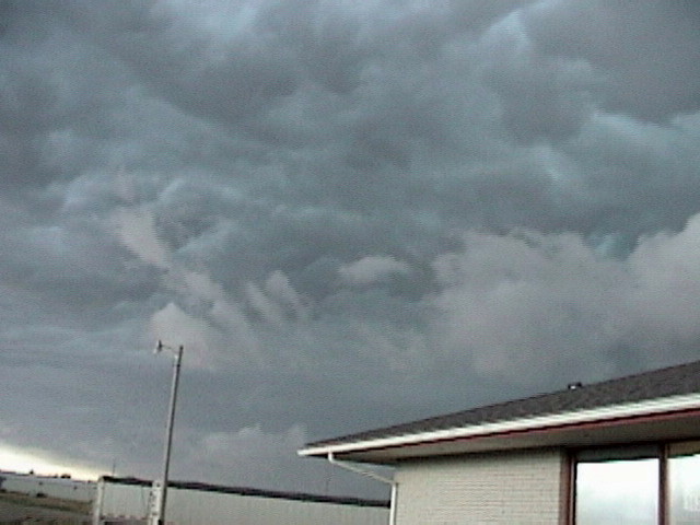
of Lamar on dirt roads. Initially we had a little trouble identifying the
updraft of our target storm since it looked great on the Baron system but not
visually. It turned out our view of the updraft was blocked by the left split of
a left split off the main storm and when the updraft finally became visible both
Roger and I said “Whoa!!” It was rock hard and perfectly vertical. At this point
we were just east of the John Martin Reservoir. The storm was anchored near
Toonerville and just sat there and grinded away for about two hours. We
maneuvered to the south of the lake and stopped to observe an absolutely huge
butt-dragging wall cloud off in the distance. The inflow rushing into the storm
was upwards of 50 MPH by this time.
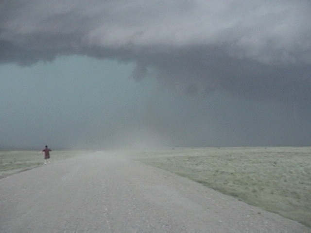
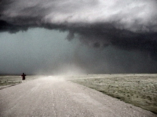
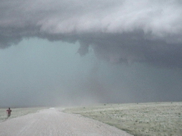
The first tornado was an elephant trunk that appeared briefly and then became
rain wrapped. Unfortunately I didn’t see it as I was too busy driving the van to
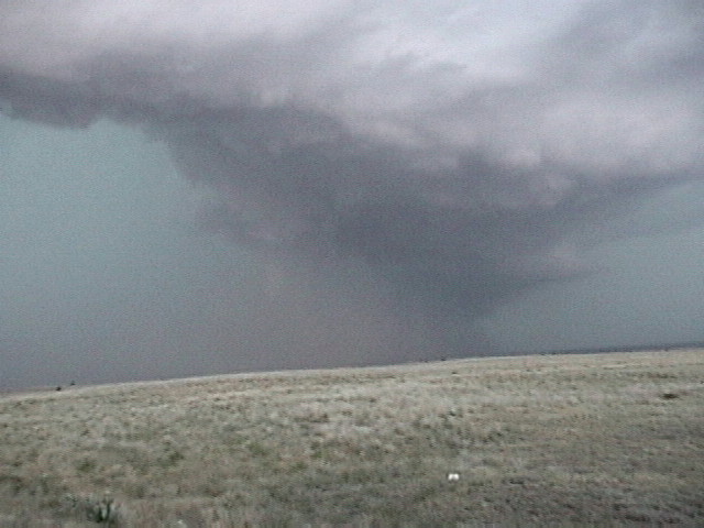
watch. The storm then developed an enormous mesocyclone with giant tail cloud,
nearly all the way to the ground. I really thought it was going to develop a big
wedge but if it did, it was in the rain. We then
moved south and had a dirty truncated stovepipe drop right in front of the lead
van about a mile up the road. Then, as we pulled away to the east a large
landspout developed to the south of the vans, and while we stopped to look at it
another dusty stovepipe developed to the north! Finally, we saw one last tornado
to the south that had a well developed circulation on the ground and a solid nub
funnel about 1/3 of the way to the ground.
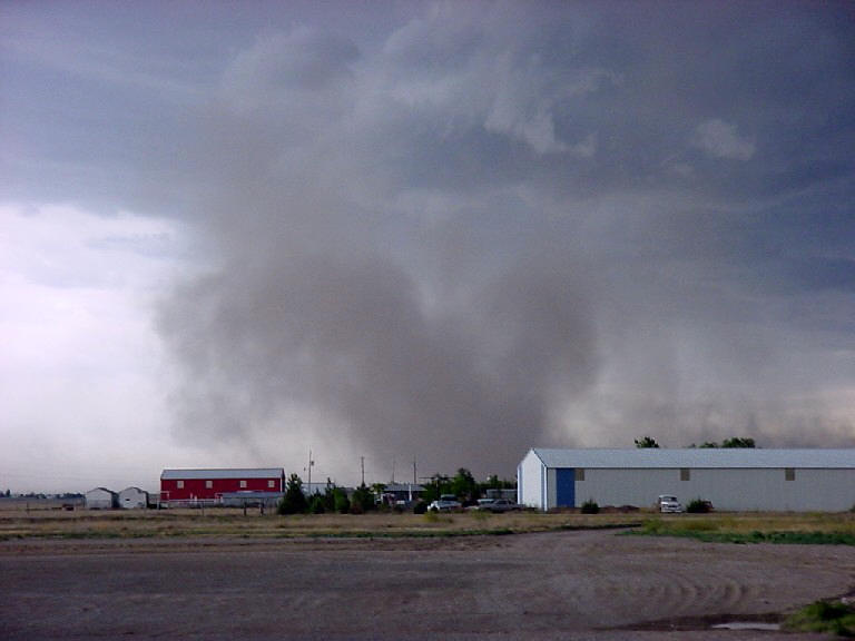
The rest of the chase was a case of the chaser becoming the chased as the storm,
which suddenly broke away from its anchored position and began to expand rapidly
in our direction. We saw most of our tornadoes as we were trying to escape to
the east over partially muddy roads. The shear line of the storm was very active
with endless rotation and funnels all along the line.
Though it was great to see 5 tubes (I only saw 4 actually, the price of being a
driver) it was sort of quantity over quality except for the dirty stovepipes.
The structure and activity of the storm were every bit as exciting as the
tornadoes. I'm sure this storm generated several rain wrapped tornadoes over its
life cycle that we simply could not see. The road network would just not let us
get north far enough to see down the inflow notch well. Eventually the storm
chased us all the way to Ulysses, Kansas where we finally stopped and let the
storm, which by now was losing its bow characteristics but was still a nasty
squall line, run over us. By that time the storm had pretty much hailed itself
out and we just got 50+ MPH outflow win and extremely heavy rain as we cut back
through about 15 miles south of what was left of the comma head back towards
Lamar. We stopped there for the night since the setup was for storms in the same
area the next day. Lamar continues to earn my label as the smelliest town in the
USA. Disgusting!!
SPC
Convective Outlook SPC
Tornado Prob.
NOAA Storm Report
 |
 |
 |
 |
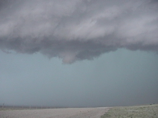
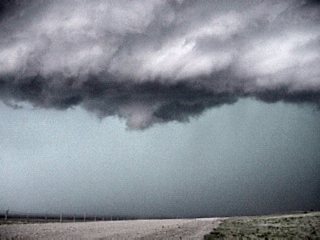
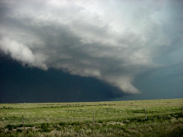
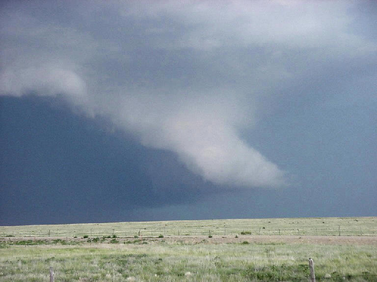
| Enormous wall and tail cloud neat the ground north of Toonerville, CO. | Truncated cone tornado just in front of my van. | Enhanced version of the same picture to bring out tornado details. | |
 |
 |
 |
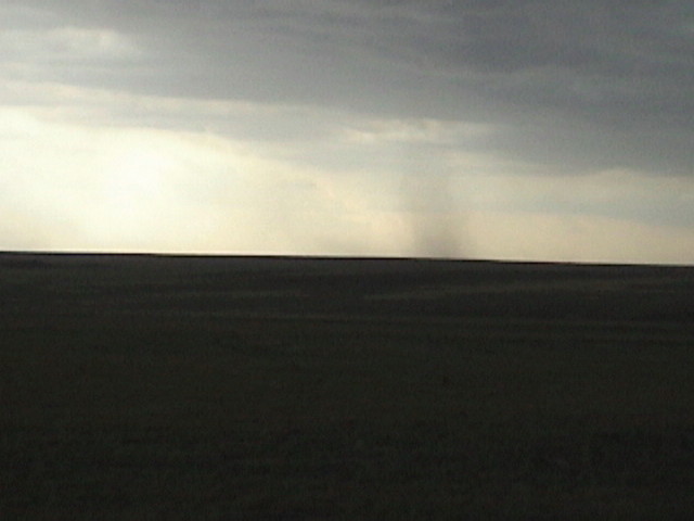 |
| The tornado moves to the north and "gusts out"... | While another funnel forms almost directly over us. | Enhanced version of the funnel shot to the left to bring out the details. | Weak landspout to the south of the van. Another cone tornado dropped to our north right about the same time. |
 |
 |
 |
 |
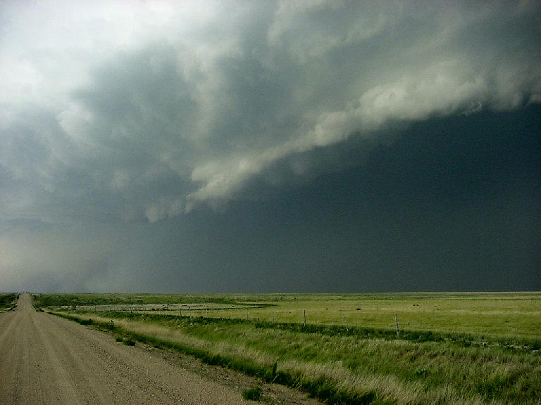
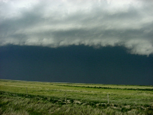
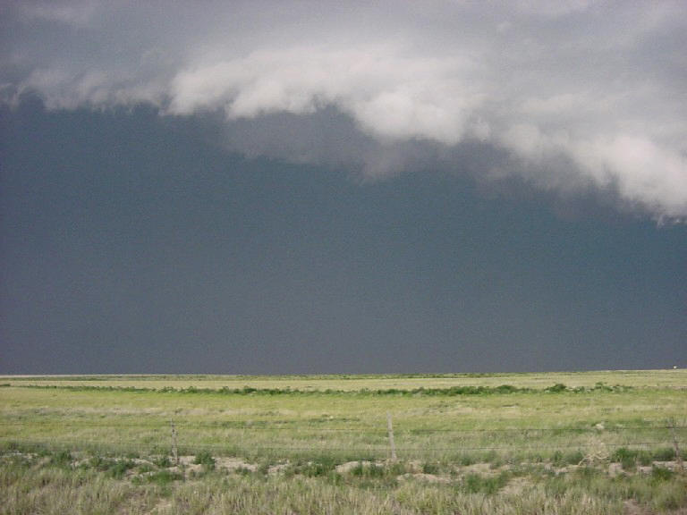
| The storm becomes an enormous bow-echo complex and starts plowing towards us. Awesome white shelf cloud. | |||
 |
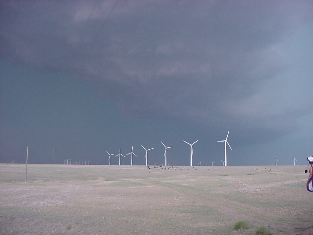 |
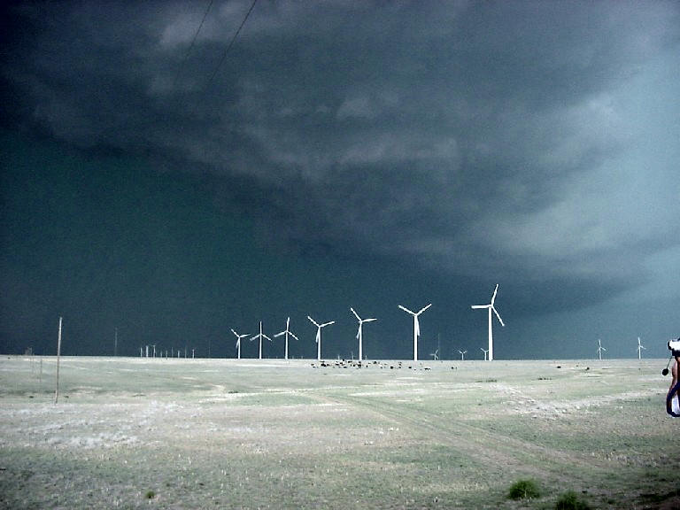 |
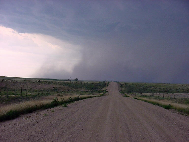 |
| To our north, this is the "comma head" of the line complex, with the most rotation in the storm. | The storm approaches a wind farm near Twin Buttes, CO | Enhanced version of the wind farm shot. | The road to the south is cut off by the storm. |
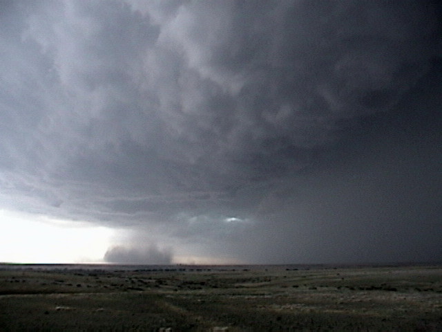 |
 |
 |
|
| Curious dust blob on the shear line had obvious rotation but was not tornadic. | Aqua looking shelf cloud approaches as we stop in Ulysses, KS. | Large gustnado on the outskirts of Ulysses. |
All pictures (C) Richard Hamel 2017.