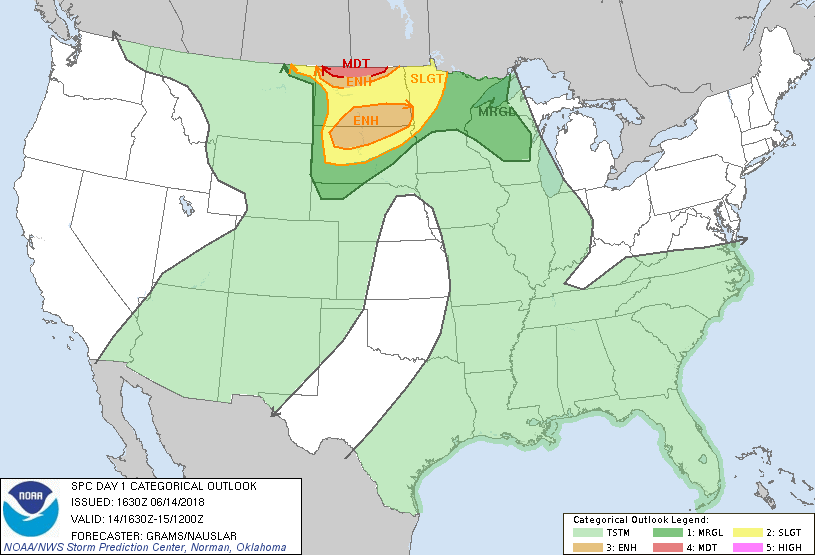
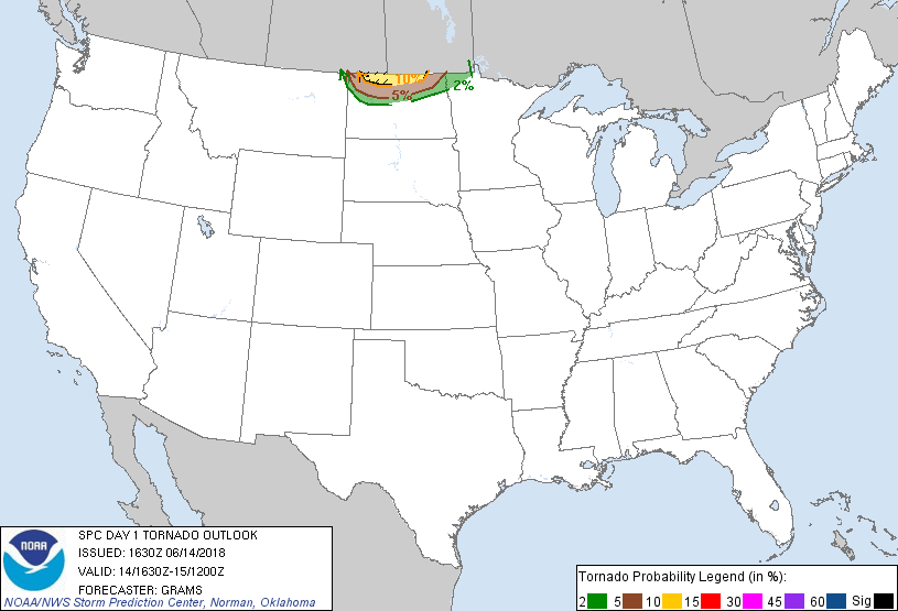
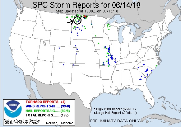
SPC Convective Outlook SPC Tornado Prob. NOAA Storm Report
June 14th, 2018, Western North Dakota Chase
A moderate risk, 10% hatched tornado threat bust! We
started the day in Gillette, WY, with the expectation that we would probably be
chasing in Canada on the warm front, but with a secondary target of the triple
point in western or southwestern North Dakota. We left Gillette and headed north
through Montana then northeast all the way to Williston, ND before stopping for
lunch and waiting. By the time we’d reached Williston we knew the Canada play
was out: The warm front had already become a mess of storms with a stratus deck
crossing the border into the US. As we waited, there was a single storm right
along the border tempting us with a 60+ dbz core and signs of rotations, but it
was clear that it was elevated. The HRRR model was showing that storm and that
it would become surface based, but we were skeptical and the storm was traveling
nearly 50 mph along the border so we’d never have caught it regardless. The
model also developed supercells along to the southwest of Williston, but there
was little sign of that happening. To kill time and be in a better position to
make a desperate attempt to catch the storm on the border if we needed to, we
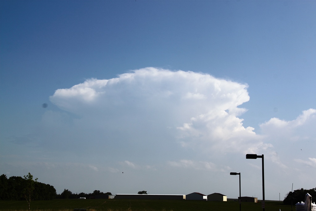
went east, making a picture stop and the going to Stanley and waiting. Finally,
not only did two cells form to our south, but the outflow boundary to the west
initiated as well and one updraft in particular caught our attention. Initially
the southern storms looked better, so we dropped south on Rt. 8, but we quickly
decided the better play was the western storm as it reached 50,000-foot tops,
while the southern storms looked to be pulsing down so we went back to Stanley
and headed west.
We pulled down a side road on Rt. 2, and watched the
storm, which had a nice broad base but not much of a lowering, for a few minutes
until the rain got to us and we moved east. At our next stop on 75th
Ave. W, the storm was now severe and had a bit of a wall cloud and produced a
quick funnel, but then lost focus. The storm continued to strengthen and soon we
had to run north back to Rt. 2 when the hail core caught up to us and we got a
bit of small hail before getting to the road.
We continued east to get space ahead of the hail core
and turned south at Berthold onto Rt. 10 to get southeast of the storm as it
right-turned. At Lonetree, we stopped again and observed that the updraft was
now a tight corkscrew spinning hard at upper levels and sparking quite a bit,
but with no low-level rotation. It also had a big inflow band feeding into it.
Soon we had to move again to stay ahead of the storm, but within a few scans the
storm fell apart and we decided to head towards our hotel in Bismarck, and also
to observe a storm that was coming up towards us from the South Dakota border.
We preceded down Rt. 83 and crossed Lake Audubon. Meanwhile, the storm coming up
from the south was now over Golden Valley and looked like a solid supercell with
55,000 ft. tops, a maxed out VIL profile, and signs of rotation, so we decided
to divert and try and intercept it around Hazen. We took Rt. 200 through
Riverdale and Pick City, then turned south towards the storm, which was showing
a decent amount of lightning but was pulsing down. As we proceeded down Rt. 200,
the storm looked like it was falling apart so we pulled off on 5th
St. SW to let the guests take a few pictures as the storm died. We stayed for a
few minutes, but then gave up and headed for the hotel. While doing so, we were
at least treated to a decent lightning show heading to the hotel. Quite a bust
of a Moderate Threat! There was only one tornado report in the threat area, a “Sherrifnado”
near dusk far in the eastern part of the threat area.
Miles for the day were 656.
SPC
Convective Outlook SPC
Tornado Prob.
NOAA Storm Report
 |
 |
 |
 |
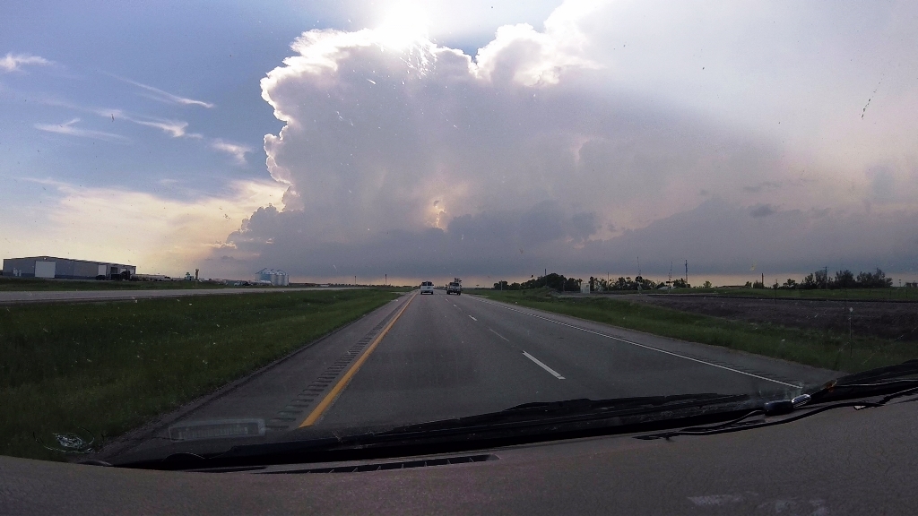
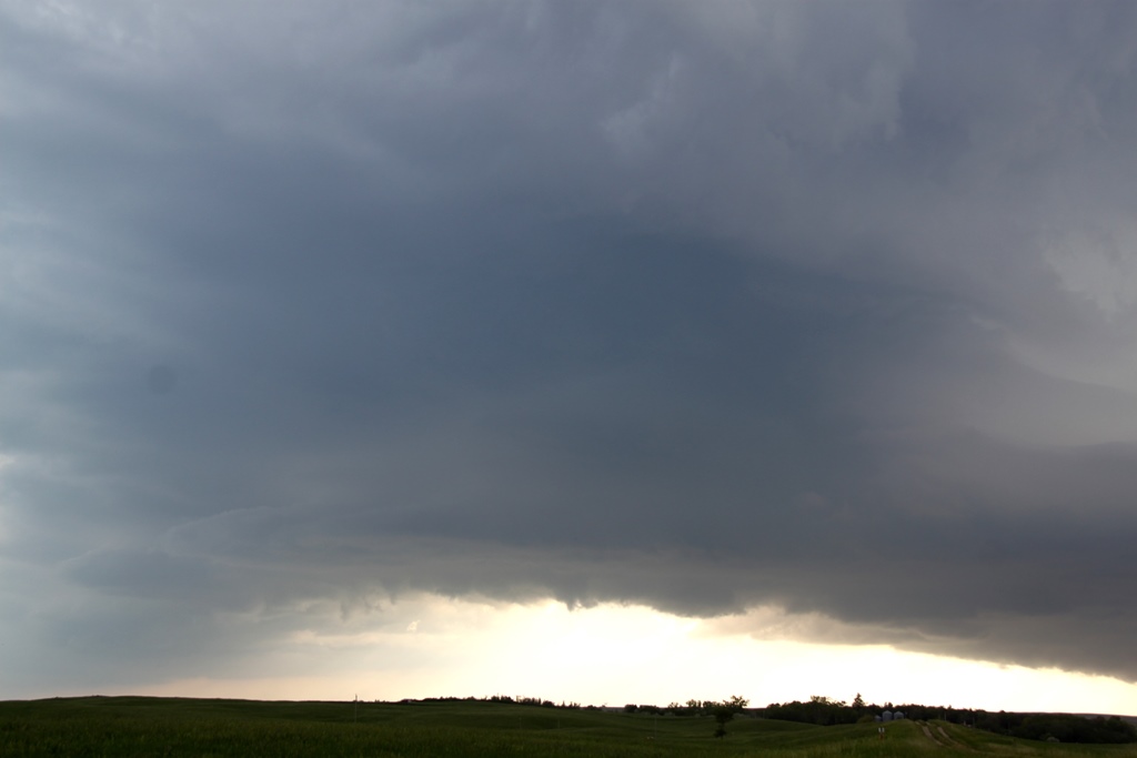
| After a long wait in the vicinity of Williston, ND, we moved east towards Stanley and finally storms fired. Initially, we were looking at this storm to the south before proceeding to our target back towards Williston. | Closing in on our target storm. |
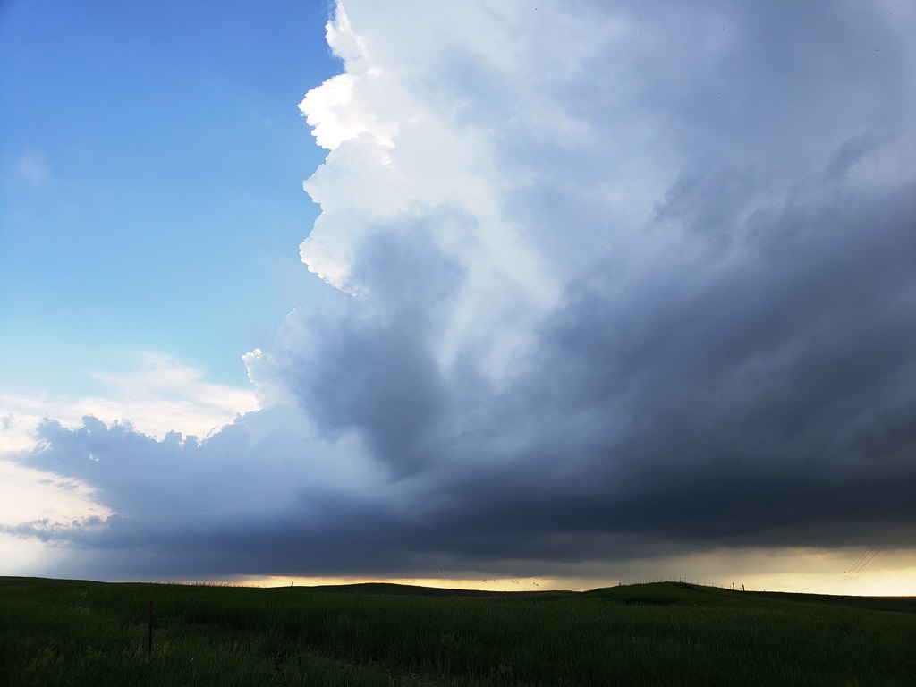
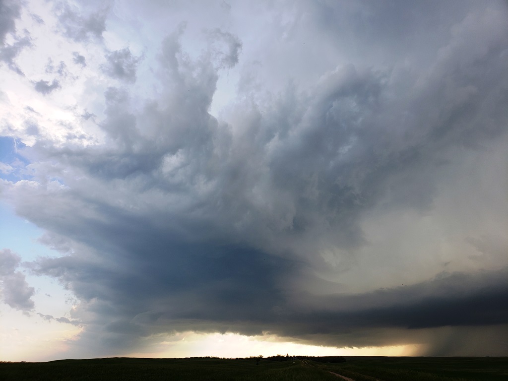
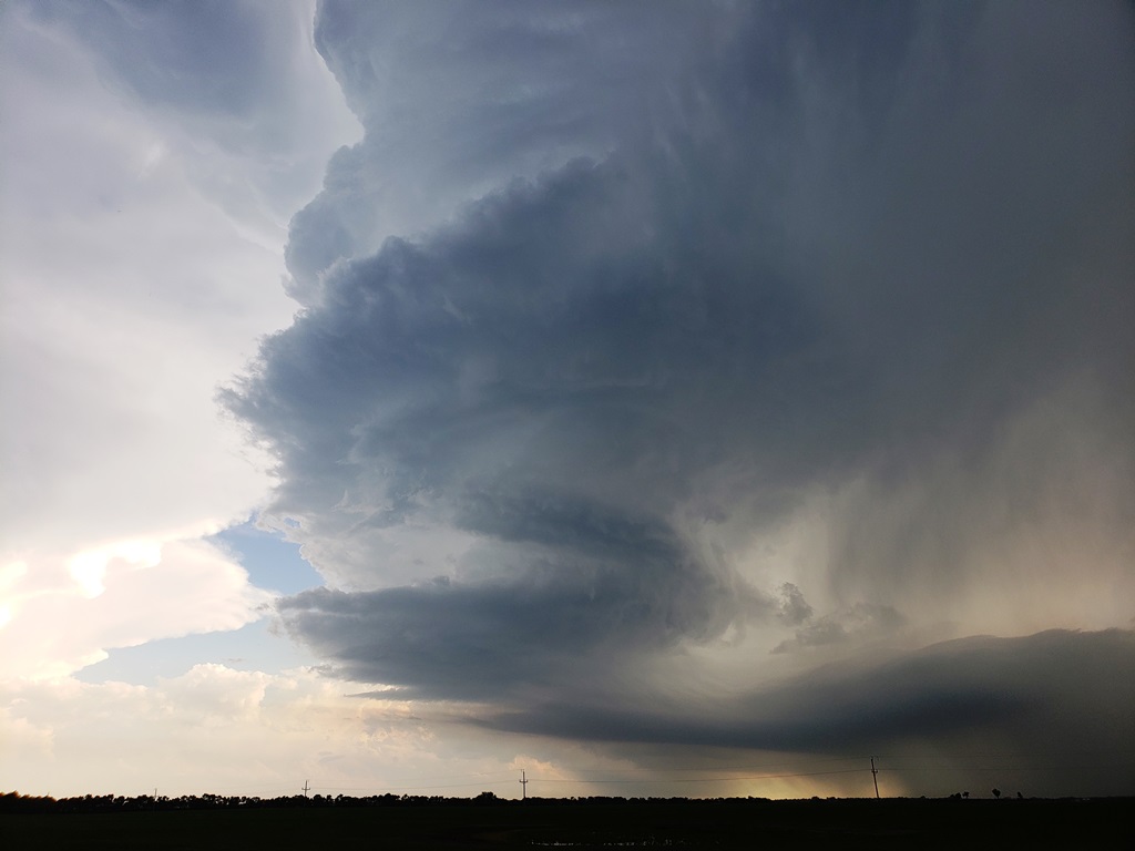
Stopping just west of Ross, we observed our nicely structured storm. |
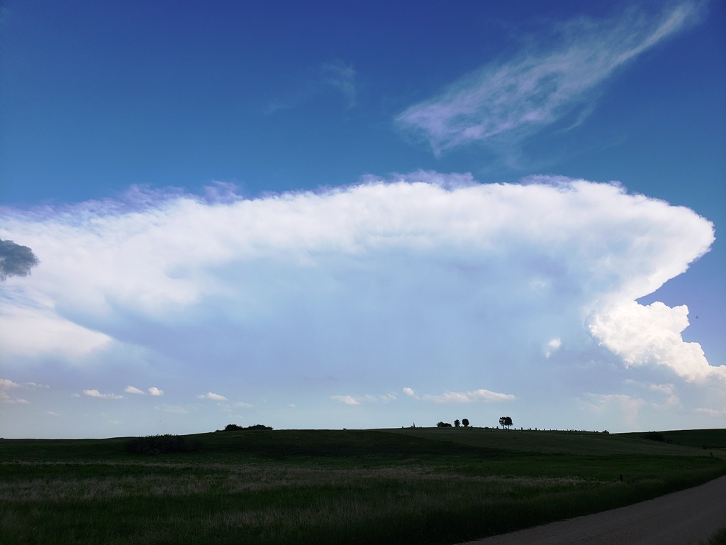
Meanwhile, we were getting further distracted by the storm to our south
towards Parshal. |
 |
 |
 |
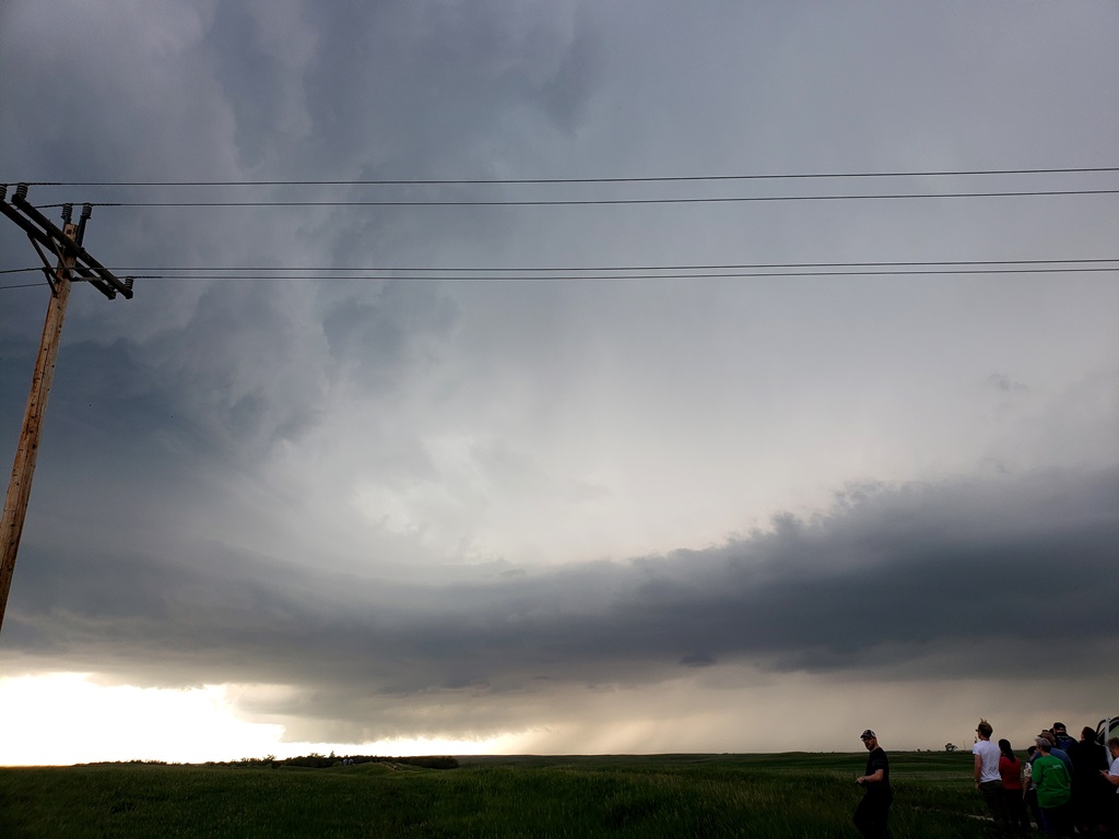 |
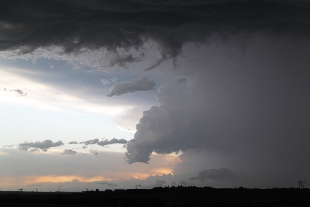
| We followed the storm east, stopping near Palermo as the supercell with a big inflow band came towards us. | Funnel forms under the updraft! |
Broader view of the storm with funnel. Sadly, the funnel quickly
dissipated. |
Closer view of the inflow band. |
 |
 |
 |
 |
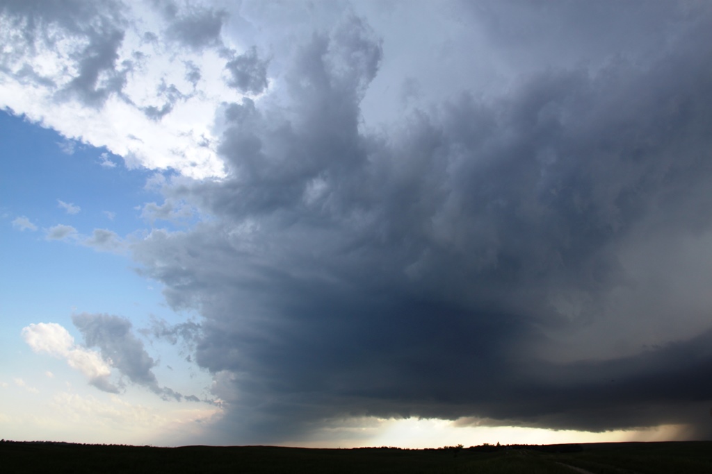
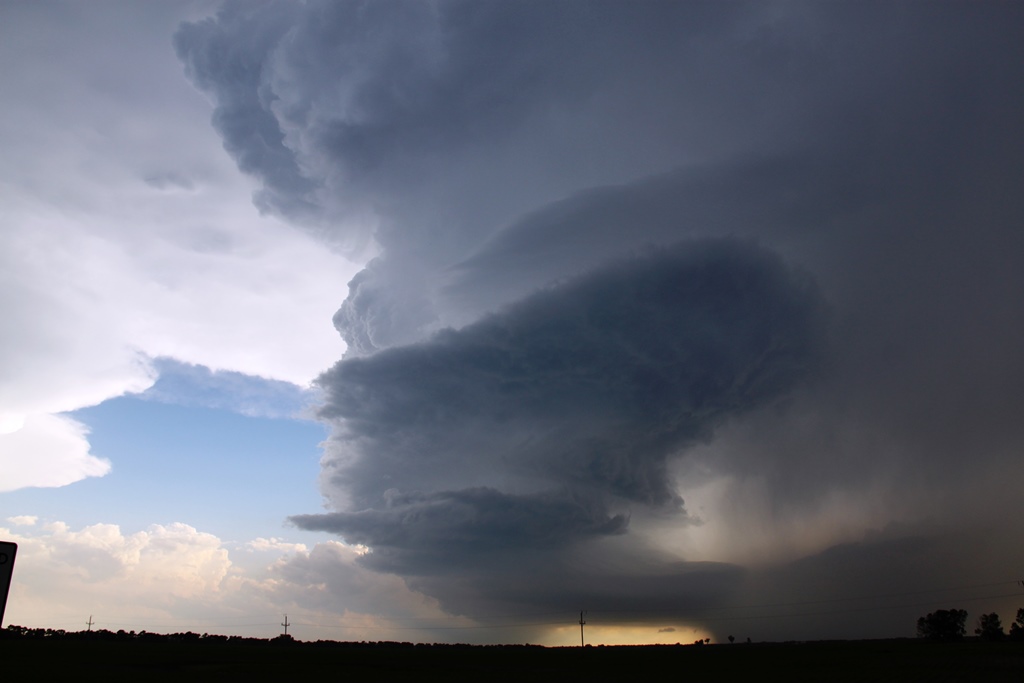
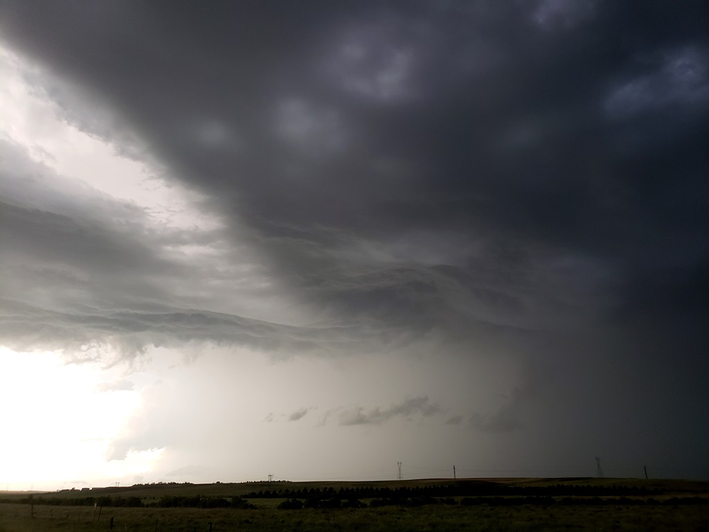
| Crazy barber pole structure as we continue east towards Lonetree! | Crazy updraft closing in on our position. |
After our storm fell apart, we headed south to try and intercept storms
coming up from Dickinson. As we came around the precipitation core in
the foreground, we're began to see some cloud features in the distance. |
Stopped near Hazen, a much better view. But by the time we got here the storms had become a multi-cellular mess. |
All pictures (C) Richard Hamel 2019.