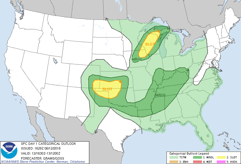
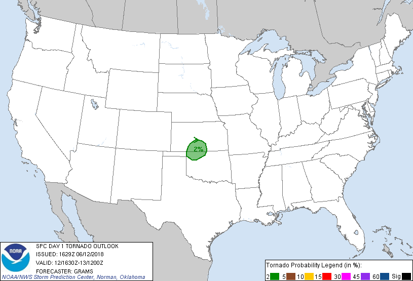
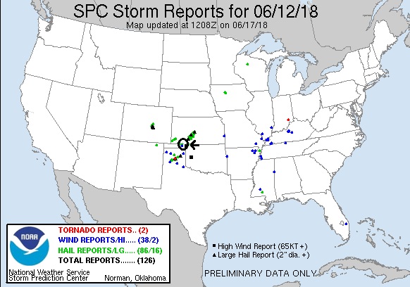
SPC Convective Outlook SPC Tornado Prob. NOAA Storm Report
June 12th, 2018 Oklahoma Panhandle Supercells
For the 3rd day in a row, we were able to
watch a storm from initiation all the way through it’s life cycle to final
collapse. We weren’t expecting much this day, and with strong instability but
minimal shear it looked like pulse storms were the best we could do. With two
potential targets: one just southwest of Wichita and the other on the Oklahoma
panhandle near Guymon, we left Topeka and headed for Wichita, stopping there for
lunch, and by that time the panhandle option looked more likely to verify so we
headed west on Rt. 400 out of Wichita.
After making the obligatory pass through Greensburg and a
stop at the metal sculptures in Mullinsville, we were forced to divert south at
Bucklin on word that there was an ethanol fire in Minneola and that roads were
blocked and people were being evacuated. We got down to Sitka and up Rt. 283 but
stopped before making the turn towards Meade to consider options as an updraft
with a broad flat base had gone up to our southeast and was already creating and
anvil. From where we stopped, we could see the smoke plume from the fire in
Minneola. Given the proximity of the updraft and the fact that the storm was in
about as good conditions as we were going to find, we went for it, intercepting
the storm at Protection. There were actually 2 updrafts, each with hefty
precipitation cores. The two updrafts were separating and the southern one was
becoming dominant, so we headed east then south on Kansas Rt 1., passing though
the core of the north storm (all rain) then crossing the state line and stopping
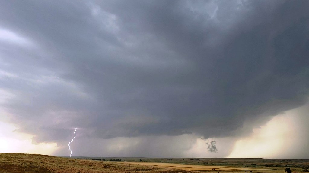
near Lookout, OK to observe the storm which now had a big core with hail and
decent structure. We continued to circle the barely moving storm, stopping on
Rt. 64 north of Selman, OK, then again a few miles farther down the road for a
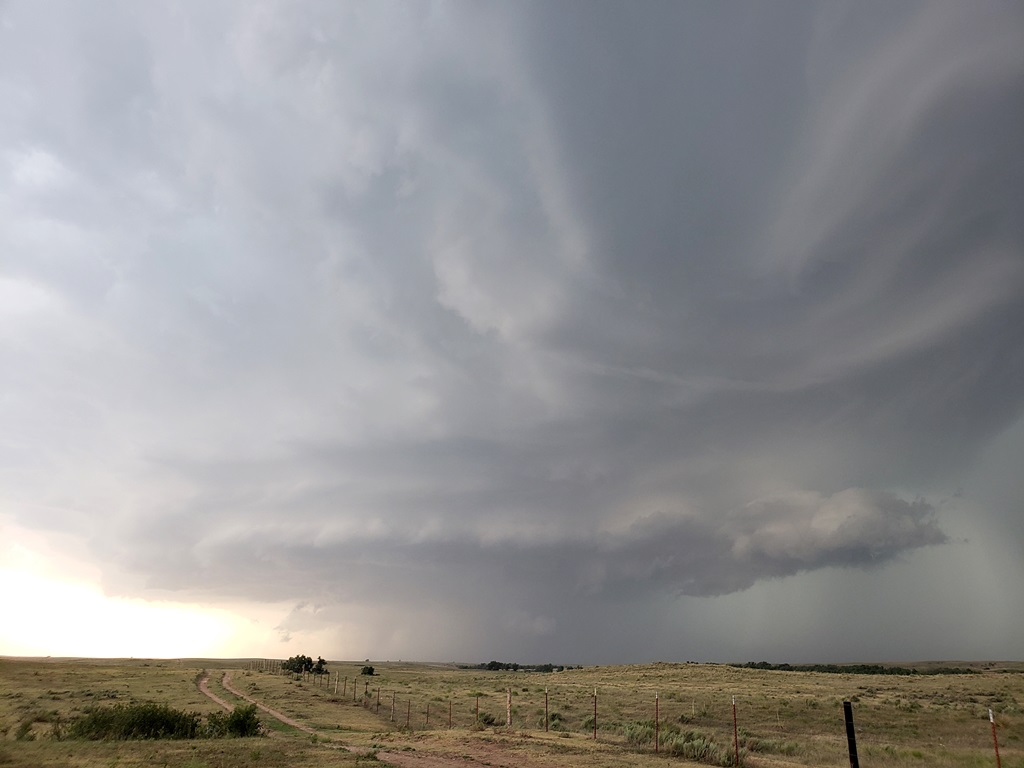
better look at the updraft, and noted that the storm was developing a wall
cloud, so we continued west to get a better look at the hook echo area.
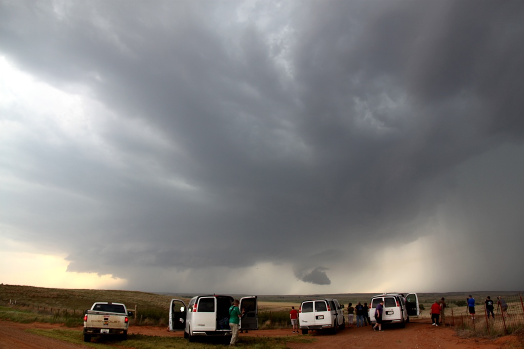
After an emergency fuel stop in Buffalo, OK we headed
west out of town and were able to get in perfect position to watch the
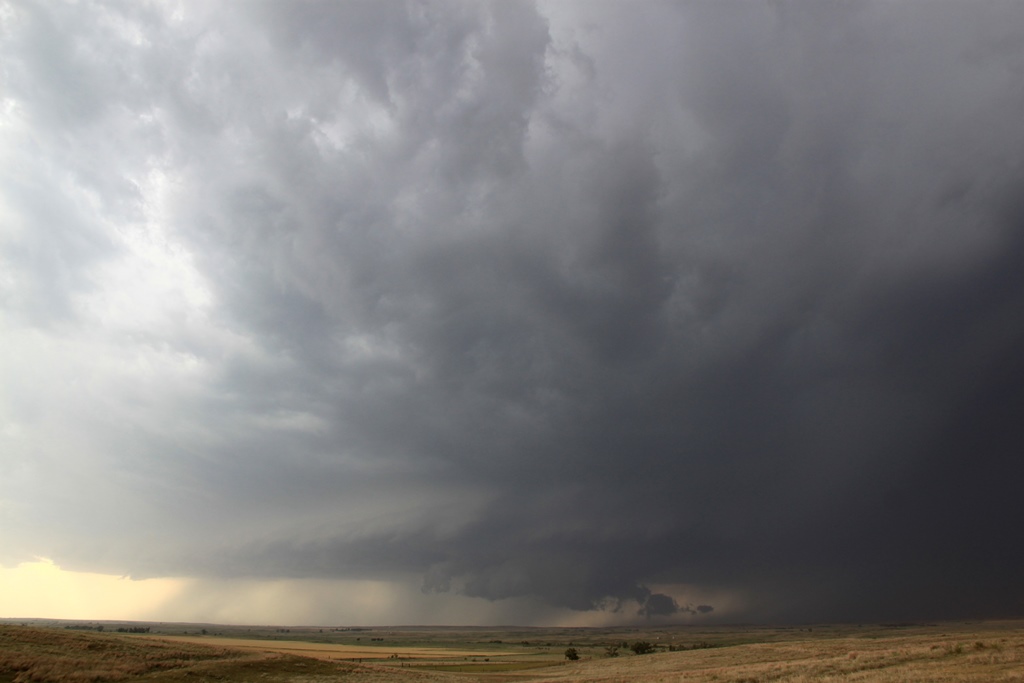
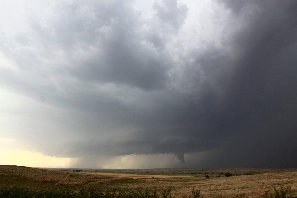
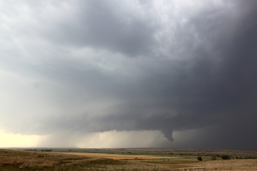
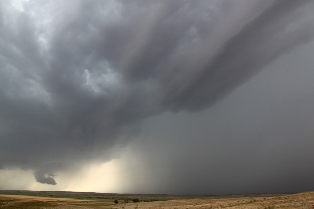
developing wall cloud ingest scud into the base. Another stop and we found a
great vantage on E0130 road and watched as the storm developed a big, almost
vertical tail cloud (it was not rotating and was not a funnel, though it was
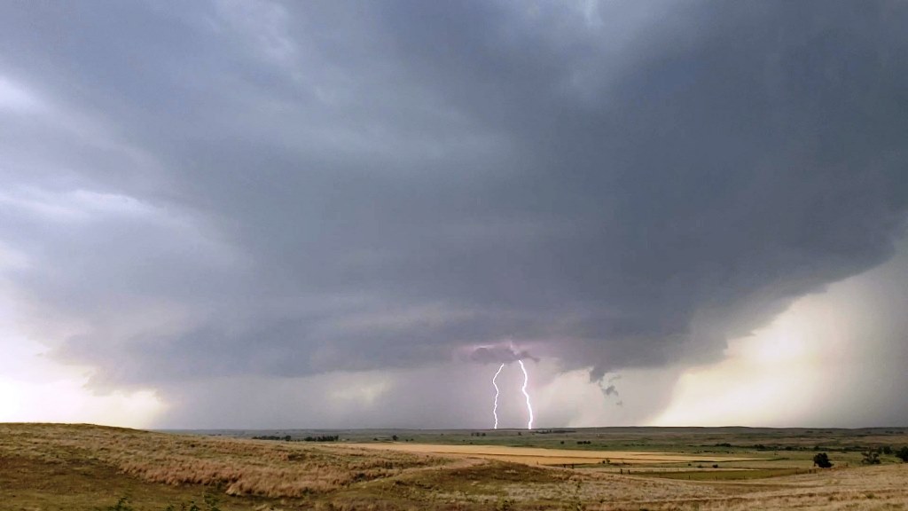
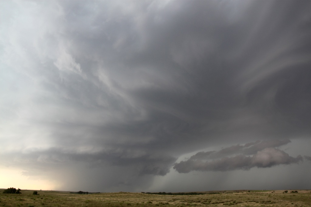
reported as one), and soon the storm was a beautifully striated stack-of-plates
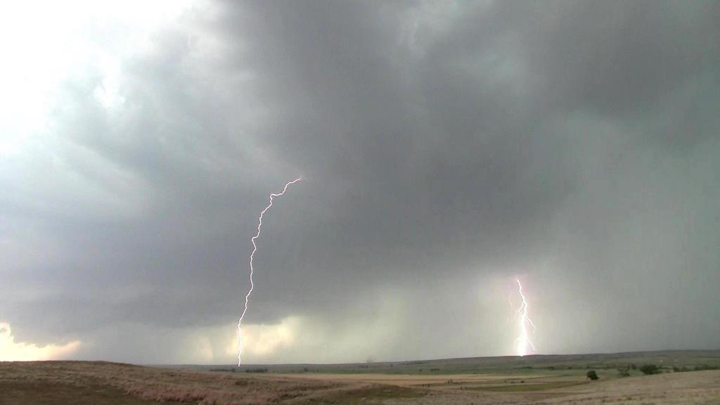
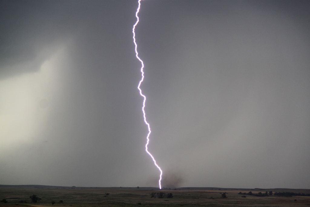
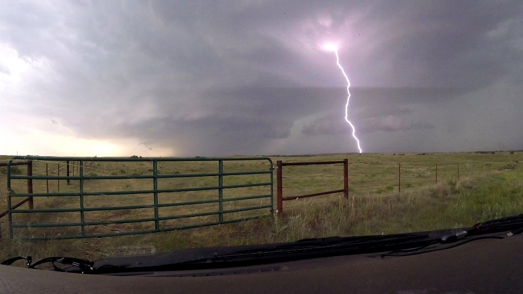
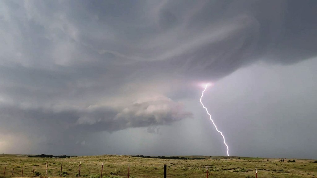
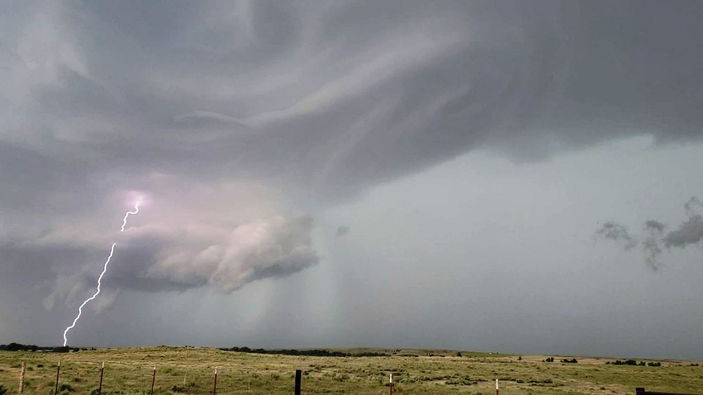
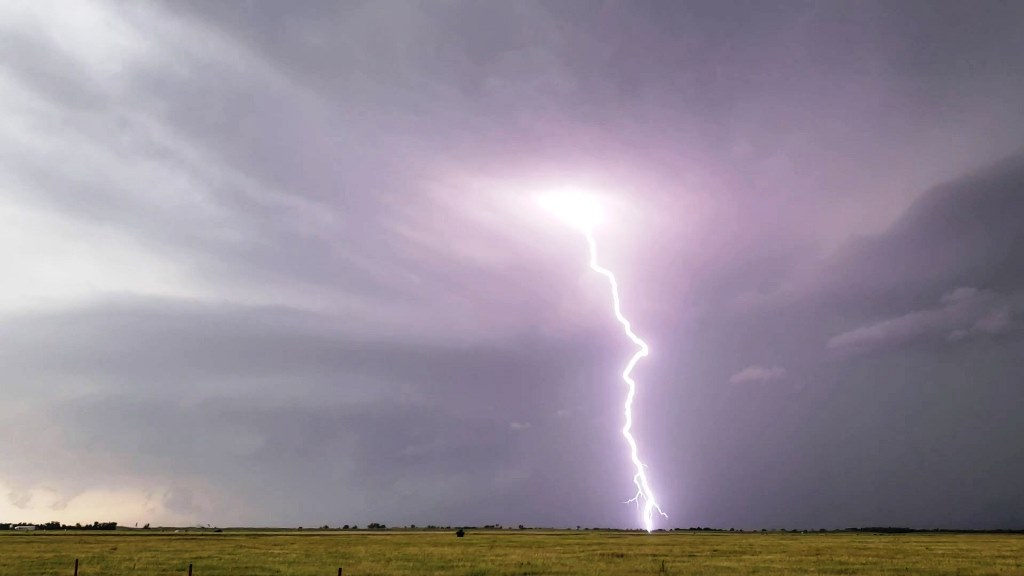
with a big inflow band and green hail glow in the vault. Around this time the
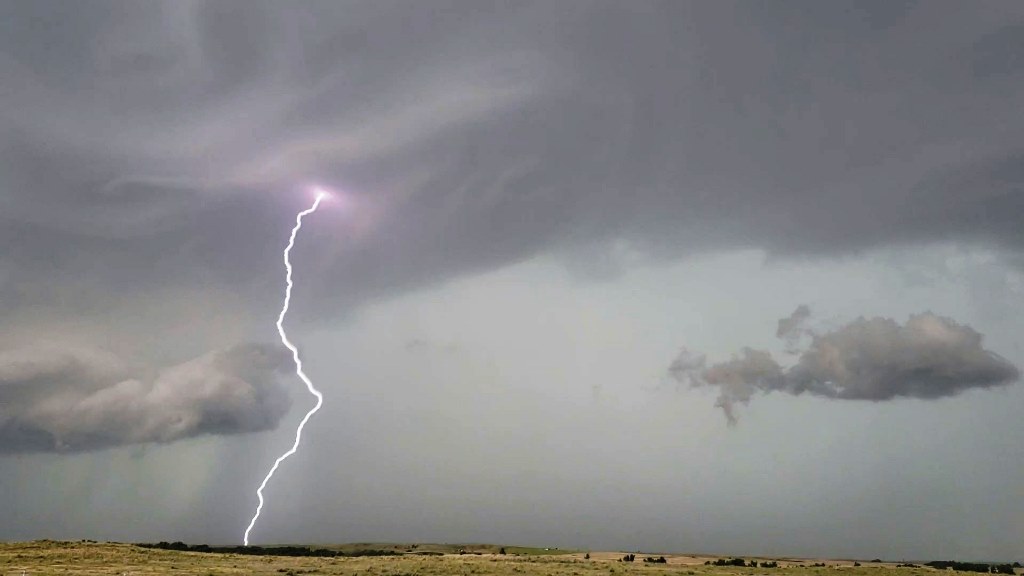
storm became very highly electrified, dropping bolts all over the place and
starting a big grass fire to our north, while sucking in copious amounts of
inflow from directly behind us, giving the vans a nice dirt bath. We continued
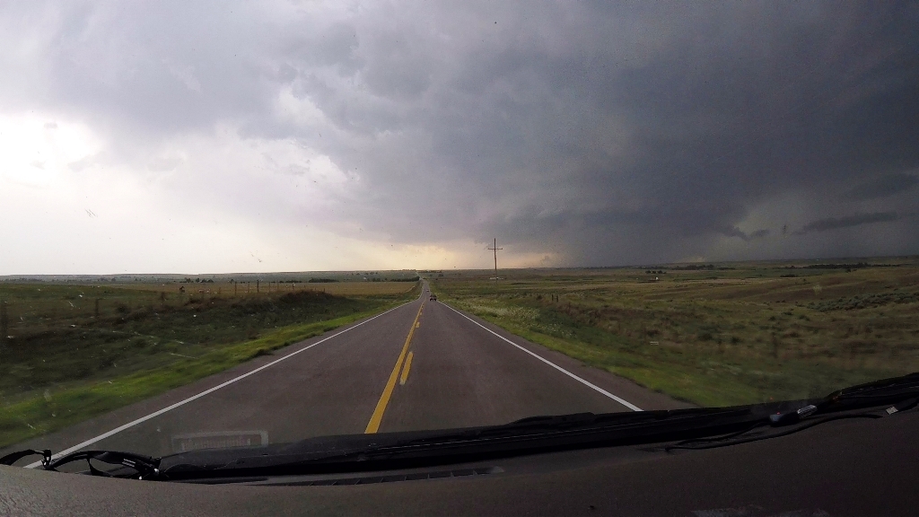
along Rt. 64, stopping for a look every few miles as the storm continued to be
almost anchored in place. At Rosstown we turned south towards Laverne after
another pause to watch the rotating storm to our north, then stopped and watched
the storm as it lost supercellular characteristics, though it continued to spark
like crazy. Once the bolts started hitting behind us, it was time to go.
At that point, we decided to head for the hotel, but had
to maneuver west to clear the still strong cores to the north. Twice along the
way the storm produced wall clouds and we diverted north, once towards Gate and
once toward Mocane to take a look. Near Mocane we were getting hammered by
outflow as we got very close to the wall cloud, but while it looked good for a
few moments, it quickly fell apart once we got there. We ended up hitting a hail
core north of Beaver, OK in violent outflow winds, and then passed through two
more cores before getting clear of the storms north of Liberal, KS and finishing
the trip to Garden City, KS where we stopped for the night.
A fun day that far exceeded our limited expectations!
Miles for the day were 605.
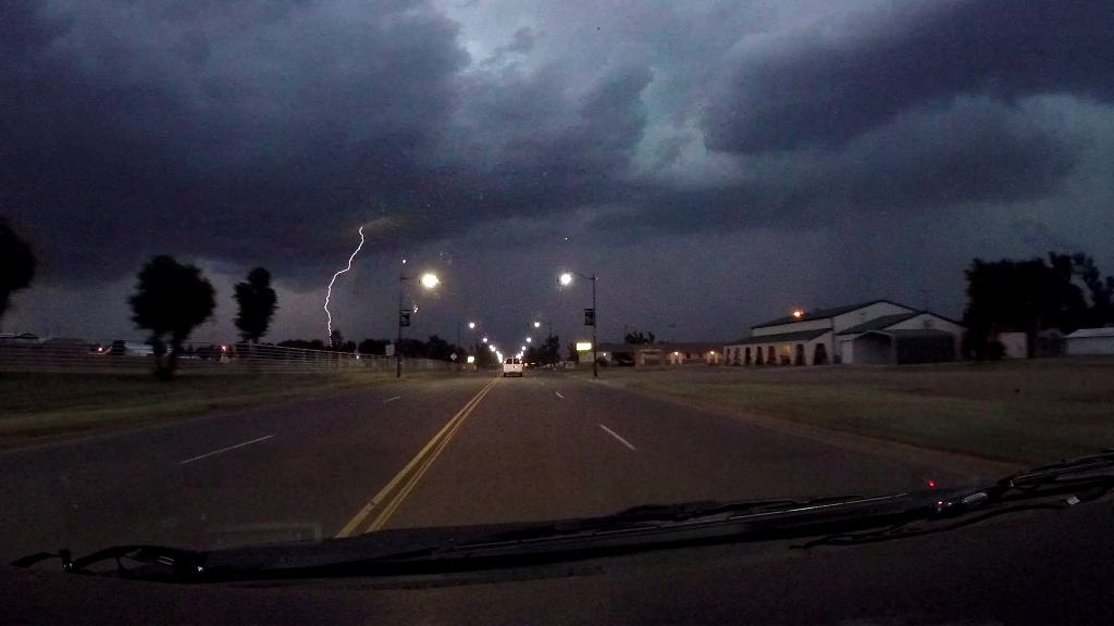
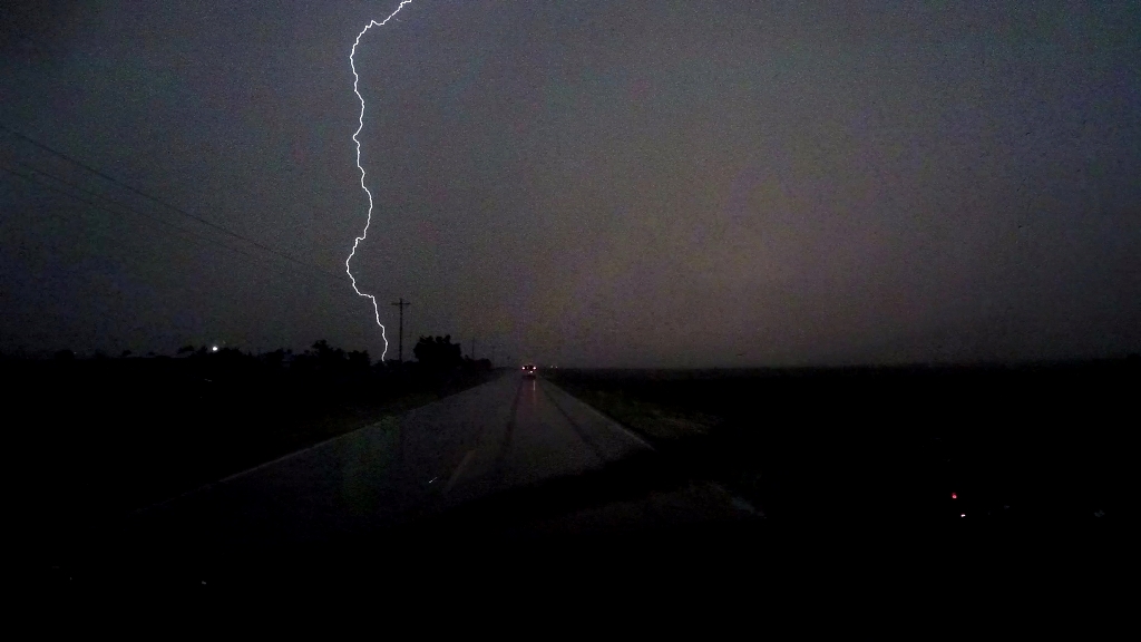
Click here for some video of the lightning show near Buffalo, OK
SPC
Convective Outlook SPC
Tornado Prob.
NOAA Storm Report
 |
 |
 |
 |
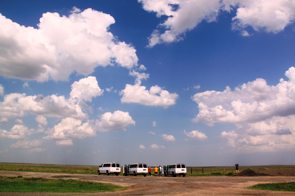
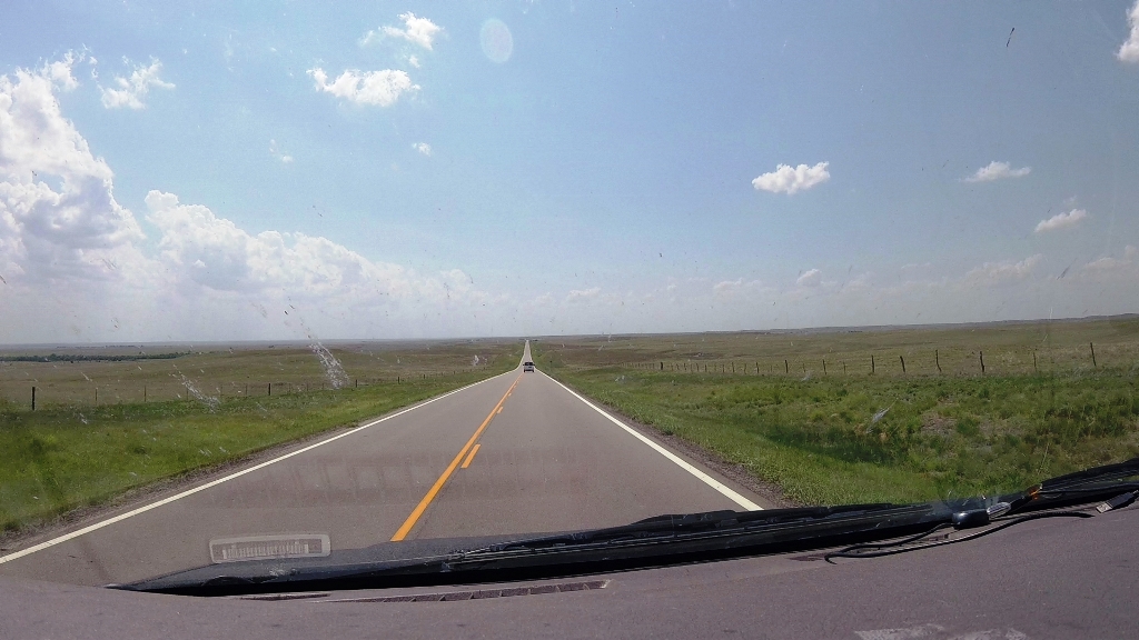
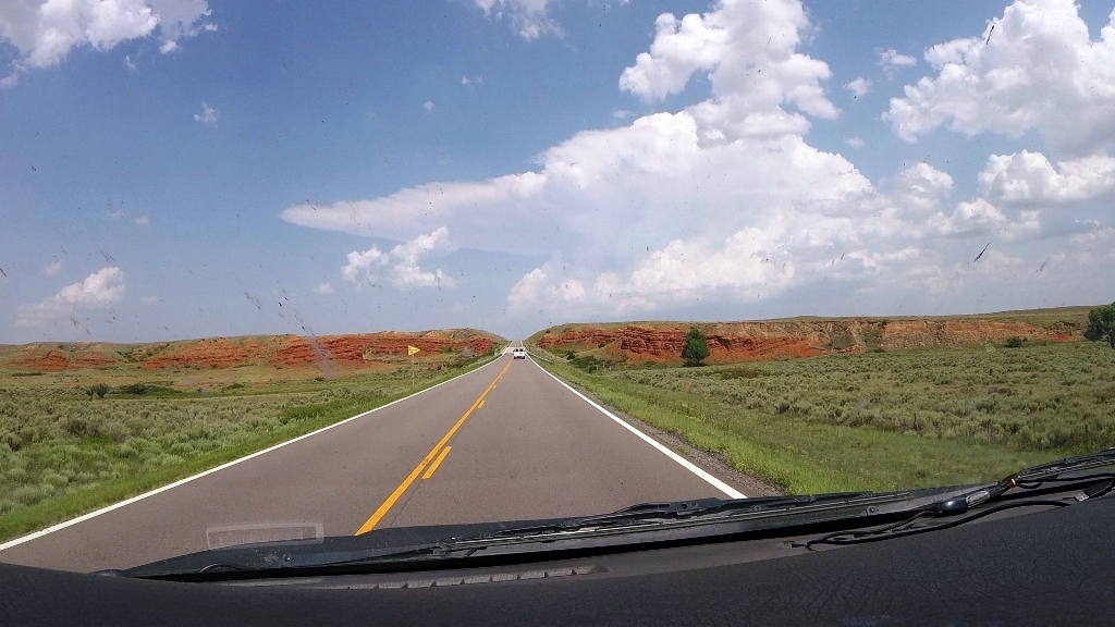
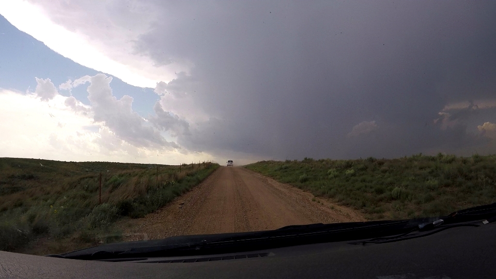
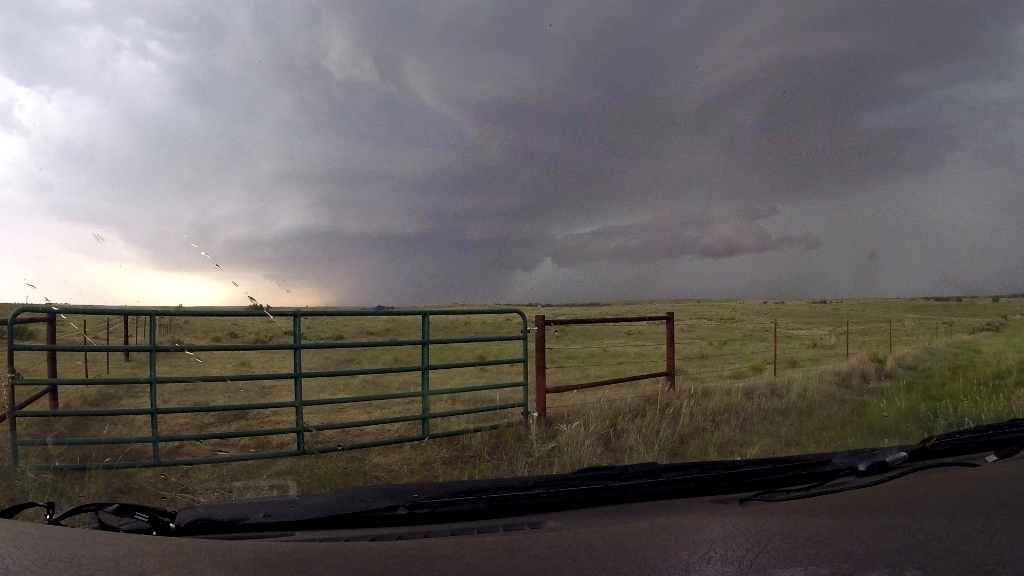
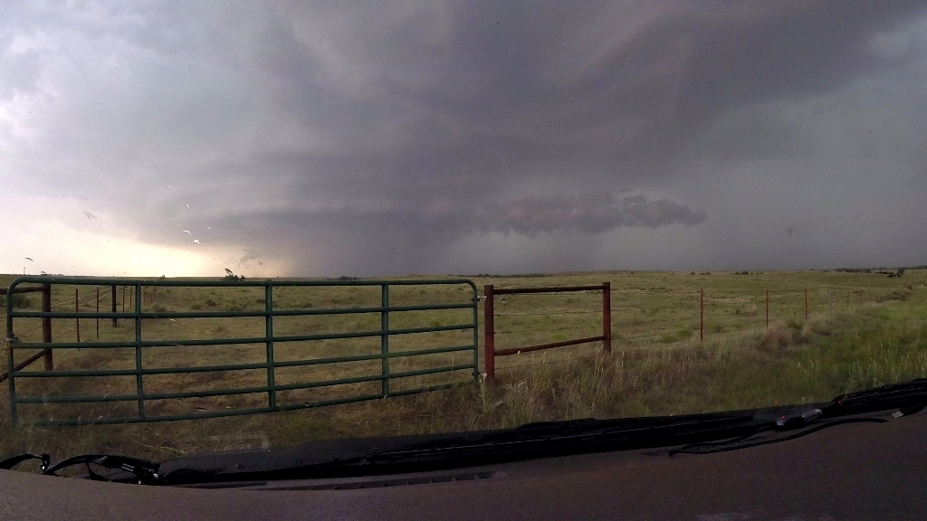
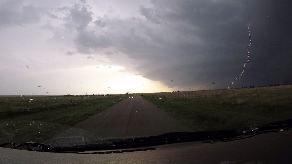
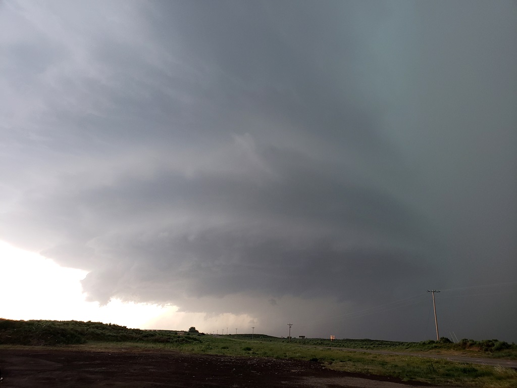
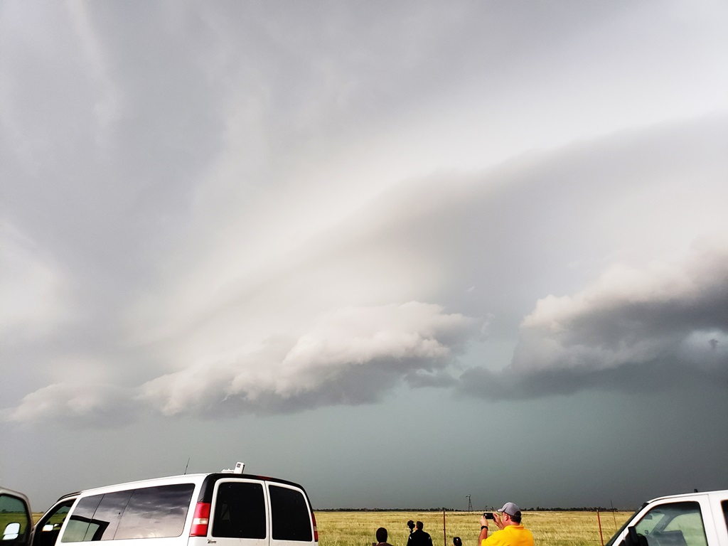
| Watching and waiting south of Minneola. | Eventually a few marginal options for target storms popped up. The closest was near Protection, KS, so we retraced our steps back that way to intercept. | Closing in with the updraft of our storm in the distance. | Entering Ashland with our target storm having broken into two cells. |
 |
 |
 |
 |
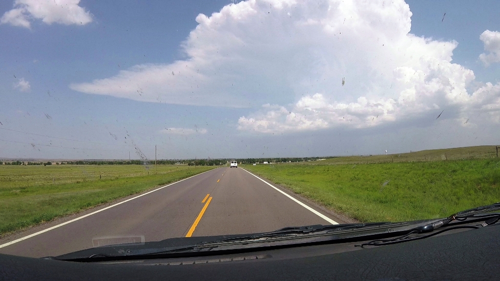
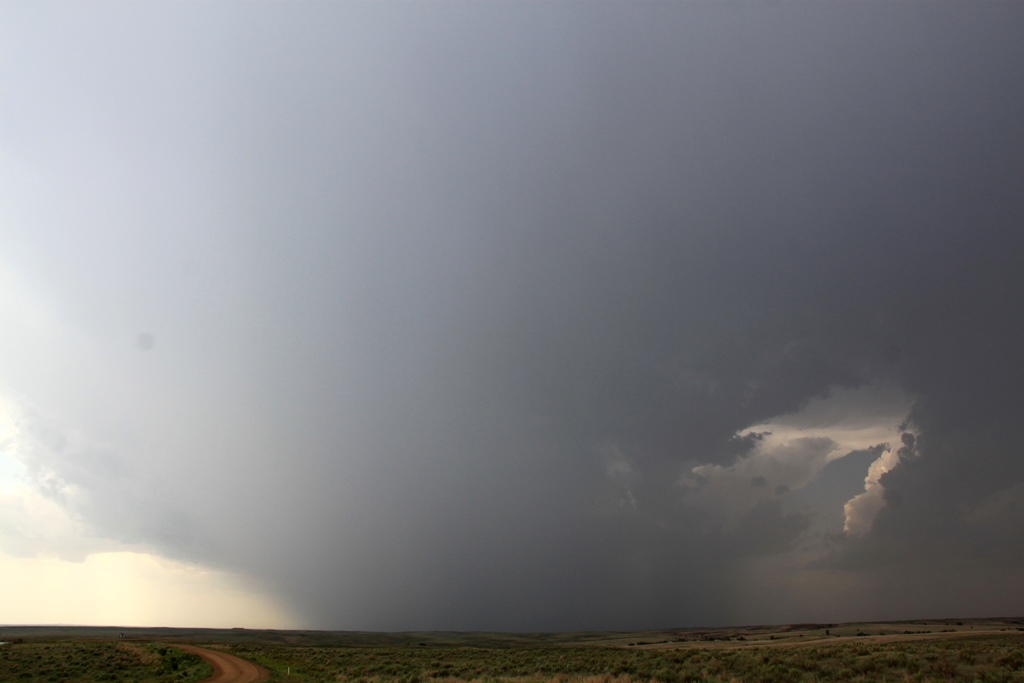
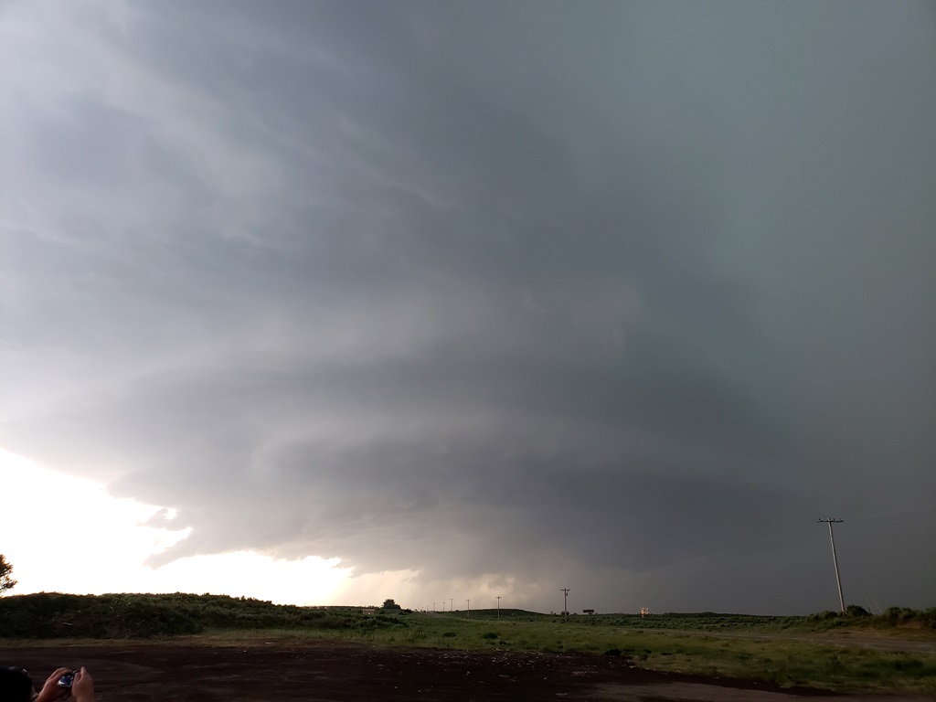
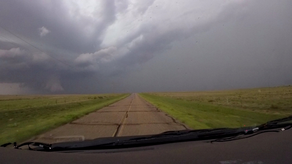
| Stopping near Sitka to observe the western of the two cells with its big rain core. | The eastern cell soon took over the show so we skirted the north end of the western cell's precipitation core and headed south. The cells were almost anchored at this point. | Crossing into Oklahoma, we stopped near Lookout to have a look at the big precipitation core to our northwest. | We continued to head south as our storm was now moving that way. Again stopping to observe the updraft north of Selman. |
 |
 |
 |
 |
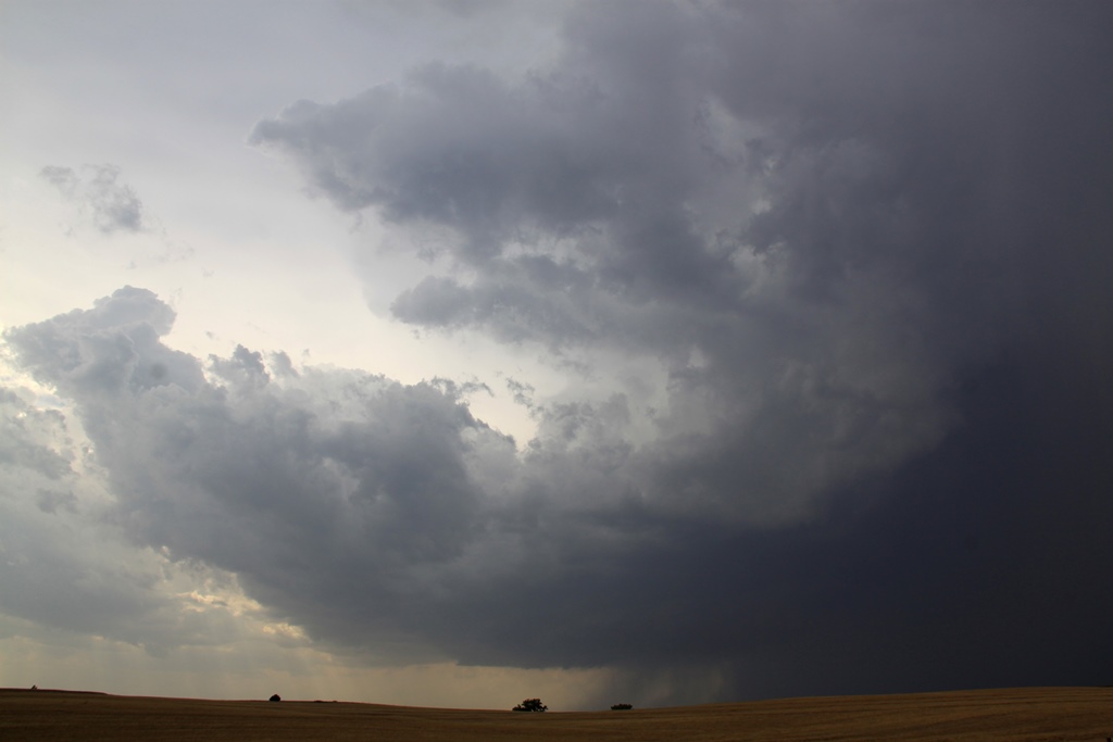
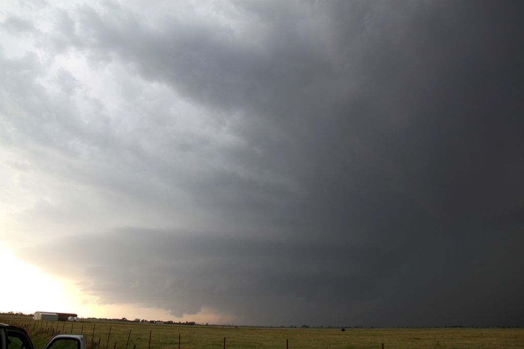
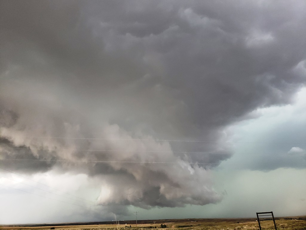
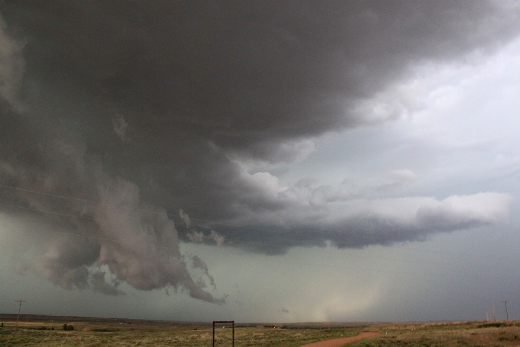
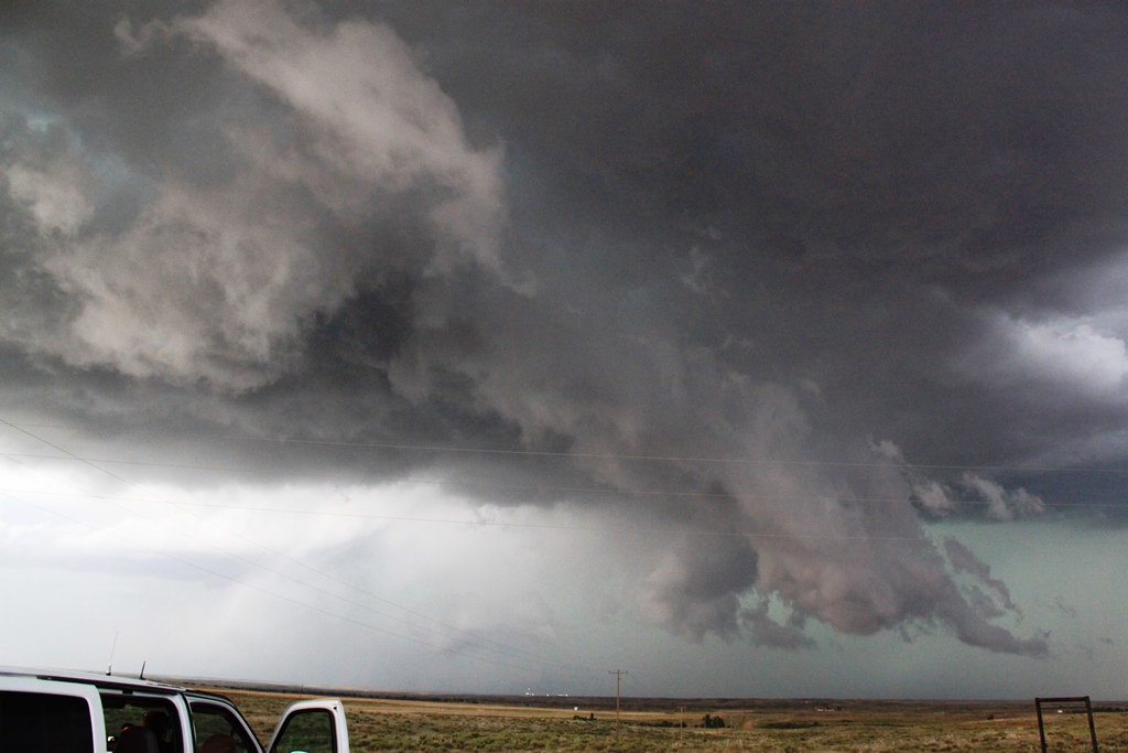
| After an emergency stop for gas in Buffalo, we positioned ourselves west of town and to the west of the updraft. The storm has taken on supercell characteristics and looked like it could tornado at any time. | Wall cloud forming underneath the base. | Big scud funnel. This was widely reported as an actual funnel but was not rotating. | Closer view. |
 |
 |
 |
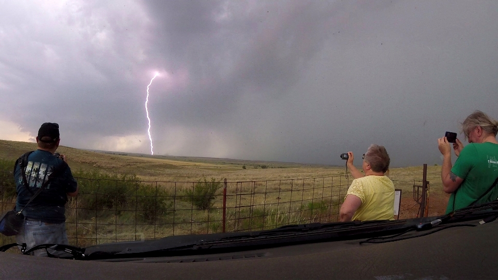 |
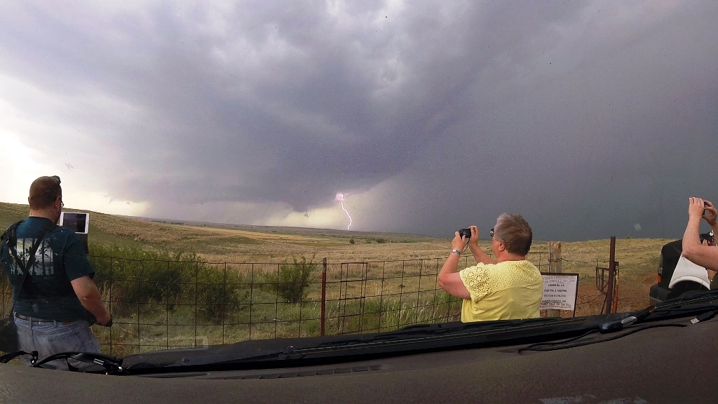
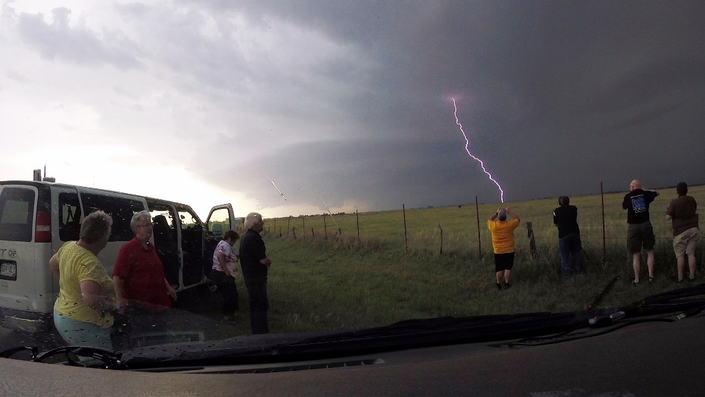
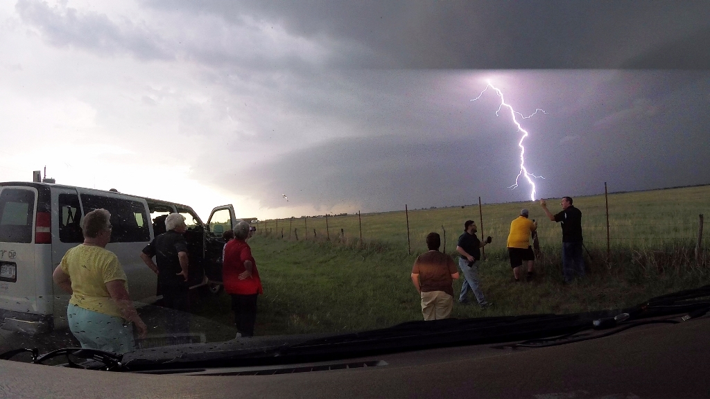
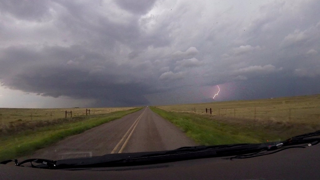
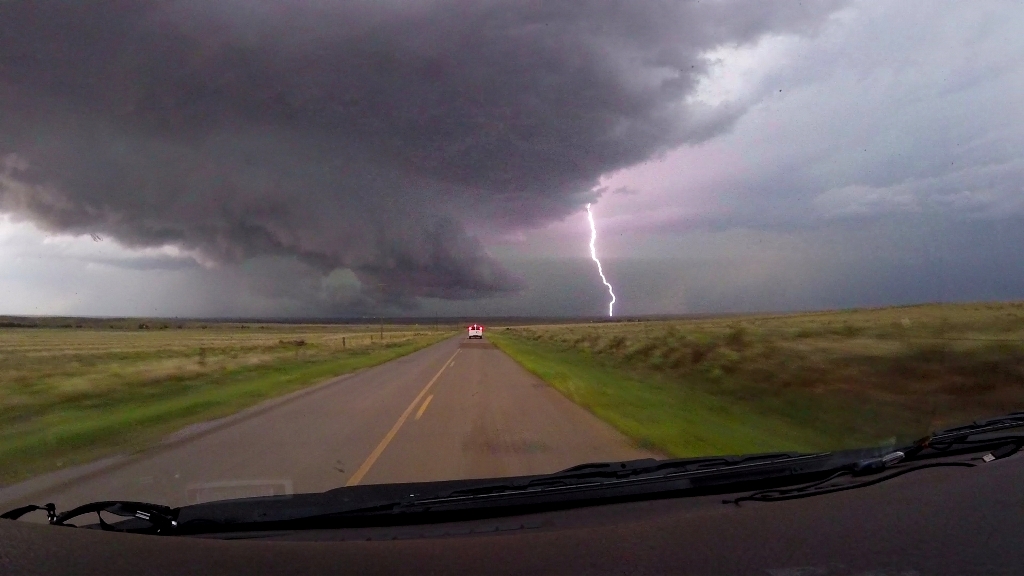
| The lightning really picked up right about this time. | The guests enjoying the light show. | Boom! Close strike, with smoke from a lightning induced fire that was already burning behind it. | More lightning. |
 |
 |
 |
 |
| The wall cloud dissipated, but the storm was throwing several lightning strikes per minute. | It's a two-fer! | Big precipitation core to our north. | The SLT fleet in the foreground. |
 |
 |
 |
 |
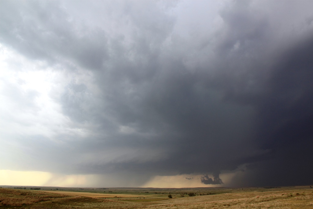
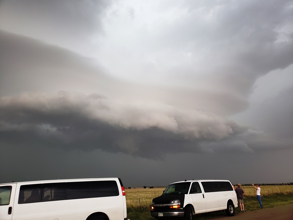
| Blasting west on Rt. 64 towards the next isolated storm in the line. | We stop to let our next supercell come to us. Nicely striated updraft with inflow tail streaming into the base. | Like all storms this day, there was a LOT of lightning. | Great structure! |
 |
 |
 |
 |
| Closer view. | The inflow tail dying off a bit as the storm gets close. | CG's from the vault region of the storm. | And more CG's! |
 |
 |
 |
 |
| A close one! | Once again, repositioning to stay south of the updraft. Approaching our next stop near Rosston. | More bolts hit nearby. | |
 |
 |
 |
 |
| Roger appears to summon lightning to his fingertips! | Now just east of Rosston, the rotating mothership is almost on top of us. | Nice stack of plates. | Chunky lowering under the wall cloud, but again, no tornado. |
 |
 |
 |
 |
| Dropping south towards Laverne as the updraft is now just to our northeast. | Long shelf cloud approaching from the northwest. | Finally we gave up for the day, but how to get to the hotel which was NORTH of the huge line of storms? As we were trying to circumnavigate, we we distracted by a wall cloud near Mocane and headed north to investigate. | Wall cloud crossing the road in front of us. |
 |
 |
 |
 |
| Lightning illuminates the structure of the wall cloud. | Even though there was tremendous motion where the inflow was being sucked into the updraft, there was no organized rotation. | Low hanging scud and inflow band but as the lowering drifted east, we resumed our trek to the hotel. | Wall cloud falling apart as it transits to the east. |
 |
 |
||
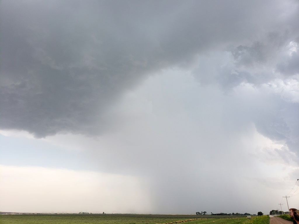
| Closing in on a date with a big line of hail cores near Forgan. | In the soup as we blast west with lightning striking all around us. |
All pictures (C) Richard Hamel 2019.