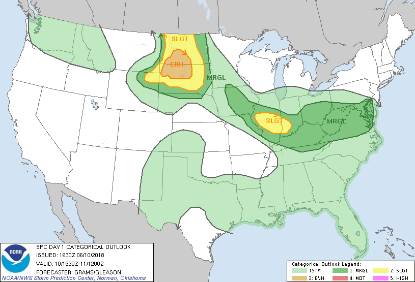
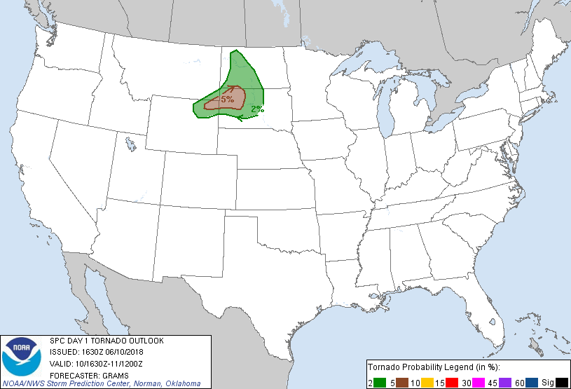
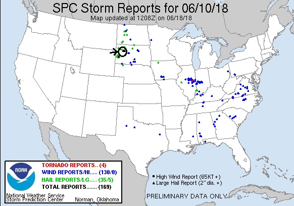
SPC Convective Outlook SPC Tornado Prob. NOAA Storm Report
June 10th, 2018 South Dakota Supercells
A good chase day to start the tour! We left Denver with
the intent to play the triple point intersection of the dryline, warm front, and
crashing cold front somewhere in western South Dakota. We knew that once the
cold front arrived, all the storms would be undercut and line out, so there
would only be a couple of hours where we could get isolated storms before that
happened. We proceeded north into Wyoming on I-25 to Orin then over to Lusk,
then north to Four Corners and Sundance before stopping for lunch in Spearfish,
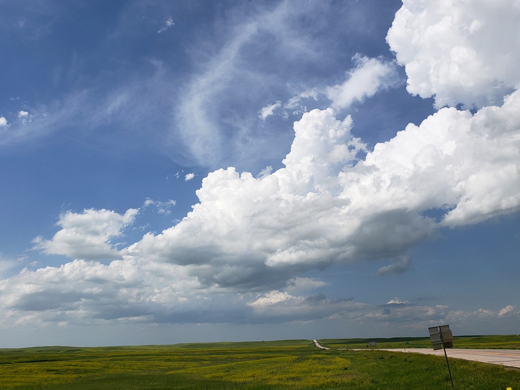
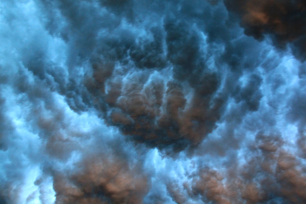
SD. By the time lunch was over, there were agitated cumulus fields to the north,
so we headed that way through Belle Fourche and onward toward Buffalo.
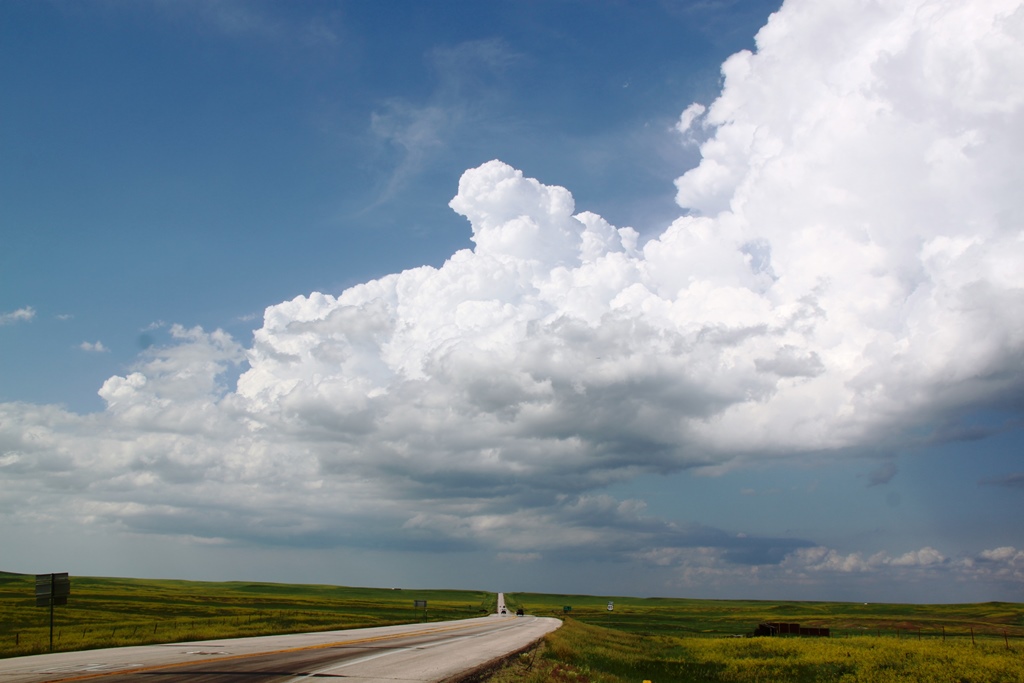
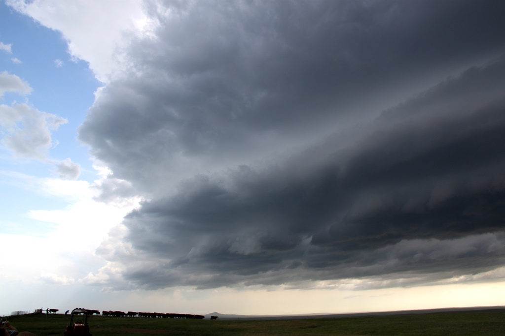
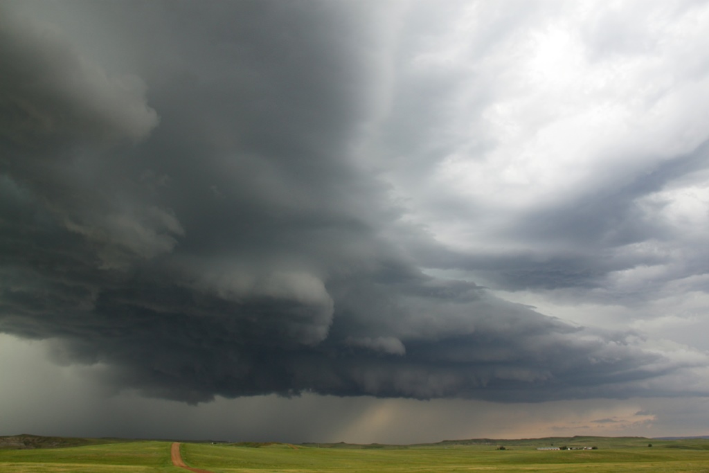
As we proceeded north on Rt. 85, we could see development
occurring right at the triple point very clearly so we stopped and waited near
the intersection with Rt. 168. We didn’t have long to wait as soon towers were
exploding right over our head with convection clearly visible to the naked eye.
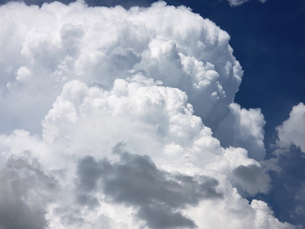
Meanwhile we also observed two sheer funnels along the line of convective towers
so we knew there was a lot of vorticity available for the storms. We waited for
another 20 minutes to see which updraft was going to take over, and once one did
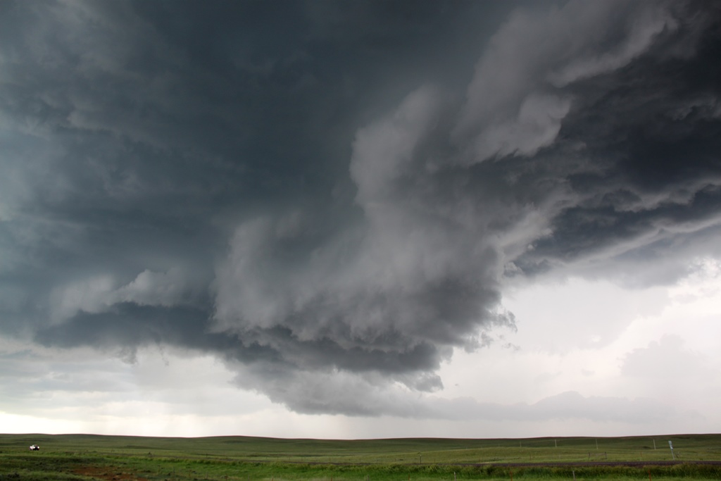
we were on the chase. Our target storm was slowly moving northeast, and we were
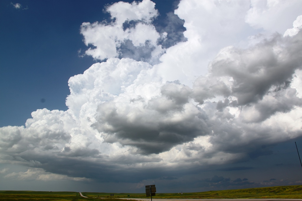
roughly paralleling it as we went up Rt. 79 towards Hoover. We stopped and saw
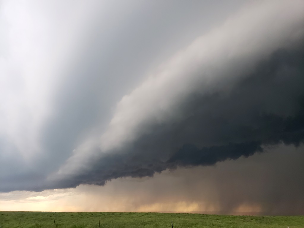
that the storm had 2 nice inflow bands feeling in, the stacked plates look, and
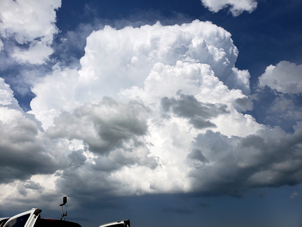
clear rotation just to our west. We watched for some time as the storm looked
like it had a chance to tornado and went tornado warned, but soon we had to get
out ahead of the storm before we got cut off by the hail core. Waiting until the
last second, we soon had to beat-feet towards Reva to avoid getting slammed by
the core. One we got clear of the hail, we headed south on the dirt Sorum Road
to get out in front of the hook echo region of the storm. We were able to find a
good point and stop and wait for the storm to come to us, but even though it was
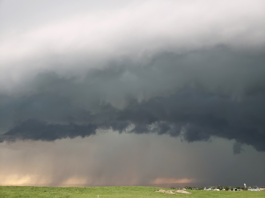
still tornado warned it wasn’t looking as organized. The storm was now beginning
to line out and surge forward and soon we were running again on 9 miles of dirt
road, getting caught by the rain core. Luckily the South Dakota dirt roads were
in great shape and we finally made it back to Rt. 20. We headed east towards
Bison to get in front of the hail and south before town on Bixby Rd, which to
our surprise was paved.
We again watched as the storm surged toward us and had another distinct
lowering. It once again failed to tornado however and rather than track north to
stay with the part of the storm we were with, we decided to go south for the
tail end part of the cell, or possibly drop down to another storm that was
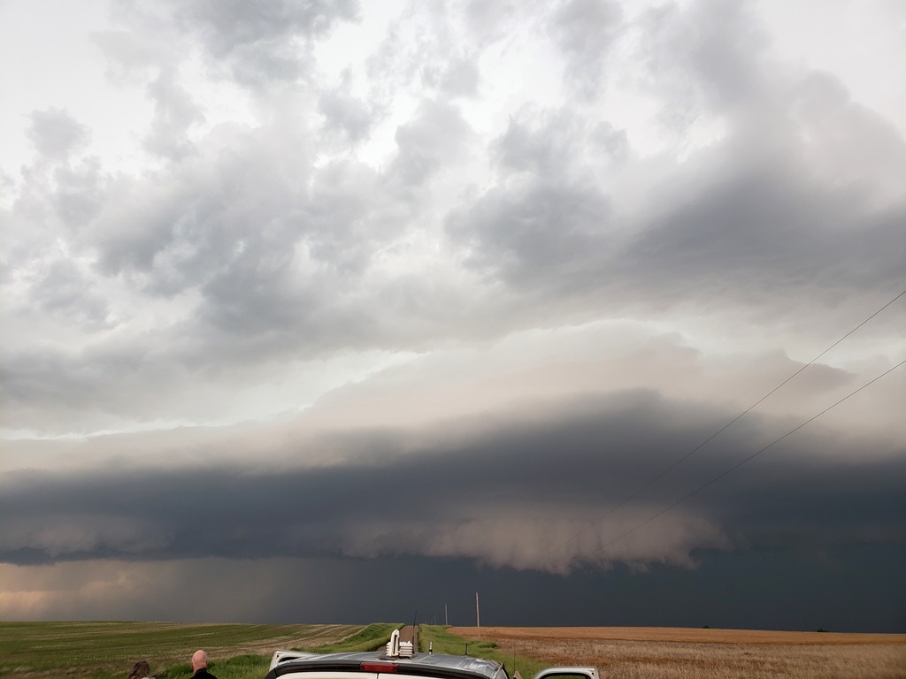
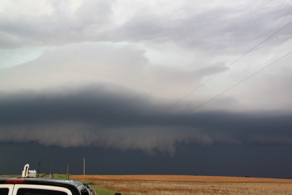
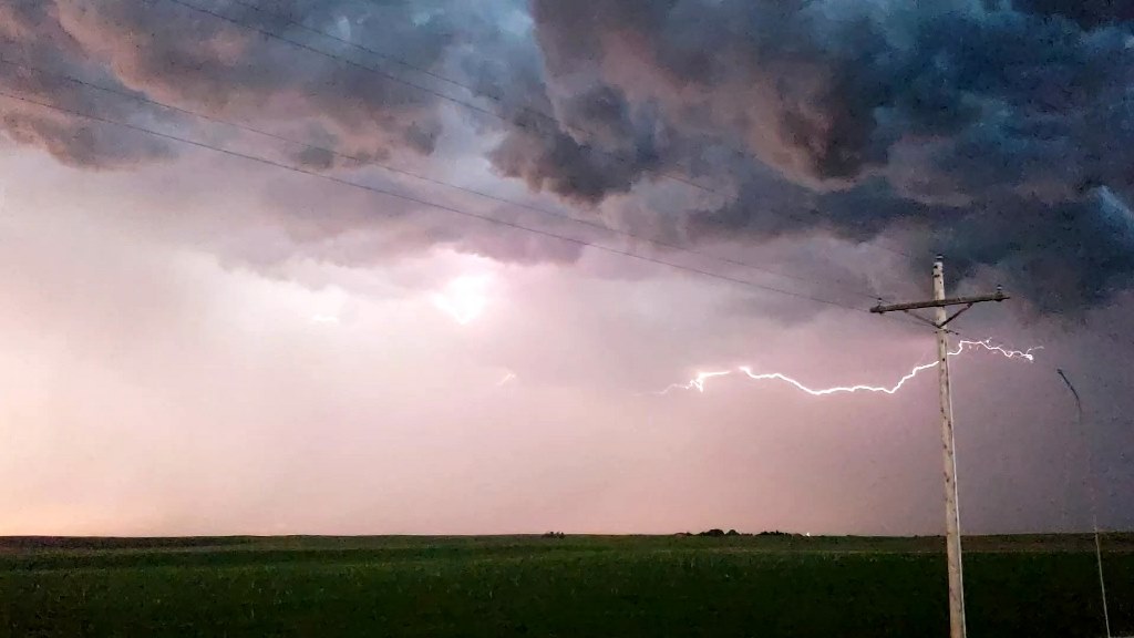
severe near Rapid City. We headed south until we hit Rt. 212, then east for a
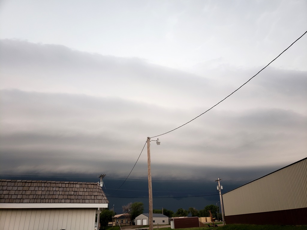
pitstop in Faith. After a LONG stop, the line of storms was catching back up to
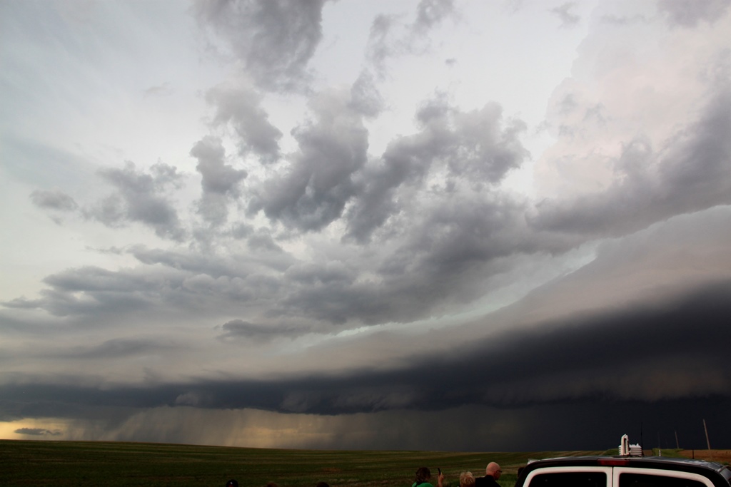
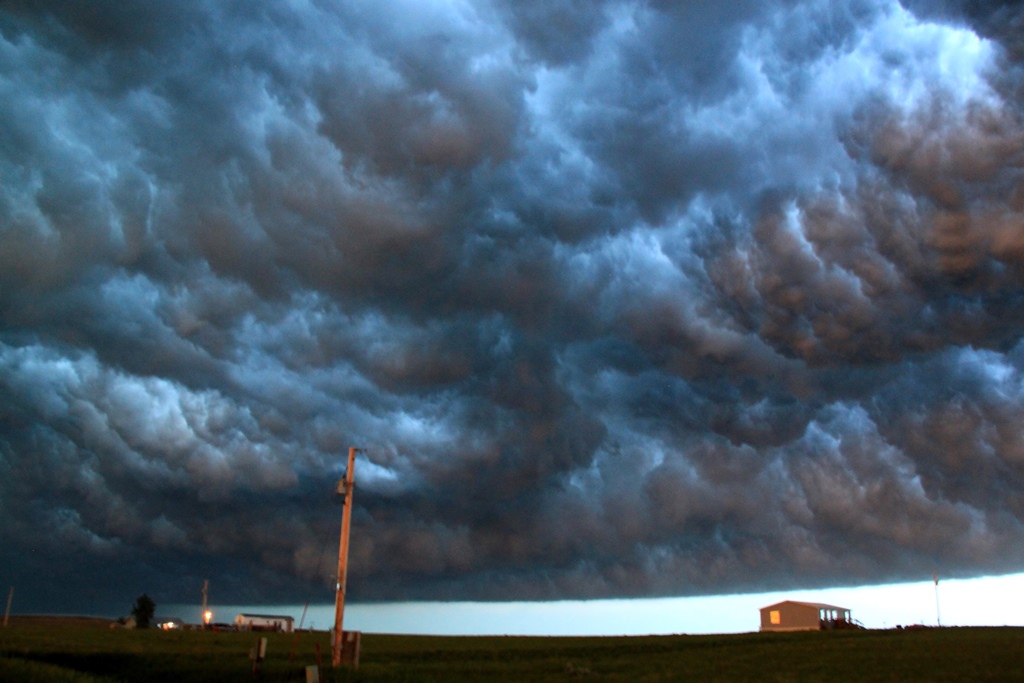
us and had a beautiful shelf cloud and was highly electrified, so we found a
side road and watched as the shelf came towards us. We then headed east and had
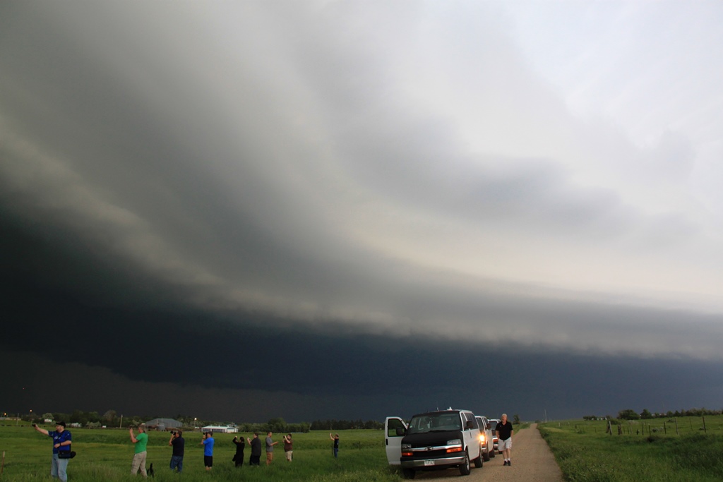
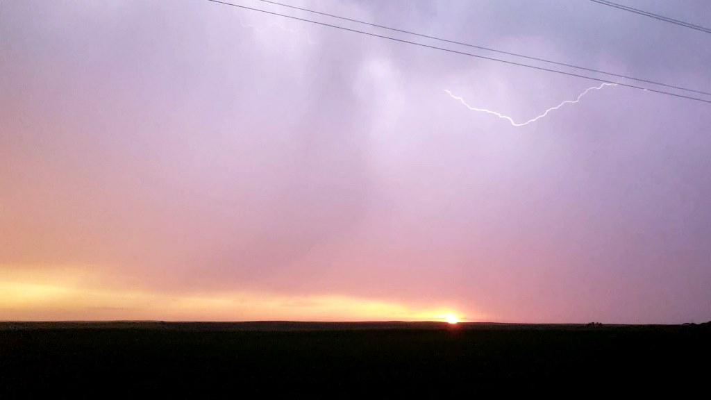
pretty much called it a night when they reissued the tornado warning, so we
stopped again to watch right at dusk. Visually, it didn't look anywhere close to
producing a tornado, but the view was spectacular: As the Sun set blood red, the
colors it lit up the shelf cloud with were amazing! We let it catch us again and
enjoyed the colors and the lightning before finally heading to our hotel in
Pierre, SD for the night.
Mileage for the day: 752 miles.
SPC
Convective Outlook SPC
Tornado Prob.
NOAA Storm Report
 |
 |
 |
 |
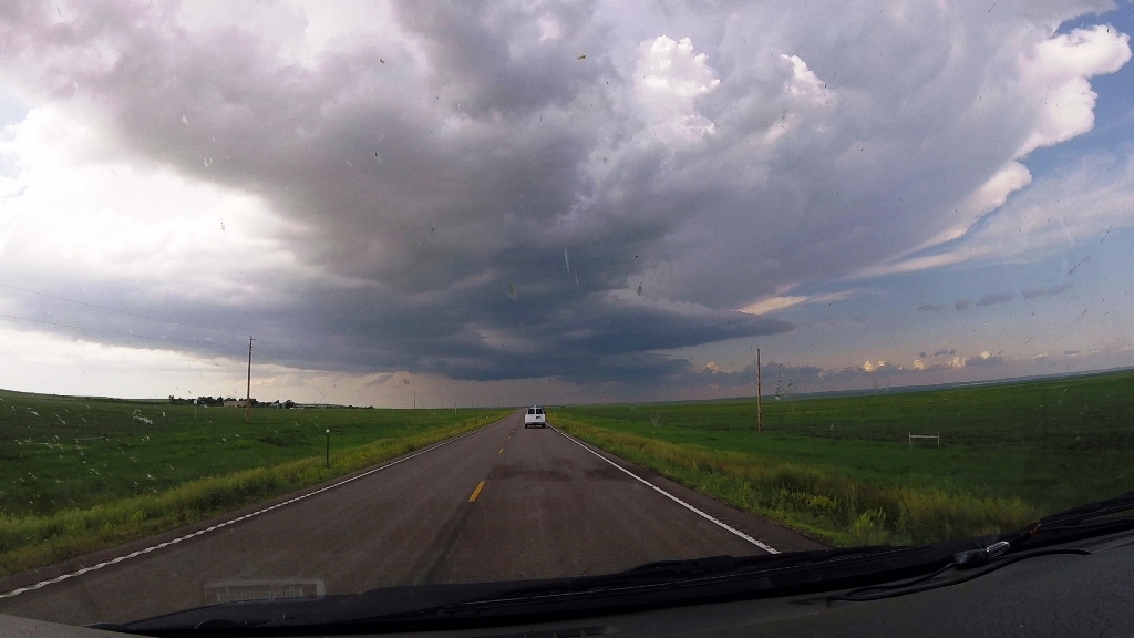
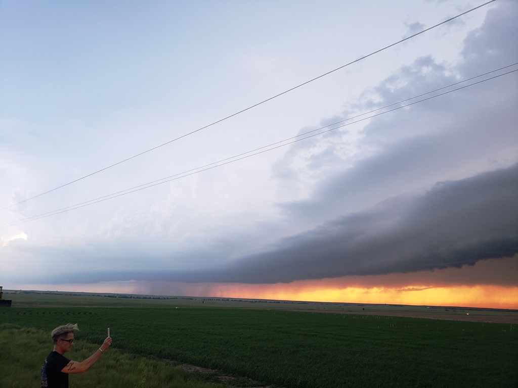
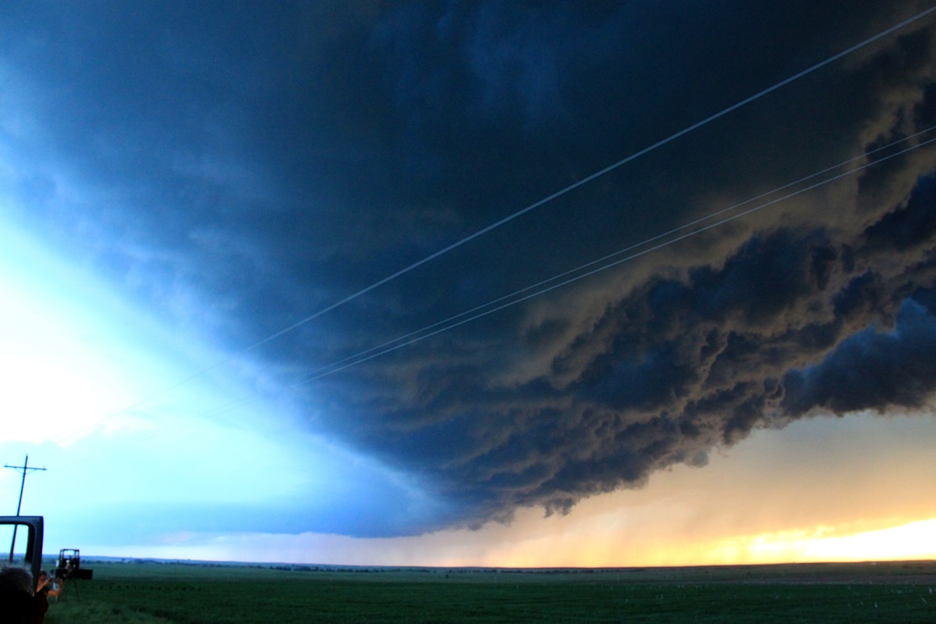
| We left Denver intending to play the triple point somewhere in western South Dakota. And here were were, at the triple point South of Redig, SD. | Tower blowing up along the triple point boundary. | The convection was so quick that you could see it with the naked eye. We quickly decided this was our target storm. | Explosive tower right overhead. |
 |
 |
 |
 |
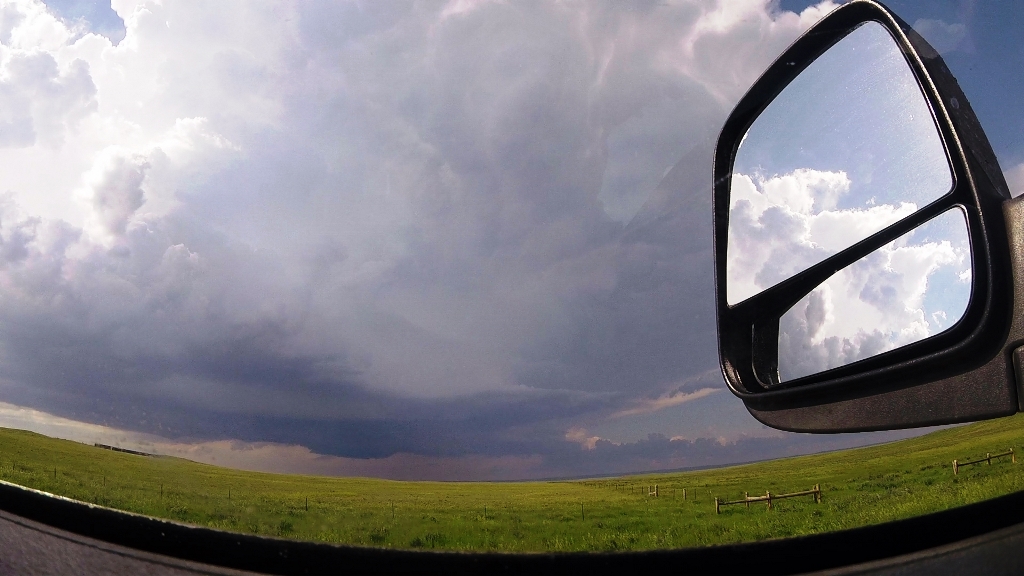
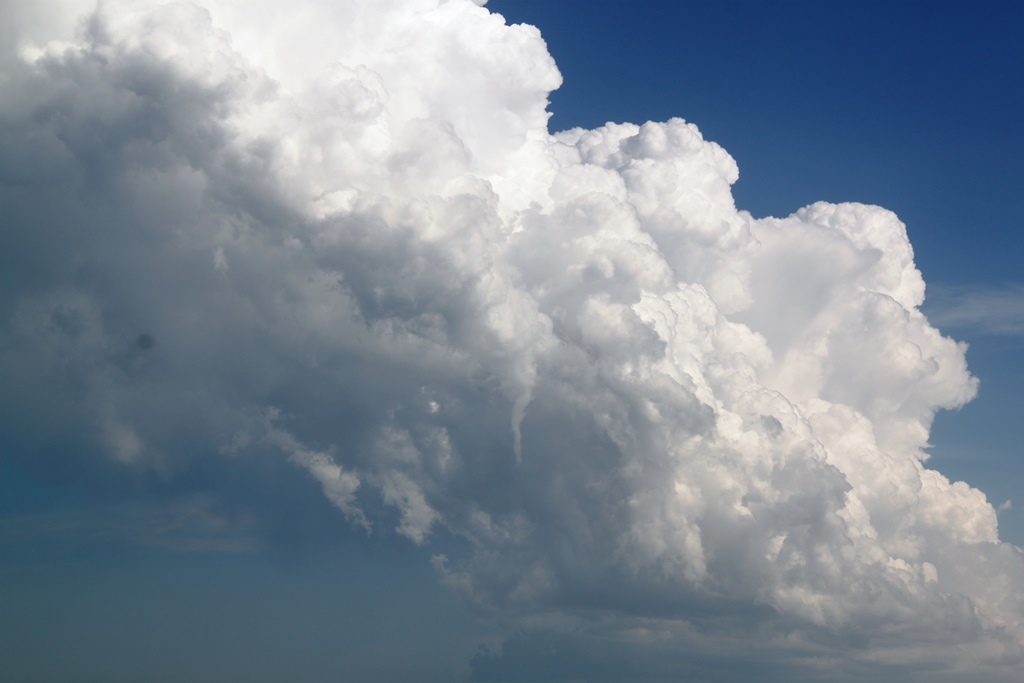
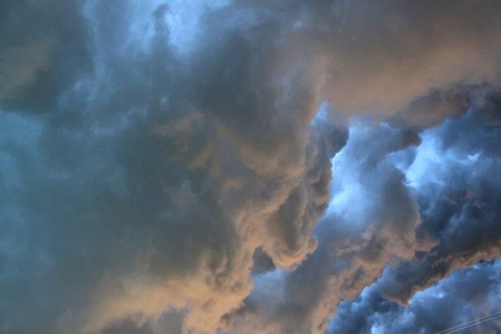
| Closeup of the convection knuckles. | Now on Rt. 79 heading towards Hoover with our target, now a full blown supercell, just to our north. | Now passing ahead of the storm with a lowering under the updraft base to our west. | Closer look at the raggedy wall cloud under the base and inflow streamer pouring into the storm. |
 |
 |
 |
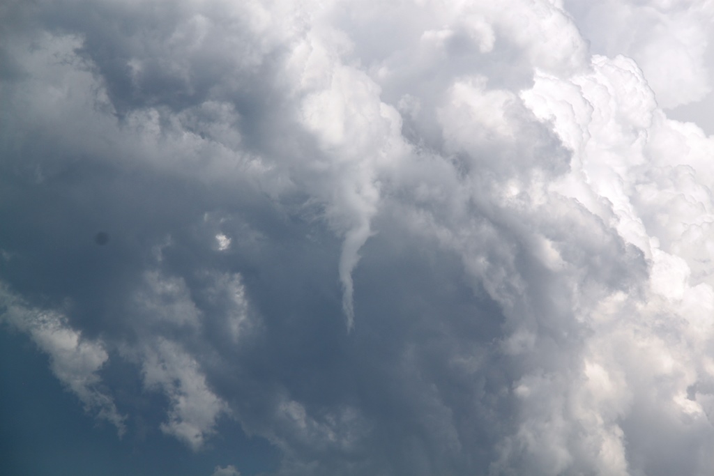 |
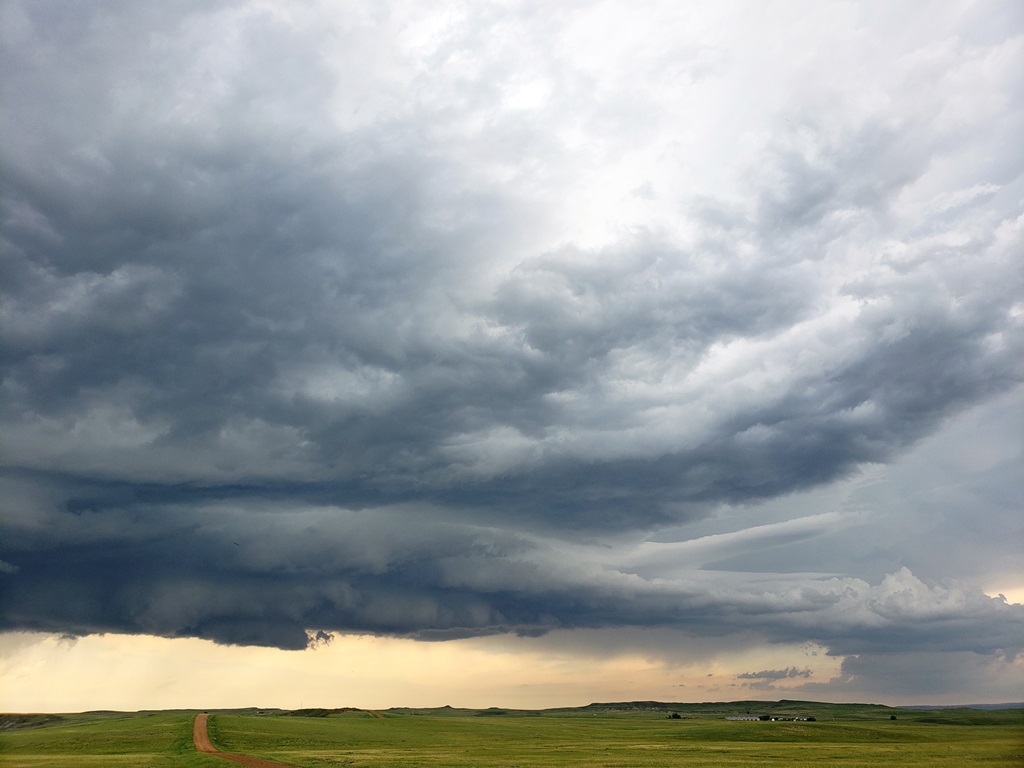
| The storm almost wrapped up and dropped a tornado but never quite did it. Now we raced the storm north towards Reva with a solid wall cloud just west of the road. | After turning east at Reva, we dropped south on Sorum Road near Strool and let what was now becoming a big line of storms come at us. | Sheer funnel above us showing there was plenty of spin in the atmosphere. | Closer look. |
 |
 |
 |
 |
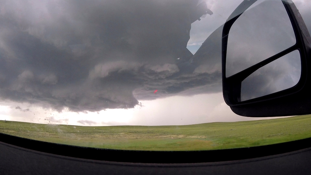
| As the line approached, a stout funnel forms to our west. | Now farther east on Bixby Rd. The storm cuts off our north option even as we decided to head south to try and intercept the tail end storm that appeared to be taking over the show. | Storm closing on us on Bixby Rd. | As we headed south, a wall cloud forms ahead of us. |
 |
 |
 |
 |
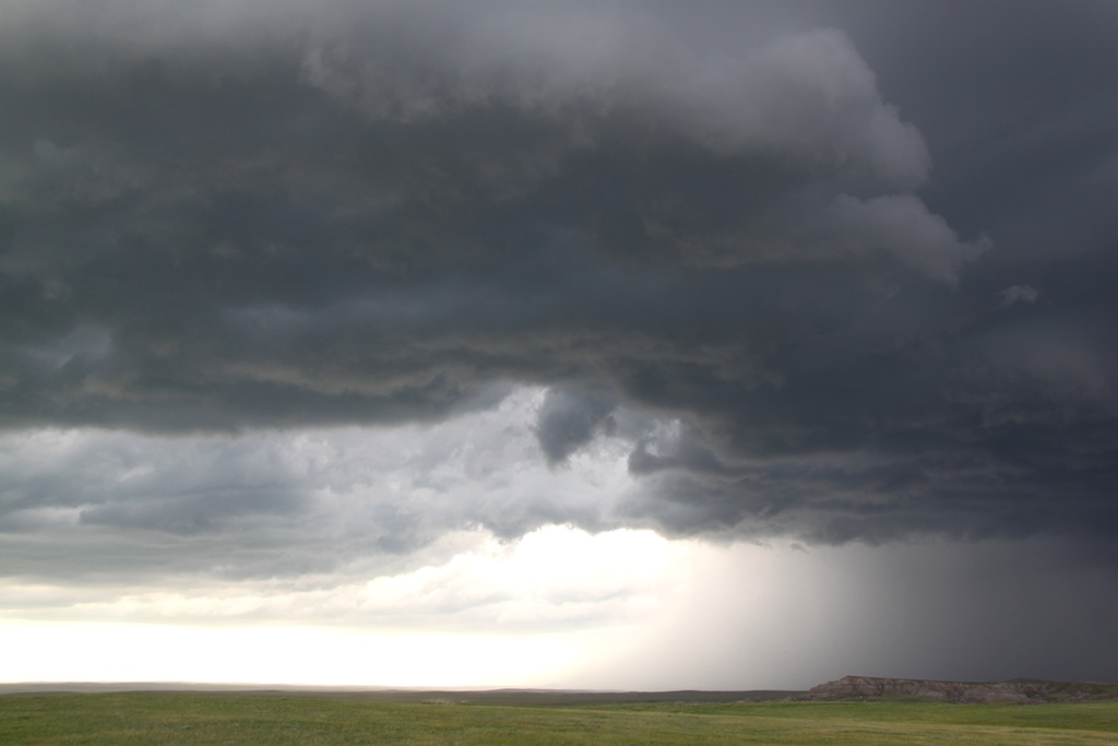
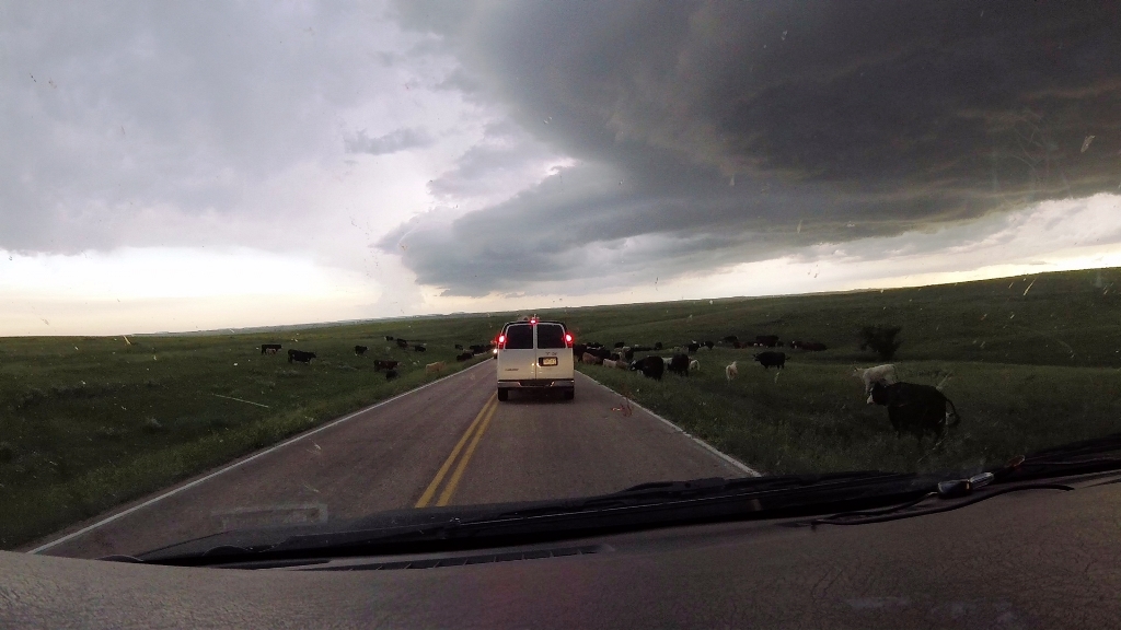
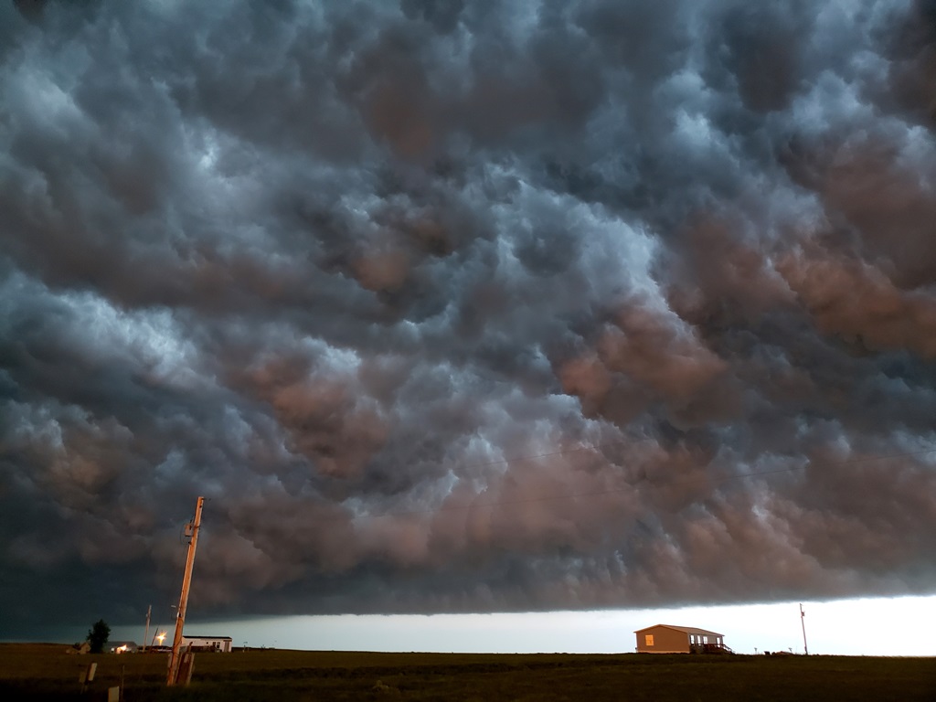
| Scud rises into the lowering but it never produced an organized funnel. | A look at the long line approaching us. | Heading south at full speed now with the line approaching and cows in the road! | Now on Rt. 212 racing the line towards Faith, nice mothership updraft to our north. |
 |
 |
 |
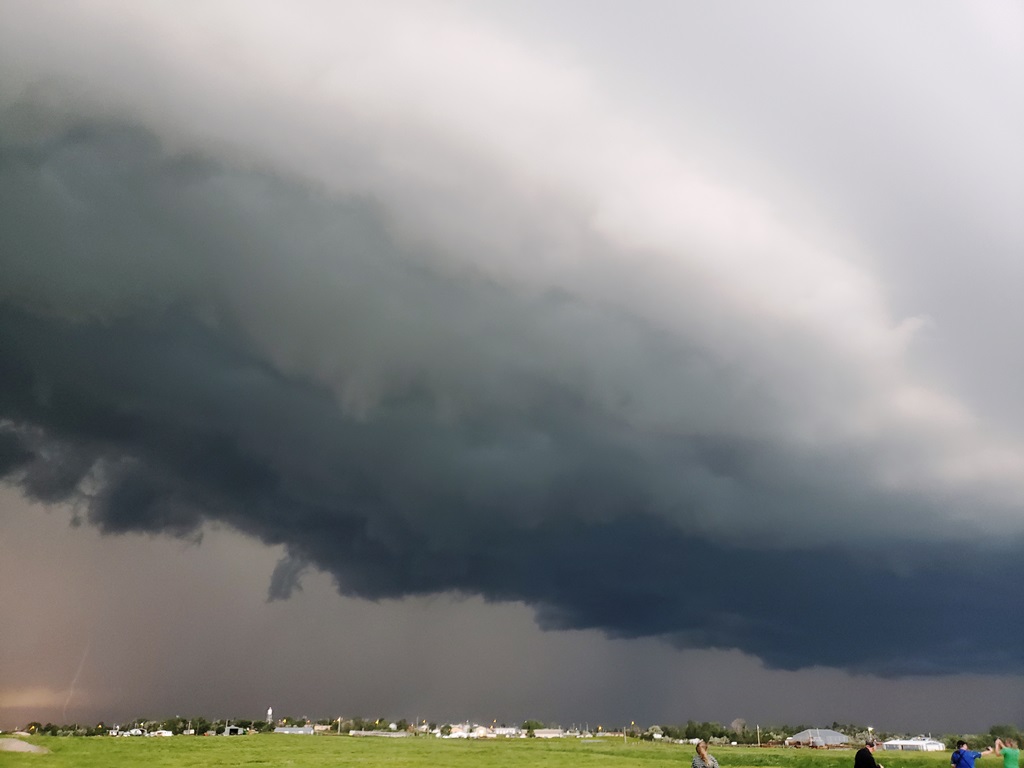 |
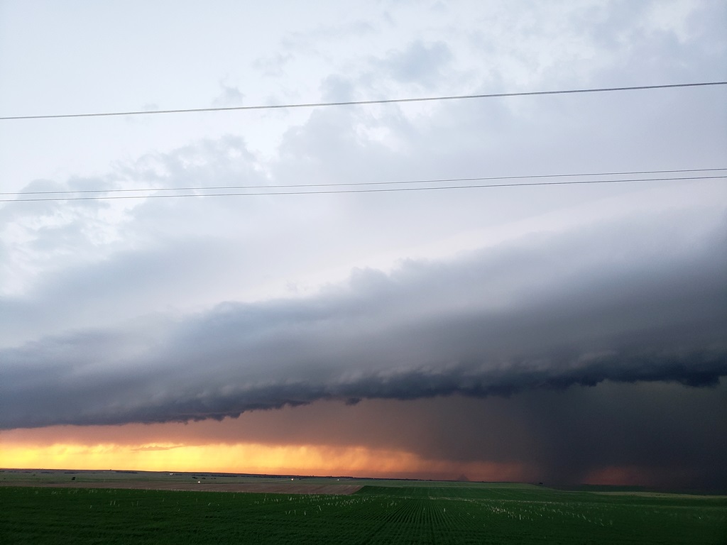
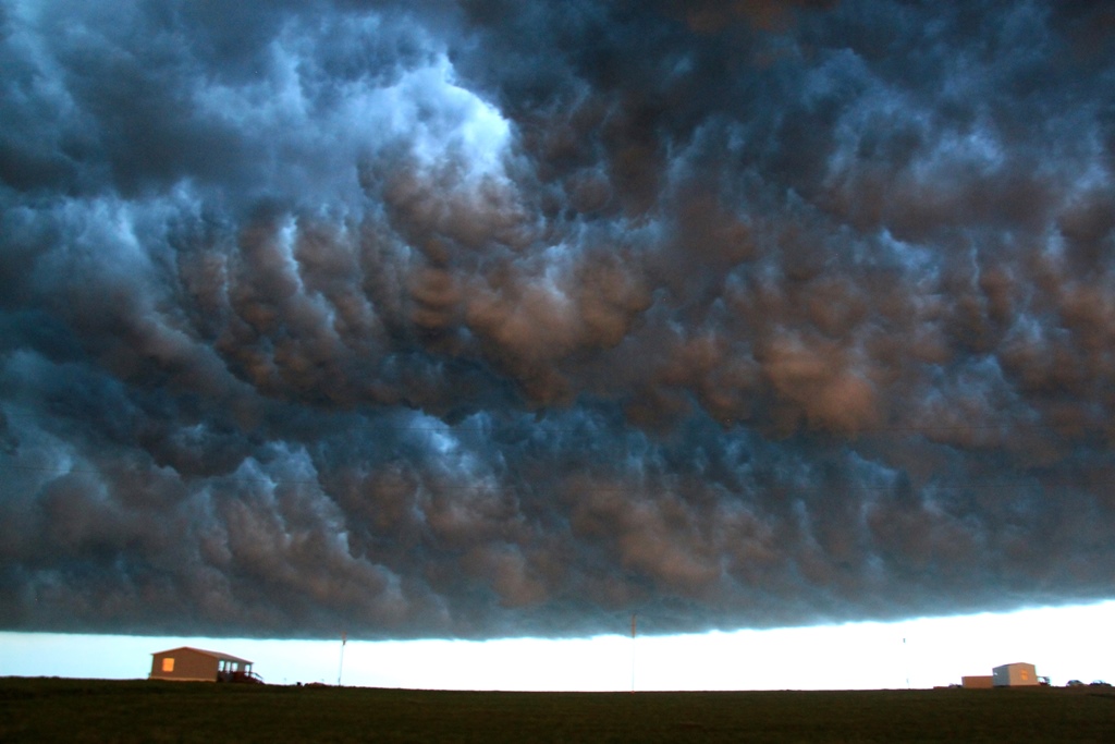
| Now in Faith for a fuel stop, here comes the line just west of town! | As the line approached, we headed just east of town to get a better view. | The line arrives over Faith. | The shelf almost overhead. |
 |
 |
 |
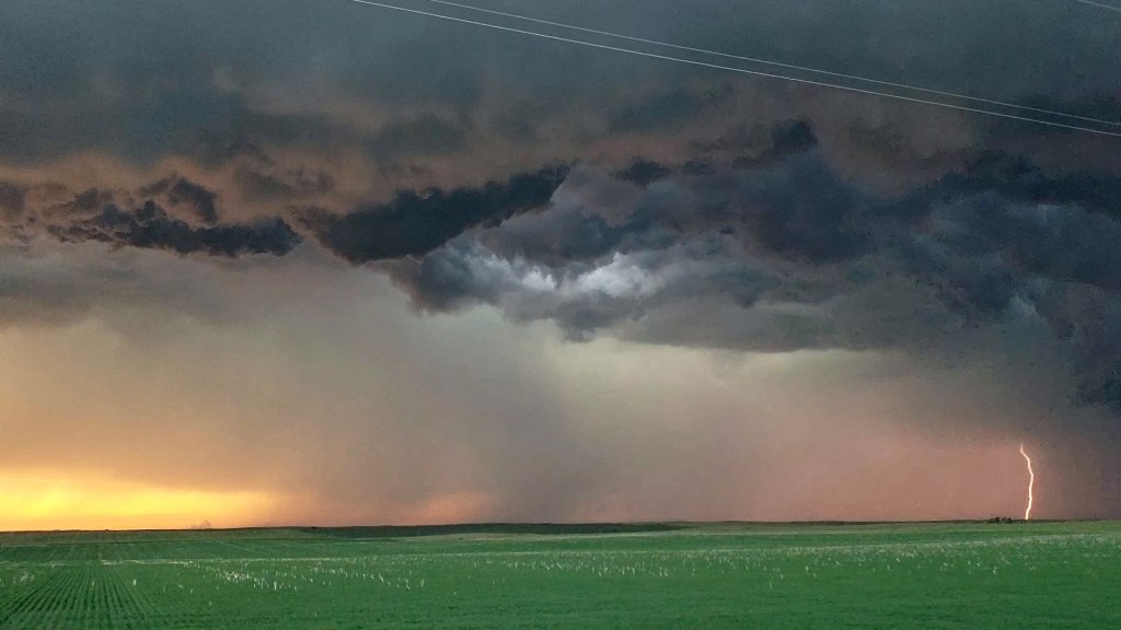 |
| The shelf bending off to the northeast in the distance. | We drifted farther east to keep ahead of the line and let it approach us again, now at sunset. | By now the line was weakening and you could see right under it. | Even though the storm was dying it was still throwing a lot of bolts. |
 |
|
 |
 |
| Amazing colors at sunset! | We decided to let the storm run us over. | Lightning illuminates the line as it stretches off to the north. | Into the whale's mouth we go! |
 |
 |
 |
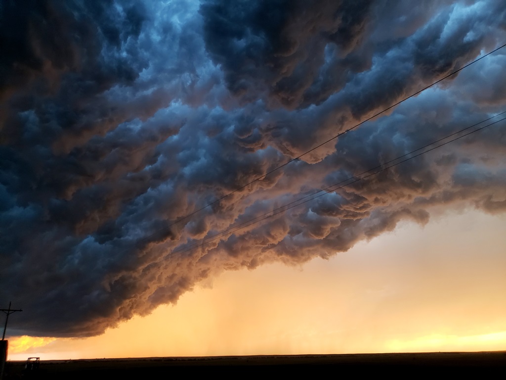
 |
| Chomp, chomp, chomp! | Interesting cloud feature as cold air sinks out of the shelf cloud. | ||
 |
 |
||
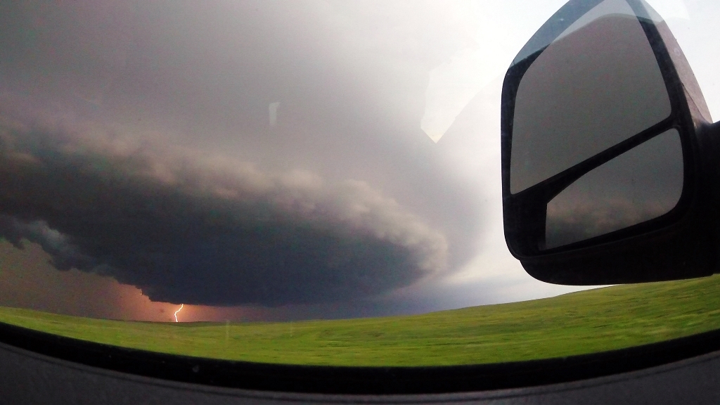
| As the shelf passes over, cloud-to-cloud lightning behind the shelf cloud. | Cloud-to-cloud lightning with the Sun setting in the distance. |
All pictures (C) Richard Hamel 2019.